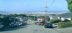
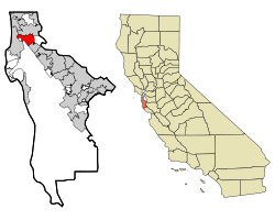
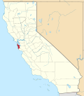
圣布鲁诺(英語:San Bruno),是美国加利福尼亚州圣马特奥县下属的一个城市。于1914年12月23日建市。它位于旧金山市以南19公里的圣克鲁兹山脉山脚,濒临旧金山湾,与旧金山国际机场临近。这座城市面积约为14.2平方公里,根据2010年美国人口普查,该市有人口41,114人。圣布鲁诺临近硅谷,也是著名互联网企业Youtube公司总部所在地。[1]
气候
 Youtube总部
圣布鲁诺拥有旧金山湾区典型的地中海气候。夏季干燥,冬季多雨。与南湾的圣荷西不同,这里的夏天干燥且凉爽,平均最高气温只有摄氏23度,不像南边临近的城市(摄氏29度)那么炎热,冬季则与其它地区一样且较冷。
这里的冬天几乎不下雪,但历史上曾有极少数的情况会有厚达3.8厘米的积雪(1962年1月21日)。在冬季这里的气温平均每年只有1.3天低于摄氏零下,1932年12月11日曾录得-7°C的极低温,在此之外的正常情况下,低于冰点的温度极少出现。
在夏天,每年会大约有4天气温超过32°C。平均最高在23°C左右。和旧金山一样,最热的月份出现在9月。在夏天,这里经常出现大雾天气,通常发生在半夜和早上。这里的夏天几乎不会下雨,除了大雾时伴随的小毛毛雨外。在极罕见的情况下,这里的最高温度会突破40°C。
| 圣布鲁诺
|
| 月份
|
1月
|
2月
|
3月
|
4月
|
5月
|
6月
|
7月
|
8月
|
9月
|
10月
|
11月
|
12月
|
σà¿σ╣┤
|
| 平均高温 °F
|
55.9
|
59.3
|
61.2
|
64.3
|
66.8
|
69.9
|
71.1
|
71.7
|
72.7
|
69.7
|
62.0
|
56.1
|
65.1
|
| 平均低温 °F
|
42.9
|
45.5
|
46.8
|
48.1
|
50.5
|
52.9
|
54.5
|
55.5
|
55.1
|
52.4
|
47.5
|
43.0
|
49.6
|
| 平均降水量 英寸
|
4.45
|
4.01
|
3.26
|
1.18
|
0.38
|
0.11
|
0.03
|
0.07
|
0.20
|
1.04
|
2.49
|
2.89
|
20.11
|
| 平均高温 °C
|
13.3
|
15.1
|
16.2
|
17.9
|
19.3
|
21.1
|
21.7
|
22.1
|
22.6
|
20.9
|
16.7
|
12.4
|
18.4
|
| 平均低温 °C
|
6.1
|
7.5
|
8.2
|
8.9
|
10.3
|
11.6
|
12.5
|
13.1
|
12.8
|
11.3
|
8.6
|
6.1
|
9.8
|
| 平均降水量 mm
|
113.0
|
101.8
|
82.8
|
30.0
|
9.7
|
2.8
|
0.8
|
1.8
|
5.1
|
26.4
|
63.2
|
73.4
|
510.8
|
| 数据来源:"Climatography of the United States", National Climatic Data Center (www.ncdc.noaa.gov)[2]
|
人口
2010σ╣┤
2010年美国人口普查的报告显示该市人口为41,114。人口密度约为每平方千米2,897.7人。人口基本构成为20,350个白人(49.5%),942个黑人(2.3%),246个北美原住民(0.6%),10,423个亚洲人(25.4%),1,377个太平洋岛屿居民(3.3%),5,075人来自其他种族,2,701人来自多个不同种族。拉美裔有12,016人(29.2%)。
该市有14,701户,10,044个家庭,15,356个住房单位。4,831户(32.9%)拥有18岁以下的未成年人。7,364户(50.1%)为异性婚姻同居,764户为异性未婚同居,123户为同性同居。3,660户(24.9%)为单人居住,平均每户人数2.77人,平均每个家庭3.31人。
该市有8,632人年龄低于18岁,3,577人为18-24岁,12,038人为25-44岁,11,653人为45-64岁,5,214人为65岁以上。年龄中位数38.8岁,男女性别比97.1比100。
| 人口详细统计[5]
|
2010
|
| 总人口 |
41,114 - 100.0%
|
| 只有一种种族血统 |
38,413 - 93.4%
|
| 不是拉丁裔 |
29,098 - 70.8%
|
| 仅白人血统 |
14,781 - 36.0%
|
| 仅黑人血统 |
841 - 2.0%
|
| 仅印第安人、阿拉斯加原住民 |
89 - 0.2%
|
| 仅亚洲人血统 |
10,228 - 24.9%
|
| 仅夏威夷人或太平洋岛屿居民 |
1,342 - 3.3%
|
| 其它族裔 |
260 - 0.6%
|
| 混血 |
1,557 - 3.8%
|
| 拉丁裔 |
12,016 - 29.2%
|
|
参考文献
- ^ Census 2010: Table 3A — Total Population by Race (Hispanic exclusive) and Hispanic or Latino: 2010. California Department of Finance. [March 22, 2010]. (原始内容 (Excel)存档于2013年12月3日).
- ^ "Climatography of the United States", National Climatic Data Center (www.ncdc.noaa.gov)
- ^ San Bruno city, California – Fact Sheet – American FactFinder. 2000 Census. US Census Bureau. [2009-12-01]. (原始内容存档于2020-02-10).
- ^ Census years 1930 through 1990 are as follows
- Vol. 1. Number and distribution of inhabitants. Total population for states, counties, and townships or other minor civil divisions; for urban and rural areas; and for cities and other incorporated places., 1930 Census (Washington, D.C.: US Census Bureau), 1931: 138 [2009-08-21], (原始内容存档于2010-02-11)
- v. 1 Number of inhabitants. Total population for States, counties, and minor civil divisions; for urban and rural areas; for incorporated places; for metropolitan districts; and for census tracts. Comprising the first series of population bulletins for the States, Territories, and possessions., 1940 Census (Washington, D.C.: US Census Bureau), 1941: 125 [2009-08-21], (原始内容存档于2009-05-08)
- Vol. I. Number of Inhabitants., 1950 Census (Washington, D.C.: US Census Bureau), 1951: 1–48 [2009-08-21], (原始内容存档于2010-02-02)
- Vol. 1. Characteristics of the Population, 1960 Census (Washington, D.C.: US Census Bureau), 1961: 6–26 [2009-08-21], (原始内容存档于2009-09-28)
- Vol. 1. Characteristics of the Population, 1970 Census (Washington, D.C.: US Census Bureau), 1971: 6–14 [2009-08-21], (原始内容存档于2009-07-25)
- California – Ch. A, B, 1980 Census (Washington, D.C.: US Census Bureau), 1981: 6–15 [2009-08-21], (原始内容存档于2013-10-12)
- Section 1 – Tables 1 through 61, 1990 Census (Washington, D.C.: US Census Bureau), 1991: California 10 [2009-08-21], (原始内容存档于2009-05-09)
- ^ Demographic Profile Bay Area Census. [2021-01-19]. (原始内容存档于2016-01-02).
|
|---|
| 水体 | | |
|---|
| 县份 | |
|---|
| 主要城市 | |
|---|
| 10万-25万人口 | |
|---|
| 5万-10万人口 | |
|---|
| 2.5万-5万人口 | |
|---|
| 1万-2.5万人口 | |
|---|
| 大区域 | |
|---|
| 其他 | |
|---|
37°37′31″N 122°25′31″W / 37.62528°N 122.42528°W / 37.62528; -122.42528


