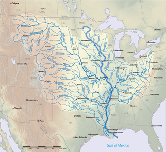
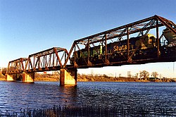
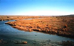
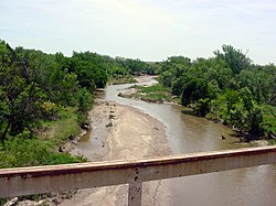
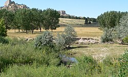
密西西比河流域包括密蘇里河 和密西西比河 ,這是美國唯二幹流最長的河流。而在上圖,密西西比河的幹流會以深藍色顯示。除上述兩條河流外,下表還記錄了其餘美國境內幹流最長的河流。 本列表收錄了美國境內38條幹流 長達500英里(800公里)或以上的河流。在水文學 中,幹流是指「河川下游內、對比於支流的主要河段」[ 註 1] 美國地質調查局 (USGS)透過列出兩個端點(即河源和河口)的坐標來定義幹流。部份同樣流經美國的著名河流,如阿查法拉亞河 、威拉米特河 、薩斯奎哈納河 ,則因其幹流短於500英里(800公里),而未獲納入本列表內。
表列河流中有七條流越兩國或形成國界。育空河 及哥倫比亞河 發源於加拿大 ,隨後流入美國。牛奶河 、聖勞倫斯河 及雷德河 則始於美國,然後流入加拿大。而在上述河流中,只有牛奶河兩度跨越國界——伏出、並再度流入美國[ 5] 科羅拉多河 和格蘭德河 等兩條河發源自美國,隨後流入墨西哥[ 5] 密西西比河 和密蘇里河 的流域 延伸入加拿大境內[ 6] [ 7] 希拉河 的流域則延伸入墨西哥 境內[ 8]
在報告水文量時,不同的資料來源的精確度可能存在著差異。湖泊學家及作者露絲·帕特里克(Ruth Patrick [ 註 2]
在下表內,流域面積及流量等數據的主要來源為《Rivers of North America 英制 及公制 一併表示。而河流流量是指河水流經河口時的流量[ 註 3]
另外,此列表中會以:
黃色背景代表該河流並不完全位於美國境內 綠色背景代表河流流域 並不完全位於美國境內
北美地圖,顯示了上述列表內的所有河流。
註釋 參考資料
^ 5.0 5.1 5.2 5.3 Rand McNally and Company. The road atlas 2008 : United States, Canada, and Mexico.. Chicago, IL: Rand McNally. 2008. ISBN 0-528-93961-0(英语) . ^ 6.00 6.01 6.02 6.03 6.04 6.05 6.06 6.07 6.08 6.09 6.10 6.11 6.12 The Atlas of Canada. Rivers . Natural Resources Canada. [2020-07-19 ] . (原始内容 存档于2007-04-04) (英语) . ^ 7.0 7.1 7.2 Missouri River Basin basic geography and natural features . United States Geological Survey. [2020-07-19 ] . (原始内容 存档于2014-04-07) (英语) . ^ 8.0 8.1 McCord, Marc W. Gila River . Wind Spirit Community. [2020-07-19 ] . (原始内容存档 于2018-08-14) (英语) . ^ 11.0 11.1 11.2 所有河口和河源的座標皆取自地名資訊系統 (GNIS,美國地質調查局 )或加拿大地名數據庫 ,除了科羅拉多河的河口由Google地球 地理定位。
^ 12.0 12.1 數據取自《Rivers of North America》一書,除非另外作註。
^ Geographic Names Information System (GNIS). Missouri River . United States Geological Survey. 1980-10-24 [2020-07-19 ] . (原始内容存档 于2022-10-11) (英语) . ^ 16.00 16.01 16.02 16.03 16.04 16.05 16.06 16.07 16.08 16.09 16.10 16.11 16.12 16.13 16.14 16.15 Kammerer, J.C. Largest Rivers in the United States . United States Geological Survey. 2005-09-01 [2020-07-20 ] . (原始内容存档 于2002-11-15) (英语) . ^ Geographic Names Information System (GNIS). Mississippi River . United States Geological Survey. 1980-06-04 [2020-07-19 ] . (原始内容存档 于2022-05-29) (英语) . ^ Atlin Lake (B.C.) . Natural Resources Canada. [2020-07-19 ] . (原始内容 存档于2011-07-06) (英语) . ^ Geographic Names Information System (GNIS). Yukon River . United States Geological Survey. 1981-03-31 [2020-07-19 ] . (原始内容存档 于2022-08-16) (英语) . ^ 24.0 24.1 24.2 24.3 Patino, Carlos; McKinney, Daene C.; Maidment, David R. Water Management Information System for the Rio Grande/Bravo Basi . University of Texas Center for Research in Water Resources. [2020-07-20 ] . (原始内容 存档于2015-04-01) (英语) . ^ Geographic Names Information System (GNIS). Rio Grande . United States Geological Survey. 1979-03-30 [2020-07-20 ] . (原始内容存档 于2022-01-24) (英语) . ^ Anderson, D. Larry. Utah's Perspective: The Colorado River (PDF) . Utah Department of Natural Resources. 2002-05 [2020-07-20 ] . (原始内容 (PDF) 存档于2014-04-09) (英语) . ^ 28.0 28.1 Arias, E.; Albar, M.; Parra, I.; Reza, M. Regional Definition (PDF) . United Nations Environment Programme. [2020-07-20 ] . (原始内容 (PDF) 存档于2017-05-31) (英语) . ^ Geographic Names Information System (GNIS). Colorado River . United States Geological Survey. 1980-02-08 [2020-07-20 ] . (原始内容存档 于2022-04-09) (英语) . ^ 由Google地球地理定位。
^ Colorado Atlas and Gazetteer (地图). DeLorme. § 47–48. 1998. ISBN 978-0-89933-265-9 ^ Geographic Names Information System (GNIS). Arkansas River . United States Geological Survey. 1979-11-30 [2020-07-20 ] . (原始内容存档 于2022-08-12) (英语) . ^ Columbia Lake . Natural Resources Canada. [2020-07-20 ] . (原始内容 存档于2011-07-06) (英语) . ^ Geographic Names Information System (GNIS). Columbia River . United States Geological Survey. 1980-11-28 [2020-07-20 ] . (原始内容存档 于2022-03-07) (英语) . ^ Kleiner, Diana J. Handbook of Texas: Red River . Texas State Historical Association. [2020-07-20 ] . (原始内容存档 于2015-12-23) (英语) . ^ Handbook of Texas: Prairie Dog Town Fork of the Red River . Texas State Historical Association. [2020-07-20 ] . (原始内容存档 于2016-03-14) (英语) . ^ Handbook of Texas: Tierra Blanca Creek . Texas State Historical Association. [2020-07-20 ] . (原始内容存档 于2018-07-10) (英语) . ^ Geographic Names Information System (GNIS). Red River . United States Geological Survey. 1980-06-04 [2020-07-20 ] . (原始内容存档 于2022-10-25) (英语) . ^ Geographic Names Information System (GNIS). Snake River . United States Geological Survey. 1979-09-10 [2020-07-20 ] . (原始内容存档 于2022-07-02) (英语) . ^ Geographic Names Information System (GNIS). Ohio River . United States Geological Survey. 1980-10-24 [2020-07-21 ] . (原始内容存档 于2022-01-24) (英语) . ^ Geographic Names Information System (GNIS). Colorado River of Texas . United States Geological Survey. 1979-11-30 [2020-07-21 ] . (原始内容存档 于2021-10-30) (英语) . ^ Geographic Names Information System (GNIS). Tennessee River . United States Geological Survey. 1979-09-20 [2020-07-21 ] . (原始内容存档 于2022-01-19) (英语) . ^ Geographic Names Information System (GNIS). Canadian River . United States Geological Survey. 1979-12-18 [2020-07-21 ] . (原始内容存档 于2022-04-11) (英语) . ^ Geographic Names Information System (GNIS). Brazos River . United States Geological Survey. 1979-11-30 [2020-07-21 ] . (原始内容存档 于2022-04-10) (英语) . ^ Geographic Names Information System (GNIS). Green River . United States Geological Survey. 1979-12-31 [2020-07-21 ] . (原始内容存档 于2022-04-22) (英语) . ^ Geographic Names Information System (GNIS). Pecos River . United States Geological Survey. 1979-11-30 [2020-07-21 ] . (原始内容存档 于2022-04-07) (英语) . ^ Geographic Names Information System (GNIS). White River . United States Geological Survey. 1980-04-30 [2020-07-21 ] . (原始内容存档 于2021-10-30) (英语) . ^ River Facts . American Rivers. [2020-07-21 ] . (原始内容 存档于2012-03-10) (英语) . ^ Geographic Names Information System (GNIS). James River . United States Geological Survey. 1980-02-13 [2020-07-21 ] . (原始内容存档 于2021-10-30) (英语) . ^ 69.0 69.1 USGS 06478513 James River near Yankton, SD . United States Geological Survey. 2010-11 [2020-07-21 ] . (原始内容存档 于2015-09-08) (英语) . ^ Geographic Names Information System (GNIS). Kuskokwim River . United States Geological Survey. 2000-01-01 [2020-07-21 ] . (原始内容存档 于2022-04-07) (英语) . ^ O'Dell, Larry. Cimarron River . Oklahoma Historical Society. [2020-07-21 ] . (原始内容 存档于2014-12-27) (英语) . ^ Geographic Names Information System (GNIS). Cimarron River . United States Geological Survey. 1979-12-18 [2020-07-21 ] . (原始内容存档 于2021-10-30) (英语) . ^ Geographic Names Information System (GNIS). Cumberland River . United States Geological Survey. 1979-09-20 [2020-07-21 ] . (原始内容存档 于2021-10-30) (英语) . ^ Geographic Names Information System (GNIS). Yellowstone River . United States Geological Survey. 1980-02-13 [2020-07-21 ] . (原始内容存档 于2022-01-21) (英语) . ^ Geographic Names Information System (GNIS). North Platte River . United States Geological Survey. 1978-10-13 [2020-07-21 ] . (原始内容存档 于2022-06-24) (英语) . ^ Marsh, James H. Milk River . Historica Canada. 2015-03-04 [2020-07-21 ] . (原始内容存档 于2020-04-29) (英语) . ^ Geographic Names Information System (GNIS). Milk River . United States Geological Survey. 1980-04-04 [2020-07-21 ] . (原始内容存档 于2021-10-30) (英语) . ^ Geographic Names Information System (GNIS). Ouachita River . United States Geological Survey. 2000-01-01 [2020-07-21 ] . (原始内容存档 于2022-05-08) (英语) . ^ St. Lawrence River (International Section) . U.S. Army Corps of Engineers, Detroit District. [2020-07-21 ] . (原始内容 存档于2018-08-15) (英语) . ^ Geographic Names Information System (GNIS). St. Lawrence River St. Lawrence River . United States Geological Survey. 2000-01-01 [2020-07-21 ] . (原始内容存档 于2022-01-19) (英语) . ^ Saint Lawrence River . Natural Resources Canada. [2020-07-21 ] . (原始内容 存档于2011-07-06) (英语) . ^ Geographic Names Information System (GNIS). Gila River . United States Geological Survey. 1980-02-08 [2020-07-21 ] . (原始内容存档 于2022-05-25) (英语) . ^ 98.0 98.1 98.2 98.3 National Hydrography Dataset . United States Geological Survey. 2011-07-26 [2020-07-21 ] . (原始内容存档 于2011-12-13) (英语) . ^ Geographic Names Information System (GNIS). Sheyenne River . United States Geological Survey. 1980-02-13 [2020-07-21 ] . (原始内容存档 于2021-11-11) (英语) . ^ 100.0 100.1 Water-Data Report 2010: 05059000 Sheyenne River near Kindred, ND (PDF) . United States Geological Survey. 2010 [2020-07-21 ] . (原始内容存档 (PDF) 于2011-10-28) (英语) . ^ Irwin, Thomas. Recordable Disclaimer of Interest Application for the Nabesna River (PDF) . U.S. Bureau of Land Management. 2005-10-03 [2020-07-21 ] . (原始内容 (PDF) 存档于2012-10-19) (英语) . ^ Alaska Atlas and Gazetteer (地图) 7th. DeLorme: 98. 2010. ISBN 0-89933-289-7 ^ Geographic Names Information System (GNIS). Tanana River . United States Geological Survey. 2000-01-01 [2020-07-21 ] . (原始内容存档 于2021-10-30) (英语) . ^ Geographic Names Information System (GNIS). Smoky Hill River . United States Geological Survey. 1978-10-13 [2020-07-21 ] . (原始内容存档 于2021-10-30) (英语) . ^ 106.0 106.1 Water-Data Report 2010: 06877600 Smoky Hill River at Enterprise, KS United States Geological Survey (PDF) . [2020-07-21 ] . (原始内容存档 (PDF) 于2018-09-01) (英语) . ^ Geographic Names Information System (GNIS). Niobrara River . United States Geological Survey. 1979-03-03 [2020-07-21 ] . (原始内容存档 于2021-10-30) (英语) . ^ Personius, Robert Giles; Eddy, Samuel. Fishes of the Little Missouri River. Copeia (American Society of Ichthyologists and Herpetologists). 1955-02-18, 1955 (1): 41. doi:10.2307/1439450 ^ Geographic Names Information System (GNIS). Little Missouri River . United States Geological Survey. 1980-02-13 [2020-07-21 ] . (原始内容存档 于2022-07-25) (英语) . ^ 111.0 111.1 111.2 USGS 06337000 Little Missouri River near Watford City, ND . United States Geological Survey. [2020-07-21 ] . (原始内容存档 于2020-07-21) (英语) . ^ Geographic Names Information System (GNIS). Sabine River . United States Geological Survey. 1980-06-04 [2020-07-21 ] . (原始内容存档 于2021-10-30) (英语) . ^ Red River of the North State Water Trail . Minnesota Department of Natural Resources. [2020-07-21 ] . (原始内容存档 于2020-07-21) (英语) . ^ Red River of the North: A Water Trail Guide (PDF) . Minnesota Department of Natural Resources. 2010 [2020-07-21 ] . (原始内容存档 (PDF) 于2019-08-05) (英语) . ^ Geographic Names Information System (GNIS). Red River of the North . United States Geological Survey. 2000-01-01 [2020-07-21 ] . (原始内容存档 于2021-10-30) (英语) . ^ Red River . Natural Resources Canada. [2020-07-21 ] . (原始内容 存档于2011-07-06) (英语) . ^ National Recreation Trails: Des Moines River Water Trail (North Section), Polk County, Iowa . American Trails. 2018-03-26 [2020-07-21 ] . (原始内容存档 于2019-10-14) (英语) . ^ National Recreation Trails: Des Moines River Water Trail (South Section), Polk County, Iowa . American Trails. 2018-03-26 [2020-07-21 ] . (原始内容存档 于2019-10-14) (英语) . ^ Geographic Names Information System (GNIS). Des Moines River . United States Geological Survey. 1979-04-30 [2020-07-21 ] . (原始内容存档 于2021-10-30) (英语) . ^ Geographic Names Information System (GNIS). White River . United States Geological Survey. 1980-02-13 [2020-07-21 ] . (原始内容存档 于2021-10-30) (英语) . ^ Geographic Names Information System (GNIS). Trinity River . United States Geological Survey. 1979-11-30 [2020-07-21 ] . (原始内容存档 于2021-10-30) (英语) . ^ Geographic Names Information System (GNIS). Wabash River . United States Geological Survey. 1979-11-30 [2020-07-21 ] . (原始内容存档 于2022-07-02) (英语) .
