Територијално проширење Сједињених Америчких Држава

Анимирана мапа територијалне еволуције Сједињених Држава ( кликните да видите слику у пуној величини )
Мапа америчког Бироа за попис становништва која приказује територијалне аквизиције и датуме државности, направљена 1970-их

Сједињене Америчке Државе створене су 4. јула 1776. године, Декларацијом о независности тринаест британских колонија у Северној Америци. У Резолуцији Ли од 2. јула 1776. колоније су решиле да су слободне и независне државе. Унија је формализована у Статуту конфедерације, који је ступио на снагу 1. марта 1781, након што је га ратификовало свих 13 држава. Њихову независност признала је Велика Британија Париским уговором из 1783. године, којим је окончан Амерички револуционарни рат. Ово је ефективно удвостручило величину колонија, које су сада могле да се протежу на запад поред Прокламационе линије до реке Мисисипи. Ова земља је била организована у територије, а затим и државе, иако је и даље постојао неки сукоб са грантовима од мора до мора које су тражиле неке од првобитних колонија. Временом су ови грантови уступљени савезној влади.

Прво велико ширење земље дошло је куповином Луизијане 1803. године, која је удвостручила територију земље, иако је југоисточна граница са шпанском Флоридом била предмет многих спорова све док она и шпанске претензије на Орегон нису уступљене САД 1821. Држава Орегон је дала Сједињеним Државама приступ Тихом океану, иако је једно време била подељена са Уједињеним Краљевством.[1] Анексија Републике Тексас 1845. довела је директно до Мексичко-америчког рата, након чега су победничке Сједињене Државе добиле северну половину територије Мексика, укључујући и оно што је брзо постало Калифорнија.[2] Међутим, како се развој земље кретао на запад, питање ропства је постало важније, уз енергичну дебату о томе да ли ће нове територије дозволити ропство и догађаје као што су компромис у Мисурију и Крвави Канзас. Ово је достигло врхунац 1860. и 1861. године, када су владе јужних држава прогласиле своје отцепљење од земље и формирале Конфедеративне Америчке Државе. Амерички грађански рат довео је до пораза Конфедерације 1865. и коначног поновног пријема држава у Конгрес Сједињених Америчких Држава. Културно веровање у манифестну судбину Сједињених Држава дало је снажан подстицај за ширење на запад у 19. веку.

Ширење земље изван Северне Америке почело је 1856. доношењем Закона о острвима Гуано, што је довело до полагања права на многа мала и ненасељена, али економски важна острва у Тихом океану и Карипском мору.[3] Већина ових потраживања је на крају напуштена због конкурентских потраживања из других земаља или због ископавања гуана. Ширење на Тихи океан кулминирало је анексијом Хаваја 1898. године, након збацивања њихове владе пет година раније. Аљаска, последња велика аквизиција у Северној Америци, купљена је од Русије 1867.

Подршка независности Кубе од Шпанског царства и потапање УСС Мајне довели су до Шпанско-америчког рата 1898. године, у којем су Сједињене Државе освојиле Гвам, Порторико и Филипине и окупирале Кубу на неколико година. Америчку Самоу су купиле Сједињене Државе 1900. године након завршетка Другог грађанског рата у Самоану.[4] Сједињене Државе су купиле америчка Девичанска острва од Данске 1917.[5] Гвам и Порторико остају територије; Филипини су постали независни 1946, након што су били главно борилиште Другог светског рата. Након рата, Уједињене нације су повериле многа острва Сједињеним Државама, и док су Северна Маријанска острва остала територија САД, Маршалска острва, Савезне Државе Микронезије и Палау су изашле из територије под поверењем као независне нације. Последња велика међународна промена била је аквизиција 1904. и повратак у Панаму 1979. године, у зоне Панамског канала, неинкорпорисане америчке територије које су контролисале Панамски канал. Коначни уступак формалне контроле над регионом предат је Панами 1999. године.

Што се тиче унутрашњих граница, иако би се територије могле променити по величини, једном успостављене државе генерално су задржале своје почетне границе. Само четири државе — Мејн, Кентаки, Вермонт и Западна Вирџинија — створене су од земље на коју полаже права друга држава; сви остали су створени са територија или директно из аквизиција. Четири државе — Луизијана, Мисури, Невада и Пенсилванија — значајно су се прошириле стицањем додатне федералне територије након њиховог првобитног пријема у Унију. Аризона, као последња држава суседних Сједињених Држава, која се обично назива „нижих 48“, примљена је 1912; Хаваји као педесета и најновија држава примљена је 1959. године.

Легенда за мапе

Key to map colors
  Сједињене Америчке Државе (домаће мапе), неоспорна област Сједињених Држава (мапе спорова)
  Територије Сједињених Држава (домаће мапе)
  спорно подручје Сједињених Држава
  област промењена догађајем

1776–1784 (Америчка револуција)

Датум Догађај Промена на мапи
4. јул 1776. Тринаест колонија Краљевства Велике Британије у Северној Америци заједно су прогласиле своју независност као Сједињене Америчке Државе,[а] иако је неколико колонија већ појединачно прогласило независност:[6]
  • Колонија Конектикат, која постаје Држава Конектикат[7]
  • Окрузи Њу Касл, Кент и Сусек, у Делаверу, познатији као Доњи округи у Делаверу, који су били колонија Делавера пре њиховог проглашења независности 15. јуна 1776.[8][9]
  • Провинција Џорџија, која постаје Држава Џорџија[10]
  • Провинција Мериленд, која постаје држава Мериленд[11]
  • Провинција Масачусетс залив, која постаје држава Масачусетс[12]
  • Држава Њу Хемпшир, која је била провинција Њу Хемпшир пре њиховог проглашења независности 15. јуна 1776.[13][14]
  • Провинција Њу Џерзи, која постаје држава Њу Џерзи[15]
  • Провинција Њујорк, која постаје држава Њујорк [16]
  • Провинција Северна Каролина, која постаје држава Северна Каролина; неки верују да је колонија прогласила независност 20. маја 1775, али то је спорно[17]
  • Провинција Пенсилванија, која постаје држава Пенсилванија[18]
  • Држава Роуд Ајланд и Провиденс Плантажа, познатија као Роуд Ајланд, која је била колонија Род Ајланда и Провиденс Плантажа пре проглашења независности 4. маја 1776.[19][20]
  • Провинција Јужна Каролина, која постаје држава Јужна Каролина[21]
  • Колонија Вирџинија, која постаје Комонвелт Вирџинија[22]

Главни град није посебно утврђен; у то време, Континентални конгрес се састао у Филаделфији.[23][24]

Многе државе су имале нејасно дефинисане и прегледане границе; које нису забележене као спорне на мапама осим ако није било активног спора. Границе Северне Каролине биле су посебно лоше испитане, њена граница са Јужном Каролином је урађена у неколико делова, од којих ниједан није заиста одговарао духу повеље, а њена граница са Вирџинијом је испитана само на пола пута ка унутрашњости од мора.[25][26]

Неколико североисточних држава имало је преклапајуће захтеве: Конектикат, Масачусетс и Њујорк све су полагале право на земљиште западно од својих прихваћених граница, преклапајући се једна са другом и са значајним захтевом Вирџиније. Од ова три, само је Конектикат озбиљно наставио са својим захтевима, док се сматра да је Вирџинија имала најлегитимније право на огроман северозапад, поделивши га на округе и задржавши ограничену контролу.

Велика Британија је полагала право на нове Сједињене Државе, укључујући острво Макијас Сил и Норт Рок, два мала острва на североисточној обали која до данас остају спорна.[27]

Map of the change to the United States in central North America on July 4, 1776

Спорови:

Map of the international disputes involving the United States in central North America from July 4, 1776, to January 15, 1777

20. септембар 1776. Окрузи Њу Касл, Кент и Сусек, након Делавера, донели су устав, преименујући се у Држава Делавер.[28] Map of the change to the United States in central North America on September 20, 1776
28. септембар 1776. Држава Пенсилванија донела је устав, преименујући себе у Комонвелт Пенсилваније.[29] без промена на мапи
20. децембар 1776. Да би избегли британске снаге које су вршиле притисак на Филаделфију, Континентални конгрес је почео да се састаје у Балтимору.[23][24] Map of the change to the United States in central North America on December 20, 1776
15. јануар 1777. Североисточни регион Њујорка, познат као Њу Хемпширски грантови, прогласио је независност као Нови Конектикат.[30][31][32] Спорови:

Map of the change to the international disputes involving the United States in central North America on January 15, 1777

4. март 1777. Континентални конгрес се вратио у Филаделфију након што је престао притисак од стране британских снага.[23][24] Map of the change to the United States in central North America on March 4, 1777
4. јун 1777. Нови Конектикат је преименован у Вермонт.[30][32] Спорови:

Map of the change to the international disputes involving the United States in central North America on June 4, 1777

27. септембар 1777. Континентални конгрес је побегао из Филаделфије после америчког пораза у бици код Брендивајна и накратко се састао у Ланкастеру[23][24] Map of the change to the United States in central North America on September 27, 1777
30. септембар 1777. Континентални конгрес је наставио да се удаљава од Филаделфије, преселивши се у Јорк.[23][24] Map of the change to the United States in central North America on September 30, 1777
11. јун 1778. Вермонт је тврдио да се зове „Источна унија“, која се састоји од неких градова у Њу Хемпширу који су 12. марта 1778. поднели петицију да се придруже Вермонту због забринутости да се њихова држава превише фокусира на приобални регион. Вермонт никада није добио потпуну контролу над тим подручјем.[30][33][34][35][б] Спорови:
Map of the change to the international disputes involving the United States in central North America on June 11, 1778
21. октобар 1778. Због притиска Континенталног конгреса, Вермонт је поништио анексију Источне уније; законодавно тело је 12. фебруара 1779. прогласило да се Источна унија од њеног почетка сматра ништавном.[33][34][35] Спорови:
Map of the change to the international disputes involving the United States in central North America on October 21, 1778
2. јул 1779. Континентални конгрес се вратио у Филаделфију након британског повлачења .[23][24] Map of the change to the United States in central North America on July 2, 1779
31. август 1779. Вирџинија се одрекла права на југозападну Пенсилванију.[18][36] Map of the change to the United States in central North America on August 31, 1779
Март 1780. Северна Каролина и Вирџинија истражиле су своју границу даље у унутрашњости. Истраживање Вирџиније је стигло до реке Тенеси, али Северна Каролина је ишла само до Камберленд Гапа, а пошто су два истраживања била удаљена отприлике 3 километра, ово је створило танку област на коју полажу право обе државе. Док је граница требало да прати координату 36°30′ северно, почетне грешке у геодетском истраживању довеле су до тога да је се скренуло северно од те координате, достигавши удаљеност од 27 километара од тренутка када је се стигло до реке.[22][37] Map of the change to the United States in central North America in March 1780
25. октобар 1780. Држава Масачусетс Беј донела је устав, преименовала се у Комонвелт Масачусетса. Map of the change to the United States in central North America on October 25, 1780
март 1781. Уговор о конфедерацији и сталној унији је ступио на снагу.[38] без промена на мапи
4. април 1781. Вермонт је поново затражио источну унију, која се састоји од неких градова у Њу Хемпширу који су желели да се придруже Вермонту; више градова је било заинтересовано него током првог покушаја 1778. године, али опет, тачан обим граница није познат. Вермонт никада није добио потпуну контролу над тим подручјем.[30][34][35][39][в] Спорови:
Map of the change to the international disputes involving the United States in central North America on April 4, 1781
16. јун 1781. Вермонт је тврдио да се зове „Западна Унија“, који се састоји од неких градова у Њујорку, углавном као противтежа покушају Вермонта да се прошири на исток. Вермонт никада није добио потпуну контролу над тим подручјем.[30][34][40][41] Конкретан датум када се то догодило није јасан; извори сугеришу 16. јун, 26. јун и 18. јул.[г] Спорови:
Map of the change to the international disputes involving the United States in central North America on June 16, 1781
22. фебруар 1782. Вермонт је одустао од покушаја да припоји Источну унију из Њу Хемпшира и Западна Унија из Њујорка.[30][35][41][42] Спорови:
Map of the change to the international disputes involving the United States in central North America on February 22, 1782
29. октобар 1782. Савезна влада је прихватила цесију од Њујорка својих западних захтева, које је држава уступила 17. фебруара 1780; Њујорк је прогласио своју нову западну границу линијом повученом јужно од западног краја језера Онтарио. У свом максималном тумачењу, држава је захтевала област омеђену језером Ери, језером Хјурон и језером Мичиген; до река Илиноис, Мисисипи и Тенеси; и северно дуж Апалачких планина, завршавајући на граници са Пенсилванијом.[43] Није јасно одакле долази ова тврдња; многи извори наводе да га је Њујорк предао, али врло мало њих објашњава како је до њега дошло. Један извор наводи да је то била цесија од стране Ирокеза, који су освојили већи део региона.[44] Међутим, Њујорк никада није озбиљно спровео ове тврдње. Цесија је укључивала мали врх Њујорка северно од Пенсилваније, који је постао познат као Ери троугао.[16][45] Map of the change to the United States in central North America on October 29, 1782
30. децембар 1782. Конгрес Конфедерације је прогласио да је земља на коју је Конектикат полагала право у северној Пенсилванији део Пенсилваније.[18][46] Захтев је био проширење најсеверније и најјужније границе Конектиката ка западу, прескачући Њу Џерзи и Њујорк, иако је северна граница Конектиката била неколико километара северно од северне границе Пенсилваније, такође је полагано право на мали део Њујорка. Иако ће се сукоб наставити неко време, ово је био крај формалне тврдње Конектиката. Map of the change to the United States in central North America on December 30, 1782
30. јун 1783. Побуна у Пенсилванији 1783. и реакција владе Пенсилваније на побуну довели су дa Конгрес Конфедерације напусти Филаделфију и пресели се у Принстон.[23] Map of the change to the United States in central North America on June 30, 1783
26. новембар 1783. Конгрес Конфедерације се поново састао у Анаполису.[23] Map of the change to the United States in central North America on November 26, 1783
1. март 1784. Вирџинија је уступила Округ Илиноиса северозападно од реке Охајо савезној влади.[22][47] Конектикат је наставио да захтева своје западне земље које су се преклапале са цесијом Вирџиније. Map of the change to the United States in central North America on March 1, 1784
12. мај 1784. Велика Британија признала је независност Сједињених Држава, окончавајући њихово право на ту земљу.[48][49][д] Уговор је окончао Амерички рат за независност, иако је војна акција завршена након Француско-америчке победe код Јорктауна 19. октобра 1781.

Због нејасноћа и слабог познавања географије, уговор је био нејасан у неколико области:

  • * Североисточна граница је дефинисана тако да иде од ртова реке Сент-Круа, али је било неколико опција за то.
  • * Северозападна граница је дефинисана као линија која иде западно од северозападне тачке Шумских језера до реке Мисисипи, али извор реке је јужно од тога; мапе универзално показују да линија иде директно од Шумских језера до извора реке, језера Итаска.
  • * Граница која се протеже од Горњег језера према Шумским језерима била је лоше дефинисана да полази од „Дугог језера“, што су обе стране тумачиле у своју корист.
  • Мачајас Сил острва и Северни Камен код североисточне обале су остали спорни, као и Острво Шећера.

Паришки мир је такође укључивао уговоре са Француском и Шпаније, при чему је Велика Британија уступила Шпанску Флориду Шпанији. Током њиховог власништва над Западном Флоридом, Британци су померили своју границу на север, а чинило се да се цесија Шпанији односи на пуну величину британске колоније. Међутим, Британско-амерички уговор је одобрио проширење Западне Флориде на Сједињене Државе, где је проширио Џорџију на југ на 31° северно, указујући да само првобитна дефиниција Западне Флориде требало је да буде уступљена Шпанији. Локални шпански гувернери су такође предузели корак да заузму утврђења дуж реке Мисисипи, са претензијама на све јужно од реке Тенеси; непознато је колико су ове тврдње биле званичне или јаке, а оне нису мапиране јер су у супротности са другом шпанском тврдњом која укључује границу Западне Флориде.[50]

Map of the change to the United States in central North America on May 12, 1784

Спорови:
Map of the change to the international disputes involving the United States in central North America on May 12, 1784

1784–1803 (Организација територија)

Датум Догађај Промена на мапи
23. август 1784. Регион у централној Северној Каролини (данашњи источни Тенеси), незадовољан државном управом над тим подручјем, прогласио је независност од државе као Држава Франкленд.[ђ][51] Влада Франклeнда је држала одређену контролу над овим подручјем и тражила је државност, добијајући подршку седам од девет потребних држава, али ће трајати само неколико година.[52][53] Незванична промена:
Map of the change to the United States in central North America on August 23, 1784
1. новембар 1784. Конгрес Конфедерације се преселио на кратко у Трентон.[23] Map of the change to the United States in central North America on November 1, 1784
11. јануар 1785. Конгрес Конфедерације се преселио у Њујорк, и тамо ће бити наредних пет година.[23] Map of the change to the United States in central North America on January 11, 1785
19. април 1785. Савезна влада је прихватила цесију од Масачусетса екстремног западног захтева, који никада није озбиљно спроведен.[е][12][43] Change on paper only:
Map of the change to the United States in central North America on April 19, 1785
Јун 1785. Држава Франкланд је преименована у Држава Франклин, како би подстакла Бенџамина Френклина да подржи државу, иако је он то одбио.[52] Незванична промена:
Map of the change to the United States in central North America in June 1785
13. септембар 1786. Конектикат је предао своје западне претензије савезној влади осим својих Западне резерве, иако је нејасно колику контролу имају над уступљеним регионом.[ж][7][54] Change on paper only:
Map of the change to the United States in central North America on September 13, 1786
16. децембар 1786. Масачусетс предао своје право на западни Њујорка, иако је нејасно да ли је Масачусетс икада држао контролу над регионом, како се тврди био на „тлу, а не на суверенитету“.[з][12][43] Ова земља је касније позната као Куповина Фелпса и Горхама. Change on paper only:
Map of the change to the United States in central North America on December 16, 1786
13. јул 1787. Територија северозападно од реке Охајо, коју је раније уступила Вирџинија, била је организована и постала позната као Северозападна територија.[55][56] Map of the change to the United States in central North America on July 13, 1787
9. август 1787. Јужна Каролина је уступила своја западна тражења савезне владе, иако је то била последица нетачне географије и Јужна Каролина никада није имала право на ову земљу. Тврдња се односила на појас земље између границе Северне Каролине и извора реке Тугалу, али, у то време непознато, река потиче из Северне Каролине. Источни део ове цесије би био дат Џорџији 1802. године, упркос томе што Џорџија технички већ има право на земљу.[21][57] Change on paper only:
Map of the change to the United States in central North America on August 9, 1787
7. децембар 1787. Делавер је постала прва држава која је ратификовала Устав Сједињених Америчких Држава.[58] без промена на мапи
12. децембар 1787. Пенсилванија је постала друга држава која је ратификовала Устав.[59] без промена на мапи
18. децембар 1787. Њу Џерзи је постала трећа држава која је ратификовала Устав.[60] без промена на мапи
2. јануар 1788. Џорџија је постала четврта држава која је ратификовала Устав.[61] без промена на мапи
6. јануар 1788. Конектикат је постала пета држава која је ратификовала Устав.[62] без промена на мапи
6. фебруар 1788. Масачусетс је постала шеста држава која је ратификовала Устав.[63] без промена на мапи
28. април 1788. Мериленд је постала седма држава која је ратификовала Устав.[64] без промена на мапи
23. мај 1788. Јужна Каролина је постала осма држава која је ратификовала Устав.[65] без промена на мапи
21. јун 1788. Њу Хемпшир постао је девета држава која је ратификовала Устав. Устав је постао активни управљачки документ оних девет држава које су га ратификовале (према члану VII).[66] без промена на мапи
25. јун 1788. Вирџинија је постала десета држава која је ратификовала Устав.[67] без промена на мапи
26. јул 1788. Њујорк је постао једанаеста држава која је ратификовала Устав.[68] без промена на мапи
Фебруар 1789. Џон Севјер, гувернер Државе Франклин, заклео се на верност Северној Каролини, чиме је ефективно окончана тврдња о независности Фрeнклина.[52][69] Незванична промена:
Map of the change to the United States in central North America in February 1789
7. август 1789. Северозападна територија је реорганизована према Уставу.[70] без промена на мапи
21. новембар 1789. Северна Каролина је постала дванаеста држава која је ратификовала Устав.[71] без промена на мапи
2. април 1790. Северна Каролина је уступила своју западну половину савезној влади.[и][53][72] Map of the change to the United States in central North America on April 2, 1790
26. мај 1970. Земљиште које је уступила Северна Каролина организовано је као Територија јужно од реке Охајо, опште позната као Југозападна територија.[53][73] Map of the change to the United States in central North America on May 26, 1790
29. мај 1790. Роуд Ајланд је постала тринаеста држава која је ратификовала Устав.[74] без промена на мапи
6. децембар 1790. Према Закону о пребивалишту, Конгрес Сједињених Држава се преселио у Филаделфију на десет година док Вашингтон није изграђен и спреман.[23][24][75] Map of the change to the United States in central North America on December 6, 1790
4. март 1791. Вермонт, који се сматрао делом Њујорка упркос томе што деловао независно од 1777. године, примљен је као четрнаеста држава.[ј][30][76] Map of the change to the United States in central North America on March 4, 1791

Спорови:
Map of the change to the international disputes involving the United States in central North America on March 4, 1791
30. март 1791. Округ Колумбија, федерални округ који је планиран да смести савезну владу до 1800. године, је формиран од земље коју су уступили Мериленд и Вирџинија, који се састоји од 100 квадратних миља, са јужним врхом на Џоунс Поинт, који се простире реком Потомак.[77][78] Међутим, још није добио то име, већ се једноставно назива федералним округом. У септембру 1791. године, комесари задужени за планирање града назвали су га „Територијом Колумбије“. Чини се да област није формално названа „Дистрикт оф Колумбија“ све до органског акта из 1871.[79] Будући да се назив „Колумбија“ користио од врло раних дана, а барем неформално од стране владе, мапа САД ће од овог датума користити „Дистрикт оф Колумбија“. Map of the change to the United States in central North America on March 30, 1791
3. март 1792. Пенсилванија је купила Ери троугао од савезне владе.[18] Map of the change to the United States in central North America on March 3, 1792
1. јун 1792. Западна половина Вирџиније, коју је држава пристала 1789. да уступи савезној влади, је примљена као петнаеста држава, Кентаки.[к][80][81][82] Map of the change to the United States in central North America on June 1, 1792
12. јун 1792. Држава Делавер донела је нови устав, преименујући себе у Држава Делавер.[83] без промена на мапи
3. август 1795. Представници Сједињених Држава и Западне конфедерације потписују Уговор из Гринвила, окончавајући Северозападноиндијски рат и препуштајући већину модерне државе Охајо контроли Сједињених Држава.[84] без промена на мапи
29. фебруар 1796. Велика Британија је пристала да уступи неколико утврђења на северозападу које је још увек заузимала, укључујући Детроит. Споразумом је такође предвиђена комисија за утврђивање границе између северозападне тачке шумских језера и Језера Итаска крај реке Мисисипи.[85] без промена на мапи
25. април 1796. Шпанија је уступила северну половину Западне Флориде, решавајући спор око региона.[86][87] Спорови:
Map of the change to the international disputes involving the United States in central North America on April 25, 1796
1. јун 1796. Југозападна територија је примљена као шеснаеста држава, Тенеси.[53][88] Map of the change to the United States in central North America on June 1, 1796
7. април 1798. Због преваре у земњи Јазу, акт је овластио председника Џона Адамса да именује комесаре који ће преговарати са Џорџијом о уступању њене западне земље. Тим актом је створена територија Мисисипија из југозападне четврти Џорџије у региону који је уступила Западна Флорида, уз задржавање да Џорџија и даље има права над територијом.[89][90] Map of the change to the United States in central North America on April 7, 1798
25. октобар 1798 Комесари су се сложили око извора Сент Крок реке, постављајући доњи део границе између Масачусетса и Велике Британије и одакле потиче линија источни север–југ.[91] Map of the change to the United States in central North America on October 25, 1798

Спорови:
Map of the change to the international disputes involving the United States in central North America on October 25, 1798
9. јун 1800. Конектикат је уступио своје Западне резерве савезној влади, која их је доделила Северозападној територији.[92] Акт о томе је усвојен у Конгресу 28. априла 1800, а Конектикат га је одобрио тог датума.[93] Map of the change to the United States in central North America on June 9, 1800
4. јул 1800. Територија Индијана је организована из западне половине Северозападне територије. [л][94][95] Map of the change to the United States in central North America on July 4, 1800
17. новембар 1800. Конгрес Сједињених Држава преселио се у Вашингтон у Дистрикт Колумбија, који је сада изграђен и спреман да буде главни град.[23] То је било две недеље пре датума утврђеног за закон о боравку; Председник Џон Адамс позвао је Конгрес да крене раније у нади да ће обезбедити довољно гласова јужњака да буде поново изабран, иако то није успело.[96] Map of the change to the United States in central North America on November 17, 1800
1. јануар 1801. Краљевина Велика Британија се ујединила са краљевином Ирске, преименујући се у Уједињено Краљевство.[97] Map of the change to international disputes involving the United States in central North America on January 1, 1801
27. фебруар 1801. Дистрикт Колумбија је организована.[78][98] без промена на мапи
26. април 1802. Џорџија је уступила своју западну половину, познату као Земља Јазу, савезној влади.[љ] У исто време, савезна влада је уступила Џорџији источни део земље који је претходно уступила Јужној Каролини, иако је у стварности Џорџија технички већ имала власништво над земљом, пошто је опис раније цесије био заснован на погрешно схватање географије.[10] Map of the change to the United States in central North America on April 26, 1802
1. март 1803. Јужна половина Северозападне територије, заједно са танким делом Индијане, примљена је као седамнаеста држава, Охајо. Остатак северозападне територије је пребачен на територију Индијане.[55][99] Западна граница је била линија северно од ушћа Велике реке Мајами; федерална дефиниција северне границе је била линија повучена источно од јужног врха Језера Мичиген, док је Устав Охаја навео да линија треба да иде од јужног врха језера Мичиген до најсевернијег рта Мауме Беј, у суштини западни врх Језера Ири. Конфузија изазвана овим различитим описима државних граница, у комбинацији са нетачним познавањем географије, пошто нико у то време није знао колико се јужно језеро Мичиген простире, довела би до сукоба око појаса Толедо. Map of the change to the United States in central North America on March 1, 1803
3. новембар 1803. Граница између Тенесија и Вирџиније је поново испитана и успостављена, чиме је окончан спор око тог дела границе. Граница између Кентакија и Тенесија, упркос праћењу првобитног истраживања, остала је нејасно дефинисана.[37][100] Map of the change to the United States in central North America on November 3, 1803

1803–1818 (Куповина Луизијане)

Датум Догађај Промена на мапи
20. децембар 1803. Сједињене Америчке Државе су купили Луизијану од Француске. Ово је датум званичне промене у Њу Орлеансу; куповина је завршена 30. априла 1803. године.[101] Пренос би био признат у Сент Луису као Горња Луизијана 10. марта 1804, познат као Дан три заставе.

Аквизиција је проширила Сједињене Државе на цео слив реке Мисисипи,[м] али обим онога што је чинило Луизијану на југу био је спор са Шпанијом: Сједињене Државе су тврдиле да је куповина укључивала део Западне Флориде западно од реке Пердидо, док је Шпанија тврдила да је окончана на западној граници Западне Флориде;[н][102] а југозападна граница са Новом Шпанијом је оспорена, пошто су Сједињене Државе тврдиле реку Сабин као границу, али Шпанија је тврдила да је то река Калкасије.[101]

Map of the change to the United States in central North America on December 20, 1803

Спорови:

Map of the change to the international disputes involving the United States in central North America on December 20, 1803

1804. Саутвик Џог“ је пребачен из Конектиката у Масачусетс, како би се прекинуле дугогодишње несугласице око границе између две државе.[12] Map of the change to the United States in central North America sometime in 1804
27. март 1804. Земљиште између Тенесија и Територије Мисисипија које је претходно уступила Џорџија додељено је територији Мисисипија.[90][103] Map of the change to the United States in central North America on March 27, 1804
1. октобар 1804. Територија Орлеанса је организована од куповине Луизијане јужно од 33° северно, а остатак је означен као Округ Луизијане и стављен под надлежност Индијане.[104][105] Map of the change to the United States in central North America on October 1, 1804
30. јун 1805. Територија Мичигена је организована од Индијане, северно од линије источно од јужног врха Језера Мичиген, и источно од линије северно од северног врха језера.[106][107] Југоисточни део границе технички је био у супротности са дефиницијом Охајо, која је полагала право на Толедо Стрип северно од те линије; међутим, тачан положај језера Мичиген још није био познат. Map of the change to the United States in central North America on June 30, 1805
4. јул 1805. Округ Луизијане је организован као Територија Луизијане.[105][108] Map of the change to the United States in central North America on July 4, 1805
1. март 1809. Територија Илиноиса је организована из западне половине Територије Индијане. [њ][109][110] Map of the change to the United States in central North America on March 1, 1809
26. септембар 1810. Република Западна Флорида прогласила је независност од Шпаније, полажући право на област Западна Флорида западно од реке Пердидо. Задржала је одређену контролу над својом територијом.[111] Спорови:
Map of the change to the international disputes involving the United States in central North America on September 26, 1810
10. децембар 1810. Оружане снаге предвођене Вилијамом Клеборном заузеле су део Западне Флориде западно од Бисерне реке, након проглашења 27. октобра 1810. од стране председника Медисона да то учини. Сједињене Државе су сматрале регион делом куповине Луизијане, укључујући област која се побунила против шпанске Флориде и формирала Републику Западну Флориду. У Медисоновом прогласу је наведено да је требало да буде „узето као део“ територије Орлеанса.[101][102][112] Земљиште западно од залива Мобил до Бисерне реке окупирано је и "де факто" анектирано од стране војске 1811.[113]:2a(map) Спорови:
Map of the change to the international disputes involving the United States in central North America on December 10, 1810
30. април 1812. Већина територије Орлина је примљена као осамнаеста држава, Луизијане.[о][105][114] Југоисточни остатак је вероватно постао неорганизована територија, јер кратко време није имао дефиницију. Map of the change to the United States in central North America on April 30, 1812
14. мај 1812. Део на који полаже право Западна Флорида источно од Бисерне реке додељен је територији Мисисипија, иако је област око залива Мобиле остала под контролом шпанске Флориде.[90][115] Сједињене Америчке Државе су војно окупирале Мобил и околину до реке Пердидо у априлу 1813. Map of the change to the United States in central North America on May 14, 1812
4. јун 1812. Пошто је њено име сада подељено са државом Луизијана, Територија Луизијане је преименована у Територија Мисурија.[116][117] Map of the change to the United States in central North America on June 4, 1812
4. август 1812. Преостали део Западне Флориде, западно од Бисерне реке, додат је Луизијани, након пристанка те државе на акт који је донео Конгрес 14. априла 1812. године.[118][119] Map of the change to the United States in central North America on August 4, 1812
16. август 1812. Током рата 1812., гарнизон у Форт Шелбију се предао, предводећи Уједињено Краљевство да заузме Детроит, главни град и насељени центар територије Мичигена.[120] Спорови:
Map of the change to the disputes involving the United States in central North America on August 16, 1812
29. септембар 1813. Форт Шелби су поново заузеле америчке снаге након Битке код језера Ери, повративши контролу над територијом Мичигена.[120][121] Спорови:
Map of the change to the disputes involving the United States in central North America on September 29, 1813
24. август 1814. Британске снаге заузеле су и спалиле Вашингтон, али су принуђене да се повуку следећег дана. Функције главног града су само на тренутак суспендоване, иако се председник Џејмс Медисон склонио у Бруквил.[122] без промена на мапи
11. децембар 1816. Јужни део територијe Индијана, заједно са малим деловима територијe Илиноис и територијe Мичиген, примљени су као деветнаеста држава, Индијана.[п] Остатак територије Индијане преко језера Мичиген постао је неорганизована територија.[94][123] Map of the change to the United States in central North America on December 11, 1816
3. март 1817. Територија Алабама је организована из источне половине Територије Мисисипија.[р][124][125] Map of the change to the United States in central North America on March 3, 1817
10. децембар 1817. Територија Мисисипија је примљена као двадесета држава Мисисипи.[90][126] Map of the change to the United States in central North America on December 10, 1817
6. фебруар 1818. Територија Алабаме је основала Тусклуса округ са описом који се нехотице преклапао са Мисисипијем. У њему је описана граница округа као "право западна до реке Томбекбе; одатле исто до луке за памук".[127] У то време непознато, порекло реке Томбигби је било у Мисисипију. Change on paper only:
Map of the change to the United States in central North America on February 6, 1818
30. јун 1818. Према условима Уговора из Гента којим је окончан Рат из 1812., Уједињено Краљевство је вратило острво Мус у Масачусетс, а Сједињене Државе су вратиле Острво Кампобело, Јеленово острво и Острво Велики Манан Уједињеном Краљевству, од којих су сви заробљени са друге стране током рата.[128] без промена на мапи
3. децембар 1818. Половина територије Илиноиса јужно од квоте 42°30′ северно примљена је као двадесет прва држава, Илиноис. Остатак територије, заједно са неорганизованом територијом која је била део територије Индијана, додељена је територији Мичигена.[109][129] Map of the change to the United States in central North America on December 3, 1818

1819–1845 (Северозападно проширење)

Датум Догађај Промена на мапи
30. јануар 1819. Уговор из 1818. је ступио на снагу, постављајући 49° северно као границу са Уједињеним Краљевством, као и успостављање округа Орегон као заједничког региона са Уједињеним Краљевством.[1][130][131] Округ Орегон није имало дефинисану северну границу, али се може претпоставити да није много задирао у руску Америку; ова мапа користи касније успостављену линију на 54°40′ северно ради једноставности. Map of the change to the United States in central North America on January 30, 1819

Northwestern North America:
Map of the change to the United States in northwest North America on January 30, 1819
4. јул 1819. Територија Арканзаса је организована из јужног дела Територије Мисурија.[с][132][133] Map of the change to the United States in central North America on July 4, 1819
14. децембар 1819. Територија Алабаме је примљена као двадесет друга држава, Алабама.[124][134] Закон о државности предвиђао је преглед јужног дела границе са Мисисипијем, који је требало да буде север–југ, ради прилагођавања ако се открије да задире у успостављене округе Мисисипија; касније је откривено да то чини. Map of the change to the United States in central North America on December 14, 1819
15. март 1820. Као део Компромиса из Мисурија, Област Мејн, северни и одвојени део Масачусетса, је примљен као двадесет трећа држава, Мејн.[135][136] Map of the change to the United States in central North America on March 15, 1820
21. април 1820. Ово је најранији познати датум када се назив „Територија Арканзаса“ званично користи уместо „Територија Арканза“.[137] Map of the change to the United States in central North America on April 21, 1820
12. мај 1820. Граница између Кентакија и Тенесија је успостављена. Да би се избегла чињеница да је граница између Камбрленда и реке Тенеси скренула на север чак 17 миља од 36°30′ северно, спроведено је ново истраживање почевши од те географске ширине на реци Мисисипи и померајући се на исток до реке Тенеси, чиме се гарантује да ће овај последњи део границе одговарати првобитном идеалу.[37] Map of the change to the United States in central North America on May 12, 1820
19. јул 1820. Преклапање уздужне јужне границе између Алабаме и Мисисипија је решено, према акту о признавању Алабаме као државе, јер је привремена граница задирала у Мисисипи.[124][138] Као резултат истраживања, јужна гранична станица је померена око 3,8 миља на исток, што је променило границу до тада северозападног угла округа Вашингтон у Алабами. Датум када се то догодило није јасан; доступни извори дају или необјављен извештај од 29. маја 1820. или завршетак разграничења нове линије 19. јула 1820. године. Change on paper only:
Map of the change to the United States in central North Ameirca on July 19, 1820
19. децембар 1820. Алабама је редефинисала неке границе округа, окончавши своје погрешно преклапање Мисисипија створено 6. фебруара 1818.[139] Change on paper only:
Map of the change to the United States in central North America on December 19, 1820
22. фебруар 1821. Адамс–Онијев споразум са Шпанијом ступио је на снагу.[102] TМноге промене су укључивале: Map of the change to the United States in central North America on February 22, 1821

Спорови:
Map of the change to the international disputes involving the United States in central North America on February 22, 1821
10. јул 1821. Источну Флориду је Шпанија формално пренела у Сједињене Државе].[140] Map of the change to the United States in central North America on July 10, 1821
17. јул 1821. Западна Флорида је Шпанија формално пренела у Сједињене Државе.[140] Map of the change to the United States in central North America on July 17, 1821
10. август 1821. Југоисточни угао територије Мисурија је примљен као двадесет четврта држава, Мисури, а остатак је постао неорганизована територија.[ћ][117][141] Map of the change to the United States in central North America on August 10, 1821
30. март 1822. Источна Флорида и Западна Флорида су спојени као Територија Флориде[142][143] Map of the change to the United States in central North America on March 30, 1822
26. мај 1824. Половина територије Арканзаса западно од јужне линије од западне границе Мисурија враћена је неорганизованој територији.[133][144] Map of the change to the United States in central North America on May 26, 1824
12. јануар 1825. Уговором са Руским царством установљена је паралела 54°40′ северно као северна граница округа Орегон за америчке сврхе; посебним уговором створена је иста граница између Русије и Уједињеног Краљевства Велике Британије и Ирске.[145] Пошто је ово ионако вероватно била де факто граница, регион је већ мапиран овом линијом. без промена на мапи
6. мај 1828. Споразум са Черокијима померио је западну границу територије Арканзаса, враћајући део на неорганизовану територију.[у][133][147] Map of the change to the United States in central North America on May 6, 1828
20. јануар 1831. Краљ Вилијам I од Холандије, након што је затражено Уговором из Гента да арбитрира око спорне границе између Мејна и Уједињеног Краљевства, донео је своју одлуку: Пошто је помирење уговора са датим мапама било претешко, повукао је компромисну линију. Британска влада га је прихватила, али је Мејн протестовао, а америчка влада је тај захтев 19. јануара 1832. одбила.[148] без промена на мапи
9. јул 1832. Регион Њу Хемпшир северно од језера Конектикат, који је био споран са Уједињеним Краљевством, прогласио је независност као Република Индијски ток.[149] Иако је мала, задржала је одређену контролу над својом територијом. Спорови:
Map of the change to the international disputes involving the United States in central North America on July 9, 1832
28. јун 1834. Територија Мичигена је добила велику парцелу земље са неорганизоване територије, која се протеже на запад до реке Мисури и реке Беле Земље.[107][150] Map of the change to the United States in central North America on June 28, 1834
5. август 1835. Република Индијски ток признала је јурисдикцију Њу Хемпшира, чиме је окончана њена независност. Наведени датум је саопштење послато британским властима;[151] док други извори примећују резолуцију коју су донели грађани Индијског тока 2. априла 1836. године.[149] Спорови:
Map of the change to the international disputes involving the United States in central North America on August 5, 1835
15. јун 1836. Територија Арканзаса је примљена као двадесет пета држава, Арканзас.[133][152] Map of the change to the United States in central North America on June 15, 1836
3. јул 1836. Територија Висконсин је организована из западне већине територије Мичигена.[ф][153][154] Два велика полуострва између Великих језера остала су на територији Мичигена; горње полуострво је укључено у замену за територију која је напустила своје право на Толедо Стрип. Територија је првобитно одбила овај план, али би га прихватила 14. децембра. Map of the change to the United States in central North America on July 3, 1836
14. децембар 1836. Територија Мичигена пристала је да одустане од права на Толедо Стрип, чиме је окончан спор са Охајом.[155] Map of the change to the United States in central North America on December 14, 1836
26. јануар 1837. Територија Мичигена је примљена као двадесет шеста држава, Мичиген.[107][156] Map of the change to the United States in central North America on January 26, 1837
28. март 1837. Куповина Платеа, добијена од неколико нација, укључујући Потаватоми, Ајовеј, Мисурију, Отое и Сак и Фокс,[157] пренела је нешто земље са неорганизоване територије на северозападни Мисури, проширујући своју северну границу на запад до реке Мисури.[117][158] Map of the change to the United States in central North America on March 28, 1837
3. јул 1838. Територија Ајове је организована из Територије Висконсин западно од реке Мисисипи.[159][160] Map of the change to the United States in central North America on July 3, 1838
11. фебруар 1839. Мисури је полагао право на област северно од своје граничне линије са територијом Ајове, што је покренуло дуги спор познат као Рат меда.[161] Map of the change to the United States in central North America on February 11, 1839
21. мај 1840. Анкета обављена дуж границе са Тексасом закључила је да подручје на које полаже право Арканзас за Округ Милер припада Тексасу.[162] Map of the change to the United States in central North America on May 21, 1840
10. новембар 1842. Споразум Вебстер–Ешбуртон дефинисао је границу са Уједињеним Краљевством источно од Стеновитих планина.[163][164] Један извор такође помиње да је то врло мало променило поморску границу између Мичигена и територије Висконсин.[165] Уговор је решио спорове око северних граница Мејна и Њу Хемпшира,[х] североисточне границе територије Висконсин,[ц] и Шећерно острво са Мичигеном.

Уговором је појашњена граница између Њујорка и Вермонта с једне стране и Уједињеног Краљевства с друге стране. Године 1816. почела је изградња неименоване тврђаве под надимком „Форт Монтгомери“ на полуострву у Језеру Шамплејн за које је откривено да је, иако јужно од испитиване границе, северно од 45° северно, што је била граница постављена Паришким уговором и тако на британској територији. Због тога је градња на тврђави напуштена. Вебстер-Асхбуртонов уговор је прецизирао да део границе треба да прати измерену линију, а не тачну паралелу, чиме се подручје тврђаве помера у Сједињене Државе, и нова тврђава, Форт Монтгомери, саграђена је на лицу места 1844. године.[166] Како је ранија линија испитана, иако није одговарала дефиницији, сматрало се да је то легитимна граница.

Map of the change to the United States in central North America on November 10, 1842

Спорови:
Map of the change to the international disputes involving the United States in central North America on November 10, 1842
5. јул 1843. Локални досељеници су створили привремену владу за Земљу Орегона. Иако није званична, задржала је неку јурисдикцију над том површином.[167] Незванична промена: Map of the change to the United States in central North America on July 5, 1843

Northwestern North America:
Map of the change to the United States in northwest North America on July 5, 1843
3. март 1845. Територија Флориде је примљена као двадесет седма држава, Флорида.[143][168] Map of the change to the United States in central North America on March 3, 1845

1845–1860 (Југозападно проширење)

Датум Догађај Промена на мапи
29. децембар 1845. Република Тексас је анектирана и примљена је као двадесет осма држава, Тексас, која је проширила Сједињене Државе југозападно до Рио Гранде.[169][170] Мексико је полагао права на цео Тексас. Док многи извори наводе да је Мексико признао независност источног дела Тексаса, уговоре из Веласка је мексичка влада одбацила. Тексас је званично предао суверенитет Сједињеним Државама на церемонији 19. фебруара 1846. године.[171] Tа анексија је довела до почетка Америчко-мексичког рата неколико месеци касније.[171] Map of the change to the United States in central North America on December 29, 1845

Спорови:
Map of the change to the international disputes involving the United States in central North America on December 9, 1845
15. јун 1846 Споразумом из Орегона установљена је 49° северно западно од шумског језера као континентална граница (тако да није укључивала острво Ванкувер) са копном у власништву од Уједињеног Краљевства. Дељење земље Орегона је завршено, а део Сједињених Држава постао је неорганизована територија.[172]

Уговор је био нејасан о томе који мореуз би требало да буде граница између острва Ванкувер и континента, што је изазвало спор око власништва Острва Сан Хуан. Наводи се „средином поменутог канала и мореуза Фука, до Тихог океана“.

Map of the change to the United States in central North America on June 15, 1846

Northwestern North America:
Map of the change to the United States in northwest North America on June 15, 1846

Спорови:
Map of the change to the international disputes involving the United States in central North America on June 15, 1846
22. септембар 1846. Наком заузимања Санта Феа, главног града мексичке територије Нови Мексико, 18. августа 1846.[173] кодекс закона познат као Керни Код је креиран за ту област.[174][175] Регион се преклапао са захтевима Тексаса, иако је Тексас имао малу или никакву контролу над подручјем изван своје источне четврти. Незванична промена:
Map of the change to the United States in central North America on September 22, 1846
28. децембар 1846. Део територије Ајове јужно од 43°30′ северно и источно од реке Биг Су је примљен као двадесет девета држава, Ајова. Остатак је постао неорганизована територија.[160][176] Map of the change to the United States in central North America on December 28, 1846
13. март 1847. Дистрикт оф Колумбија је ретроцедирао округ Александрија назад у Вирџинију.[78] Конгрес је донео акт 9. јула 1846. године,[177] а становнике округа Александрија је председник прогласио да су пристали на то 7. септембра 1846. године,[178] а Вирџинија је тог датума преузела посед земље.[179] Map of the change to the United States in central North America on March 13, 1847
29. мај 1848. Јужни део територије Висконсин је примљен као тридесета држава, Висконсин.[ч] Остатак је постао неорганизована територија.[154][180] Међутим, грађани остатка одлучили су да наставе са грађанском владом, па су чак изабрали и делегата у Представничком дому Сједињених Држава који ће заседати 15. јануара 1849, чиме је овај регион у суштини постао де факто наставак територије Висконсин.[181] Map of the change to the United States in central North America on May 29, 1848
4. јул 1848. Уговором из Гвадалупе Идалга окончан је мексичко-амерички рат и Мексику је уступљена велика парцела земље, која се састоји од његових територија Алта Калифорнија и Санта Фе де Нуево Мексико, и права на Тексас.[џ][183] Због неслагања око јужне границе Санта Фе де Нуево Мексико, почео је гранични спор.[182] Map of the change to the United States in central North America on July 4, 1848

Спорови:
Map of the change to the international disputes involving the United States in central North America on July 4, 1848
14. август 1848. Територија Орегона је организована са неорганизоване територије која је раније била део Орегон државе.[184][185] Map of the change to the United States in central North America on August 14, 1848
13. фебруар 1849. Спор око границе између Ајове и Мисурија познат као Медени рат решио је Врховни суд Сједињених Држава. Резултирајућа граница је била Саливенова линија која је постојала пре спора, грубо раздвајајући две тврдње.[186] Map of the change to the United States in central North America on February 13, 1849
3. март 1849. Територија Минесоте је организована из региона који је функционисао као де факто Територија Висконсина, и неорганизоване територије источно од реке Мисури и реке Бела Земља.[187][188] Map of the change to the United States in central North America on March 3, 1849
12. март 1849. Локална влада је формирала државу Десерет и преузела је велики део југозапада, укључујући већину Мексичке цесије. Иако је поднета петиција да територија буде припојена Сједињеним Државама, предлог је одбијен и 1850. је уместо тога формирана територија Јуте.[189] Подручје на које се полаже право се мало преклапа са Тексашким подручјем на које се полаже право, као и део територије Орегона. Незванична промена:
Map of the change to the United States in central North America on March 12, 1849
24. новембар 1849. Тексас је, уз сагласност Конгреса Сједињених Држава,[190] проширио своју границу са Луизијаном од западне обале реке Сабин до средине реке.[190][191][192][193] без промена на мапи
9. септембар 1850. Западни део мексичке цесије је прихваћен као тридесет прва држава, Калифорнија.[ш][2][194] Део остатка северно од 37° северно и западно од врха Стеновитих планина организован је као територија Јуте.[195][196] Део територије Јута се преклапао са делом Тексаса који ће бити купљен 13. децембра 1850. године, али је закон којим се овлашћује куповина усвојен на данашњи дан, тако да су границе територије Јуте претпостављале да ће куповина проћи. Map of the change to the United States in central North America on September 9, 1850
9. децембар 1850. Уједињено Краљевство уступило је мање од једног хектара подводног камења за светионик у језеру Ири близу Буфала ; иако се налазио на Средњем гребену, име је добио по оближњем гребену Потковице.[197] Био је окружен британским водама, стварајући тако облик енклаве.[198] Map of the change to the United States in central North America on December 9, 1850
13. децембар 1850. Савезна влада је купила западне претензије на Тексас.[аа][170] Територија Новог Мексика је организована из дела ове земље источно од Рио Гранде, заједно са преосталом неорганизованом територијом од мексичке цесије.[аб][199][200] Територија Новог Мексика је обухватала све области које су биле регулисане Керни правом. Map of the change to the United States in central North America on December 13, 1850
5. април 1851. Држава Дезерет се сама распала, а њене функције и територију је у великој мери заменила Територија Јуте.[201] Незванична промена:
Map of the change to the United States in central North America on April 5, 1851
2. март 1853. Територија Вашингтона је организована од половине територије Орегона северно од 46° северно и реке Колумбија.[202][203] Map of the change to the United States in central North America on March 2, 1853
30. мај 1854. Територија Канзаса је организована са неорганизоване територије северно од 37° северно, а Територија Небраске је организована северно од 40° северно.[204][205][206] Већи део преостале неорганизоване територије, источно од 100° западно, постао је познат као Индијанска територија, одређено као место за пресељење индијанских племена.

Мала трака између Тексас превлаке и територије Канзаса није затражена, због пада јужно од границе територије Канзаса, али северно од 36°30′ северно успостављен у Мисури Компромис као северна граница ропства, па га Тексас није могао имати. Ово је постало познато као Оклахома превлака, или понекад "Ничија земља".[207]

Map of the change to the United States in central North America on May 30, 1854
30. јун 1854. Сједињене Државе су купиле велику парцелу од Мексика познату као Гадсден куповина, јер је нудила много бољу руту за јужну трансконтиненталну железницу.[ав][208][209] Тиме је решен гранични спор, јер је спорно земљиште укључено у откуп.[182] Map of the change to the United States in central North America on June 30, 1854

Спорови:
Map of the change to the international disputes involving the United States in central North America on June 30, 1854
4. август 1854. Недавно добијена Гадсден куповина додељена је Територији Новог Мексика.[199][210] Map of the change to the United States in central North America on August 4, 1854
11. јануар 1855. Због своје неприступачности из остатка државе, Бостонски угао је пребачен из Масачусетс у Њујорк.[211][212][213] Map of the change to the United States in central North America on January 11, 1855
6. март 1855. Врховни суд је пресудио у корист Флориде у граничном спору са Џорџијом, постављајући државну граничну линију дуж МекНилове линије.[214] без промена на мапи
28. октобар 1856. Острво Бејкер и Острво Џарвис положено је по Закону о острвима Гвано.[3] Pacific Ocean:
Map of the change to the United States in the Pacific Ocean on October 28, 1856
11. мај 1858. Источна половина Територије Минесоте је прихваћена као тридесет друга држава, Минесота.[аг] Остатак је постао неорганизована територија.[188][215] Map of the change to the United States in central North America on May 11, 1858
31. август 1858. Острво Наваса је положено по Закону о острвима Гвано.[3] Caribbean Sea:
Map of the change to the United States in the Caribbean Sea on August 31, 1858
3. децембар 1858. Острво Хауланд је положено по Закону о острвима Гвано.[3] Pacific Ocean:
Map of the change to the United States in the Pacific Ocean on December 3, 1859
14. фебруар 1859. Западна половина територије Орегона је примљена као тридесет трећа држава, Орегон.[ад] Остатак је пребачен у територију Вашингтона.[185][216] Map of the change to the United States in central North America on February 14, 1859
6. јул 1859. Тим геодета је направио „Мидлтон Офсет“, мали зарез на граници између Кентакија и Тенесија. Не зна се тачно зашто је то учињено, иако је једна теорија да је локални земљопоседник желео своју имовину у Тенесију.[217][218] Map of the change to the United States in central North America on July 6, 1859
6. септембар 1859. Атол Џонстон је положен према Закону о острвима Гвано,[3] иако је на њега полагала права Хаваји 1858.[219] Pacific Ocean:
Map of the change to the United States in the Pacific Ocean on September 6, 1859
7. новембар 1859. Успостављена је локална управа која обухвата делове територија Канзас, Небраска, Нови Мексико, Јута, и Вашингтон, са именом Џеферсон.[ађ] Иако никада није призната од стране савезне владе, генерално је држала контролу над тим подручјем све док територија Колорадо није успостављена, која је усвојила већину својих закона.[220] Незванична промена:
Map of the change to the United States in central North America on November 7, 1859
27. децембар 1859. Острво Ендербери, Острво МеКин, Острво Раваки и Острво Старбак положено је по Закону о острвима Гвано.[3] Pacific Ocean:
Map of the change to the United States in the Pacific Ocean on December 27, 1859
29. децембар 1859. Божићно острво и Острво Малден су положени према Закону о острвима Гвано.[3] Pacific Ocean:
Map of the change to the United States in the Pacific Ocean on December 29, 1859
8. фебруар 1860. Тексас је створио Грир округ, полажући право на део индијанске територије на основу другачијег схватања савезне владе о томе која се рачва Црвеном реком југа је била граница између њих.[221]

Атафу, Острво Бирни, Бутаритари, Острво Каролина, Табуаран, Острво Флинт, Никумароро, Острво Кантон, Кингмен, Манихики, Маракеј, Нукунону, Палмира, Пенрин, Пукапука, Ракаханга, Острво Свејнс, Острво Манра, Острво Восток и Терајна су положени под Закон о острвима Гвано.[3] Многа додатна острва су наведена као повезана на овај датум, али на основу координата била су или фантоми или дупликати. Поред тога, тврдило се Острво Сара Ен, које је можда постојало и било би виђено тек 1917. године, али је од тада нестало.[222]

Map of the change to the United States in central North America on February 8, 1860

Pacific Ocean:
Map of the change to the United States in the Pacific Ocean on February 8, 1860

1860–1865 (Амерички грађански рат)

Датум Догађај Промена на мапи
20. децембар 1860. Као одговор на изборе Абрахама Линколна, Јужна Каролина је прогласила сецесију из Уније, повлачећи се из Конгреса Сједињених Држава.[223] Map of the change to the United States in central North America on December 20, 1860

Спорови:
Map of the change to the international disputes involving the United States in central North America on December 20, 1860
9. јануар 1861. Мисисипи је прогласио своје отцепљење од Уније, повлачећи се из Конгреса.[223] Map of the change to the United States in central North America on January 9, 1861

Спорови:
Map of the change to the international disputes involving the United States in central North America on January 9, 1861
10. јануар 1861. Флорида је прогласила сецесију из Уније, повлачећи се из Конгреса.[223] Map of the change to the United States in central North America on January 10, 1861

Спорови:
Map of the change to the international disputes involving the United States in central North America on January 10, 1861
11. јануар 1861. Алабама је прогласила своје отцепљење од Уније, повлачећи се из Конгреса.[223] Map of the change to the United States in central North America on January 11, 1861

Спорови:
Map of the change to the international disputes involving the United States in central North America on January 11, 1861
19. јануар 1861. Џорџија је прогласила сецесију из Уније, повлачећи се из Конгреса.[223] Map of the change to the United States in central North America on January 19, 1861

Спорови:
Map of the change to the international disputes involving the United States in central North America on January 19, 1861
26. јануар 1861. Луизијана је прогласила своје отцепљење од Уније, повлачећи се из Конгреса.[223] Међутим, 1. и 2. конгресни округ, око Њу Орлеанса, их је одржао у Конгресу. Map of the change to the United States in central North America on January 26, 1861

Спорови:
Map of the change to the international disputes involving the United States in central North America on January 26, 1861
January 29, 1861 The bulk of Kansas Territory east of 25° west from Washington was admitted as the thirty-fourth state, Kansas. The remainder became unorganized territory.[205][224] Map of the change to the United States in central North America on January 29, 1861
February 8, 1861 The Confederate States of America was formed by representatives of the seceded states of Alabama, Georgia, Florida, Louisiana, Mississippi, and South Carolina.[225] Спорови:
Map of the change to the international disputes involving the United States in central North America on February 8, 1861
February 28, 1861 Colorado Territory was organized from portions of Nebraska Territory, New Mexico Territory, and Utah Territory, along with unorganized territory.[ае][226][227] Map of the change to the United States in central North America on February 28, 1861
March 2, 1861 Texas proclaimed its secession from the Union and was admitted to the Confederate States,[223][228] withdrawing from Congress.

Dakota Territory was organized from Nebraska Territory and the unorganized territory north of it.[аж] Nebraska Territory's western border was moved to 27° west from Washington, gaining small portions of Utah Territory and Washington Territory.[206][229][230] Nevada Territory was organized from Utah Territory west of 39° west from Washington.[231][232]

Map of the change to the United States in central North America on March 2, 1861

Спорови:
Map of the change to the international disputes involving the United States in central North America on March 2, 1861
March 28, 1861 Representatives in the southern half of New Mexico Territory proclaimed an independent Arizona Territory south of 34° north.[233] Спорови:
Map of the change to the international disputes involving the United States in central North America on March 28, 1861
April 12, 1861 The Battle of Fort Sumter in South Carolina begins the American Civil War. Спорови:
Map of the change to the international disputes involving the United States in central North America on April 12, 1861
April 17, 1861 Following the Battle of Fort Sumter and President Abraham Lincoln's call for troops to respond, Virginia proclaimed its secession from the Union, withdrawing from Congress.[223] However, the 1st (along the Eastern Shore), 7th (near Washington, D.C.), and 10th, 11th, and 12th (in the northwest of the state) congressional districts maintained representation in Congress. Map of the change to the United States in central North America on April 17, 1861

Спорови:
Map of the change to the international disputes involving the United States in central North America on April 17, 1861
May 6, 1861 Arkansas proclaimed its secession from the Union, withdrawing from Congress.[223] Map of the change to the United States in central North America on May 6, 1861

Спорови:
Map of the change to the international disputes involving the United States in central North America on May 6, 1861
May 7, 1861 Virginia was admitted to the Confederate States.[234] Спорови:
Map of the change to the international disputes involving the United States in central North America on May 7, 1861
May 16, 1861 Kentucky declared itself neutral in the American Civil War. без промена на мапи
May 20, 1861 Arkansas was admitted to the Confederate States.[235]

North Carolina proclaimed its secession from the Union, withdrawing from Congress.[223]

Map of the change to the United States in central North America on May 20, 1861

Спорови:
Map of the change to the international disputes involving the United States in central North America on May 20, 1861
May 21, 1861 North Carolina was admitted to the Confederate States. The law admitting the state required a presidential proclamation before it was to take effect,[236] which sources say took place on this date;[237] the only primary source found so far is a statement from Jefferson Davis on July 20 stating that the proclamation had been made.[238] Спорови:
Map of the change to the international disputes involving the United States in central North America on May 21, 1861
June 6, 1861 Robert Williamson Steele, governor of Jefferson Territory, declared the territory disbanded and handed over the government to the first governor of Colorado Territory.[220] Незванична промена:
Map of the change to the United States in central North America on June 6, 1861
June 8, 1861 Tennessee proclaimed its secession from the Union, withdrawing from Congress.[223] However, the 2nd, 3rd, and 4th congressional districts in the central part of the state maintained representation in Congress. Map of the change to the United States in central North America on June 8, 1861

Спорови:
Map of the change to the international disputes involving the United States in central North America on June 8, 1861
June 25, 1861 The federal government recognized the Restored Government of Virginia in Wheeling as the legitimate government of Virginia.[239] Map of the change to the United States in central North America on June 25, 1861
July 2, 1861 Tennessee was admitted to the Confederate States.[240] Спорови:
Map of the change to the international disputes involving the United States in central North America on July 2, 1861
August 1, 1861 Following Confederate victory in the First Battle of Mesilla, Arizona Territory was proclaimed as part of the Confederate States.[241] Спорови:
Map of the change to the international disputes involving the United States in central North America on August 1, 1861
September 13, 1861 Following the Confederate occupation of Columbus, Kentucky, on September 3, 1861, the state abandoned neutrality and aligned with the Union government.[242] без промена на мапи
October 31, 1861 A splinter government in Neosho, Missouri, declared the secession of the state from the United States.[223] Спорови:
Map of the change to the international disputes involving the United States in central North America on October 31, 1861
November 20, 1861 A convention in Russellville, Kentucky, declared the formation of a splinter government in Bowling Green and the secession of Kentucky from the United States.[223] Спорови:
Map of the change to the international disputes involving the United States in central North America on November 20, 1861
November 28, 1861 The splinter Neosho government of Missouri was admitted to the Confederate States. The Confederate States never held much power over the state, but it was given full representation in the legislature.[243] Спорови:
Map of the change to the international disputes involving the United States in central North America on November 28, 1861
December 10, 1861 The splinter Bowling Green government of Kentucky was admitted to the Confederate States. The Confederate States never held much power over the state, but it was given full representation in the legislature.[244] Спорови:
Map of the change to the international disputes involving the United States in central North America on December 10, 1861
December 21, 1861 The Confederate States ratified treaties with the Osage, and the Seneca and Shawnee.[245][246] Спорови:
Map of the change to the international disputes involving the United States in central North America on December 21, 1861
December 23, 1861 The Confederate States ratified treaties with the Cherokee, granting them a delegate to the Congress of the Confederate States, and with the Seminole, granting them a delegate to be shared with the Creek.[245][246] Спорови:
Map of the change to the international disputes involving the United States in central North America on December 23, 1861
December 31, 1861 The Confederate States ratified treaties with the Choctaw and Chickasaw, granting them a delegate in the Congress of the Confederate States; with the Comanche; with the Creek, granting them a delegate to be shared with the Seminole; and the Quapaw.[245][246] Спорови:
Map of the change to the international disputes involving the United States in central North America on December 31, 1861
March 1, 1862 A decree by the Supreme Court of the United States took effect, modifying the border between Massachusetts and Rhode Island.[аз][12][247] Map of the change to the United States in central North America on March 1, 1862
April 15, 1862 Palmyra Atoll was annexed by Hawaii, and the American claim falls dormant.[248] Pacific Ocean:
Map of the change to the United States in the Pacific Ocean on April 15, 1862
July 14, 1862 The slice of Utah Territory west of 38° west from Washington was transferred to Nevada Territory.[232][249] Map of the change to the United States in central North America on July 14, 1862
December 30, 1862 The Swan Islands were claimed under the Guano Islands Act.[3] Caribbean Sea:
Map of the change to the United States in the Caribbean Sea on December 30, 1862
February 24, 1863 Arizona Territory was organized from the half of New Mexico Territory west of 32° west from Washington.[250][251] Map of the change to the United States in central North America on February 24, 1863
March 3, 1863 Idaho Territory was organized from the parts of Dakota Territory and Nebraska Territory west of 27° west from Washington, and the half of Washington Territory east of the Snake River and a line north from the mouth of the Clearwater River.[252][253] Map of the change to the United States in central North America on March 3, 1863
March 4, 1863 Due to disruption in voting and low turnout, no one was allowed to take the seats in the United States House of Representatives held by the Unionist areas of Louisiana, Tennessee, and Virginia, effectively expelling the states.[254] Map of the change to the United States in central North America on March 4, 1863
June 20, 1863 The northwestern counties of Virginia, represented by the Restored Government of Virginia in Wheeling, were split from the rest of Virginia and admitted to the Union as the thirty-fifth state, West Virginia.[аи][255][256] The Restored Government of Virginia was relocated to Alexandria. Map of the change to the United States in central North America on June 20, 1863
August 5, 1863 Berkeley County was transferred by the federal government from Virginia to West Virginia.[257] Map of the change to the United States in central North America on August 5, 1863
November 2, 1863 Jefferson County was transferred from Virginia to West Virginia.[258] Map of the change to the United States in central North America on November 2, 1863
May 26, 1864 Montana Territory was organized from the northeast third of Idaho Territory,[ај] and the southeast third of Idaho Territory was transferred to Dakota Territory.[ак][230][259][260] Map of the change to the United States in central North America on May 26, 1864
October 15, 1864 Malden Island was claimed by the United Kingdom.[261] Pacific Ocean:
Map of the change to the United States in the Pacific Ocean on October 15, 1864
October 31, 1864 Nevada Territory was admitted as the thirty-sixth state, Nevada.[232][262] Map of the change to the United States in central North America on October 31, 1864
May 5, 1865 The Confederate States cabinet met in Washington, Georgia, and dissolved.[263] Military surrenders were scattered throughout 1865, but the most important is regarded as that of the Army of Northern Virginia following the Battle of Appomattox Court House on April 9. Спорови:
Map of the change to the international disputes involving the United States in central North America on May 5, 1865

1866–1897 (Reconstruction and western statehood)

Date Event Change Map
May 5, 1866 The slice of Utah Territory west of 37° west from Washington was transferred to Nevada.[264] Map of the change to the United States in central North America on May 5, 1866
July 24, 1866 Tennessee was readmitted to Congress.[265] Map of the change to the United States in central North America on July 24, 1866
December 26, 1866 Starbuck Island was claimed by the United Kingdom.[261] Pacific Ocean:
Map of the change to the United States in the Pacific Ocean on December 26, 1866
January 18, 1867 The northwestern corner of Arizona Territory, west of the Colorado River and 37° west from Washington, was transferred to Nevada. The law transferring the land was approved May 5, 1866, but unlike the Utah Territory transfer of that day, this transfer was contingent on the state accepting it.[264][266] Map of the change to the United States in central North America on January 18, 1867
March 1, 1867 Nebraska Territory was admitted as the thirty-seventh state, Nebraska.[206][267] Map of the change to the United States in central North America on March 1, 1867
July 1, 1867 Canada was formed from several British colonies, including New Brunswick, thus inheriting the dispute over Machias Seal Island and North Rock. Спорови:
Map of the change to the international disputes involving the United States in central North America on July 1, 1867
August 28, 1867 Midway Atoll was claimed.[268] An attempt had been made at the time of its discovery in 1859 to claim it under the Guano Islands Act.[269] Pacific Ocean:
Map of the change to the United States in the Pacific Ocean on August 28, 1867
October 18, 1867 Alaska was purchased from the Russian Empire and designated the Department of Alaska.[ал][271][272] Due to a vague description and lack of quality surveying, the southeastern border with British holdings was unclear and disputed.[270] Northwestern North America:
Map of the change to the United States in northwest North America on October 18, 1867
June 22, 1868 Arkansas was readmitted to Congress.[273] Map of the change to the United States in central North America on June 22, 1868
June 25, 1868 Florida was readmitted to Congress.[274] Map of the change to the United States in central North America on June 25, 1868
July 4, 1868 North Carolina was readmitted to Congress.[275] Map of the change to the United States in central North America on July 4, 1868
July 9, 1868 Louisiana and South Carolina were readmitted to Congress.[276]

Caroline Island was claimed by the United Kingdom.[261]

Map of the change to the United States in central North America on July 9, 1868

Pacific Ocean:
Map of the change to the United States in the Pacific Ocean on July 9, 1868
July 13, 1868 Alabama was readmitted to Congress.[277] Map of the change to the United States in central North America on July 13, 1868
July 25, 1868 Georgia was readmitted to Congress.[278]

Wyoming Territory was organized from portions of Dakota, Idaho, and Utah Territories.[аљ][279][280] The territory would remain under the jurisdiction of the Dakota Territory until its own government was organized on May 19, 1869.[281] The act organizing Wyoming Territory became law on this date, but it is unclear if the territory could be considered "organized" until May 19, 1869, as the act specifies it was not to take effect until a government is organized; however, all sources use this date as the creation, and most use it for the organization, of the territory. A tiny portion of the Dakota Territory was erroneously left behind on the western side of Wyoming Territory.[282]

Map of the change to the United States in central North America on July 25, 1868
August 12, 1868 The list of bonded guano island claims mentions "Islands in Caribbean Sea not named" bonded on this date, but it is unknown to what this is referring.[3] без промена на мапи
December 11, 1868 Serrana Bank was claimed under the Guano Islands Act.[3] Colombia has claimed it throughout its history. Caribbean Sea:
Map of the change to the United States in the Caribbean Sea on December 11, 1868
March 3, 1869 Georgia was again expelled from Congress following failures of Reconstruction in the state.[283] Map of the change to the United States in central North America on March 3, 1869
November 22, 1869 Bajo Nuevo Bank, Pedro Cays, Quita Sueño Bank, and Roncador Bank were claimed under the Guano Islands Act.[3][268] Except for Pedro Cays, Colombia has claimed them throughout its history. Caribbean Sea:
Map of the change to the United States in the Caribbean Sea on November 22, 1869
January 26, 1870 Virginia was readmitted to Congress.[284] Map of the change to the United States in central North America on January 26, 1870
February 23, 1870 Mississippi was readmitted to Congress.[285] Map of the change to the United States in central North America on February 23, 1870
March 30, 1870 Texas was readmitted to Congress.[286] Map of the change to the United States in central North America on March 30, 1870
July 15, 1870 Georgia was again readmitted to Congress.[287]

The North-Western Territory was transferred by the United Kingdom to Canada, thus transferring its portion of the Alaska boundary dispute.[288]

Map of the change to the United States in central North America on July 15, 1870

Northwestern North America:
Map of the change to the United States in northwest North America on July 15, 1870
February 9, 1871 A small parcel was transferred from Dakota Territory to Nebraska following a sudden change in course of the Missouri River.[206][289] Map of the change to the United States in central North America on February 9, 1871
July 20, 1871 British Columbia joined Canada, transferring the dispute over the San Juan Islands as well as its portion of the Alaska boundary dispute.[290] Спорови:
Map of the change to the international disputes involving the United States in central North America on July 20, 1871

Northwestern North America:
Map of the change to the United States in northwest North America on July 20, 1871
October 21, 1872 The dispute with Canada over the San Juan Islands was resolved in the favor of the United States claim.[291] Спорови:
Map of the change to the international disputes involving the United States in central North America on October 21, 1872
1873 Vostok Island was claimed by the United Kingdom.[292] Pacific Ocean:
Map of the change to the United States in the Pacific Ocean sometime in 1873
February 17, 1873 The small portion of Dakota Territory that was left behind when Wyoming Territory was created was transferred to Montana Territory.[282][293] Map of the change to the United States in Central North America on February 17, 1873
August 1, 1876 Colorado Territory was admitted as the thirty-eighth state, Colorado.[226][294] Map of the change to the United States in central North America on August 1, 1876
August 13, 1877 The United Kingdom created the British Western Pacific Territories, including Atafu and Nukunono.[295] Pacific Ocean:
Map of the change to the United States in the Pacific Ocean on August 13, 1877
March 3, 1879 The border across the Chesapeake Bay between Maryland and Virginia was decided via arbitration. It is unknown if any land actually changed hands.[11] too vague to map
September 8, 1879 Arenas Key, claimed by Mexico; the Morant Cays; and Serranilla Bank, claimed by Colombia, were claimed by the United States under the Guano Islands Act;[3] according to the Office of Insular Affairs, Serranilla Bank was claimed again on September 13, 1880.[268] Caribbean Sea:
Map of the change to the United States in the Caribbean Sea on September 8, 1879
April 7, 1880 A very small area of Fair Haven, Vermont was transferred to New York due to a change in the course in the Poultney River.[30][296] too small to map
September 13, 1880 Western Triangle Island, claimed by Mexico, was claimed by the United States under the Guano Islands Act.[3] The list of bonded claims also mentions a "De Anes" island claimed on this date, with coordinates matching Isla de Aves; however, the same list points out that the claim to "Aves Island" was found to be invalid. Caribbean Sea:
Map of the change to the United States in the Caribbean Sea on September 13, 1880
1881 Flint Island was claimed by the United Kingdom.[297] Pacific Ocean:
Map of the change to the United States in the Pacific Ocean sometime in 1881
May 23, 1882 The area between 43° north and the Keya Paha and Niobrara Rivers was transferred from Dakota Territory to Nebraska.[230][298] The act was passed in Congress on March 28 and accepted by the Nebraska legislature on this date.[299] Map of the change to the United States in central North America on May 23, 1882
June 1, 1882 The Morant Cays and Pedro Cays were annexed by the United Kingdom to Jamaica; it appears they were no longer claimed by the United States after this.[300] Caribbean Sea:
Map of the change to the United States in the Caribbean Sea on June 1, 1882
May 17, 1884 The Department of Alaska was organized into the District of Alaska.[301] Northwestern North America:
Map of the change to the United States in northwest North America on May 17, 1884
June 21, 1884 The Alacrans Islands, claimed by Mexico, were claimed under the Guano Islands Act.[3] Caribbean Sea:
Map of the change to the United States in the Caribbean Sea on June 21, 1884
March 15, 1888 Fanning Island was annexed by the United Kingdom; it appears the island was no longer claimed by the United States after this.[302] Pacific Ocean:
Map of the change to the United States in the Pacific Ocean on March 15, 1888
March 17, 1888 Christmas Island was claimed by the United Kingdom.[261] Pacific Ocean:
Map of the change to the United States in the Pacific Ocean on March 17, 1888
October 26, 1888 The Cook Islands became a protectorate of the United Kingdom, thus initiating a claim on the atolls of Pukapuka, Manihiki, Penrhyn, and Rakahanga.[261] Pacific Ocean:
Map of the change to the United States in the Pacific Ocean on October 26, 1888
May 29, 1889 Washington Island was annexed by the United Kingdom; it appears the island was no longer claimed by the United States after this.[302] Pacific Ocean:
Map of the change to the United States in the Pacific Ocean on May 29, 1889
June 3, 1889 Jarvis Island was claimed by the United Kingdom.[261] Pacific Ocean:
Map of the change to the United States in the Pacific Ocean on June 3, 1889
June 26, 1889 Sydney Island was claimed by the United Kingdom.[261] Pacific Ocean:
Map of the change to the United States in the Pacific Ocean on June 26, 1889
June 29, 1889 Phoenix Island was claimed by the United Kingdom.[261] Pacific Ocean:
Map of the change to the United States in the Pacific Ocean on June 29, 1889
July 10, 1889 Birnie Island was claimed by the United Kingdom.[261] Pacific Ocean:
Map of the change to the United States in the Pacific Ocean on July 10, 1889
November 2, 1889 Dakota Territory was split in half along the "seventh standard parallel north", a few miles south of 46° north, and admitted as the thirty-ninth state, North Dakota, and the fortieth state, South Dakota.[230][303] Map of the change to the United States in central North America on November 2, 1889
November 8, 1889 Montana Territory was admitted as the forty-first state, Montana.[259][303] Map of the change to the United States in central North America on November 8, 1889
November 11, 1889 Washington Territory was admitted as the forty-second state, Washington.[203][303] Map of the change to the United States in central North America on November 11, 1889
May 2, 1890 Oklahoma Territory was organized from the Public Land Strip and the western half of Indian Territory, except for the Cherokee Outlet, which would be added later upon cession from the Cherokee.[ам][304][305] Map of the change to the United States in central North America on May 2, 1890
July 3, 1890 Idaho Territory was admitted as the forty-third state, Idaho.[253][306] Map of the change to the United States in central North America on July 3, 1890
July 10, 1890 Wyoming Territory was admitted as the forty-fourth state, Wyoming.[279][307] Map of the change to the United States in central North America on July 10, 1890
March 8, 1892 The Gilbert Islands became a protectorate of the United Kingdom, thus initiating a claim on Butaritari and Marakei.[261] No record of a United States claim exists after this point, so it is assumed this is when the claim fell dormant. Pacific Ocean:
Map of the change to the United States in the Pacific Ocean on March 8, 1892
May 28, 1892 Gardner Island was claimed by the United Kingdom.[261] Pacific Ocean:
Map of the change to the United States in the Pacific Ocean on May 28, 1892
September 16, 1893 Per a treaty with the Cherokee, the federal government purchased the Cherokee Outlet in the Indian Territory and opened it to settlement, transferring it to Oklahoma Territory as provided in the Oklahoma Organic Act.[304][308] Map of the change to the United States in central North America on September 16, 1893
November 17, 1894 The Alacrans Islands, Arenas Key, and Western Triangle Island were stricken from the list of claimed guano islands.[3] Caribbean Sea:
Map of the change to the United States in the Caribbean Sea on November 17, 1894
January 4, 1896 Utah Territory was admitted as the forty-fifth state, Utah.[196][309] Map of the change to the United States in central North America on January 4, 1896
March 16, 1896 The dispute between the federal government, on behalf of Oklahoma Territory, and Texas over Greer County was resolved in favor of the federal claim.[221] Map of the change to the United States in central North America on March 16, 1896
July 24, 1897 Due to an earlier shift in the course of the Missouri River, an island was transferred from Nebraska to South Dakota.[310] Map of the change to the United States in central North America on July 24, 1897

1898–1945 (Pacific and Caribbean expansion)

Date Event Change Map
August 12, 1898 The Republic of Hawaii was annexed.[311] The ceremony to transfer sovereignty occurred on this date; the act was signed on July 7, 1898.[312] Johnston Atoll was not included with Hawaii, nor was Sikaiana Atoll, which had been ceded to Hawaii in 1856 by its residents and approved by King Kamehameha IV. However, the annexation was based on the islands named in a report of the Hawaiian Commission, which omitted Sikaiana.[313][314] Pacific Ocean:
Map of the change to the United States in the Pacific Ocean on August 12, 1898
January 17, 1899 Wake Island was claimed.[315] Pacific Ocean:
Map of the change to the United States in the Pacific Ocean on January 17, 1899
April 11, 1899 Guam, Porto Rico, and, on agreed payment of $20 million, the Philippines were ceded by Spain following the Spanish–American War.[316] The Philippines were claimed by the First Philippine Republic. The ceded region for the Philippines included the island of Palmas, which was administered by the Netherlands. This overlap would not be noticed until January 21, 1906.[317] While the United States occupied Cuba for a time, it was not ceded nor claimed. Pacific Ocean:
Map of the change to the United States in the Pacific Ocean on April 11, 1899

Caribbean Sea:
Map of the change to the United States in the Caribbean Sea on April 11, 1899
February 16, 1900 The United States took ownership of the Samoan Islands east of 171° west, per the terms of the Tripartite Convention.[318] Pacific Ocean:
Map of the change to the United States in the Pacific Ocean on February 16, 1900
February 19, 1900 The newly acquired Samoan islands were established as Naval Station, Tutuila. It included all of the islands granted by the Tripartite Convention, though formal cession of the islands by local authorities would take place later in 1900 and 1904.[318] Pacific Ocean:
Map of the change to the United States in the Pacific Ocean on February 19, 1900
April 12, 1900 Porto Rico was organized into a civil territory.[319] без промена на мапи
April 17, 1900 The island of Tutuila was formally ceded to the United States and added to Naval Station, Tutuila.[318][320] As the United States had already claimed the island on February 19, 1900, no change is mapped. The treaty would be ratified by Congress on February 20, 1929. без промена на мапи
June 14, 1900 The former Republic of Hawaii was organized into Hawaii Territory.[321][322] Pacific Ocean:
Map of the change to the United States in the Pacific Ocean on June 14, 1900
March 3, 1901 The transfer for a thin sliver of Bristol, Tennessee, to Bristol, Virginia, was approved by Congress after having been approved by both states.[323][324] The location of the border along Main Street (now State Street) between the two cities was either the northern sidewalk of the street, or down the middle of the street; Tennessee's cession of the northern half of the street laid the issue to rest. too small to map
March 23, 1901 The president of the First Philippine Republic, Emilio Aguinaldo, was captured, and the republic was dissolved.

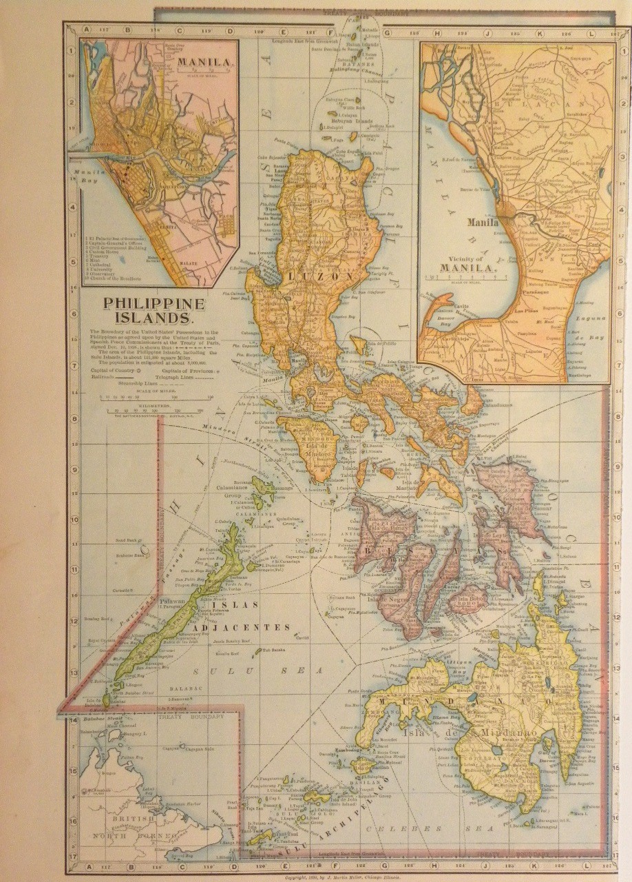
On this same date several islands, Cagayan de Sulu and Sibutu among them, were purchased from Spain and assigned to the Philippines, which was then being governed as a U.S. insular area. The borders specified in the Treaty of Paris of 1898 had excluded these islands; the new treaty simply ceded "any and all islands belonging to the Philippine Archipelago".[325][326]

Pacific Ocean:
Map of the change to the United States in the Pacific Ocean on March 23, 1901
July 4, 1901 The Insular Government of the Philippine Islands was established.[327][328] Pacific Ocean:
Map of the change to the United States in the Pacific Ocean on July 4, 1901
July 1, 1902 The Philippines were organized.[329] без промена на мапи
October 20, 1903 The Alaska boundary dispute with Canada was resolved, generally in favor of the United States claim.[270] Northwestern North America:
Map of the change to the United States in northwest North America on October 20, 1903
December 10, 1903 Land along southern Guantánamo Bay was leased in perpetuity from Cuba for use as a naval base;[330] the treaty took effect February 23, 1903, and the formal handover occurred on this date.[331] без промена на мапи
May 4, 1904 The United States took ownership of the Panama Canal Zone. At this stage, only the most basic borders were defined; it was a zone surrounding the canal on each side for five miles, but excluded the cities of Colón and Panama City, which remained exclaves of Panama, as well as the water for their harbors.[332] The Hay–Bunau-Varilla Treaty granting it to the United States was ratified on February 26, 1904.[333] A formal border agreement, which also gave the Canal Zone some land and a lighthouse in northwest Colón, would be ratified on June 15, 1904.[334][335] Caribbean Sea:
Map of the change to the United States in the Caribbean Sea on May 4, 1904
July 16, 1904 The Manuʻa islands were formally ceded to the United States and added to Naval Station, Tutuila.[318] As the United States had already claimed the islands on February 19, 1900, no change is mapped. The treaty would be ratified by Congress on February 20, 1929. без промена на мапи
December 12, 1904 The "Taft Agreement" was made with Panama on December 3, with one of its sections refining the maritime boundary of the harbor of Panama City and the Panama Canal Zone.[336][337] It became effective December 12. без промена на мапи
February 10, 1905 The border between Arkansas and Indian Territory was slightly adjusted near Fort Smith, Arkansas, transferring a small amount of land on the east side of the Poteau River to Arkansas.[338][339] Map of the change to the United States in central North America on February 10, 1905
November 16, 1907 Indian Territory and Oklahoma Territory were combined and admitted as the forty-sixth state, Oklahoma.[304][340] Map of the change to the United States in central North America on November 16, 1907
April 11, 1908 A boundary treaty with the United Kingdom on behalf of Canada redefined the maritime borders between the United States and Canada.[341] Among other changes, this "de-enclaved" Horseshoe Reef in Lake Erie by making the water around it contiguous with the water on the American side of the border.[198][342] без промена на мапи
January 1, 1909 The new Constitution of Michigan included some area of Wisconsin within its definition of Michigan.[343] Map of the change to the United States in central North America on January 1, 1909
August 20, 1910 A boundary treaty with the United Kingdom on behalf of Canada addressed a slight uncertainty in the maritime border in Passamaquoddy Bay between Maine and Canada.[344][345][346] The border was adjusted to run east of Pope's Folly Island, which previously lay on the border line, and had been the subject of some debate for many years.[347][348] Map of the change to the United States in central North America on August 20, 1910
July 17, 1911 Naval Station, Tutuila, was renamed American Samoa;[349] the station continued to operate separate from territorial governance until 1951. Pacific Ocean:
Map of the change to the United States in the Pacific Ocean on July 17, 1911
January 6, 1912 New Mexico Territory was admitted as the forty-seventh state, New Mexico.[199][350] Map of the change to the United States in central North America on January 6, 1912
February 14, 1912 Arizona Territory was admitted as the forty-eighth state, Arizona.[250][351] Map of the change to the United States in central North America on February 14, 1912
August 24, 1912 The District of Alaska was reorganized as the Alaska Territory.[352] Northwestern North America:
Map of the change to the United States in northwest North America on August 24, 1912
January 31, 1913 New Mexico filed suit in the Supreme Court against Texas over the "Country Club Dispute", questioning whether the present course or the 1850 course of the Rio Grande should be their border.[353] Map of the change to the United States in central North America on January 31, 1913
August 5, 1914 The Corn Islands were leased from Nicaragua for a period of 99 years; however, this was not a full transfer of sovereignty, and the islands were never administered as an insular area.[354] без промена на мапи
May 1, 1915 The borders of the Panama Canal Zone were explicitly defined. Whereas the original definition was a simple corridor surrounding the canal, this treaty specified the actual border. Among the changes this caused were: a slice of Canal Zone was ceded to Panama so Panama City would be connected with the rest of the country; the middle island of the Las Tres Hermanas Islands, which marked the border of Panama City's harbor, was wholly made part of Canal Zone; Gatun Lake and other surrounding waters were formally annexed to the territory; and an area of northwest Colón was ceded to Canal Zone.[355][356][357] Caribbean Sea:
Map of the change to the United States in the Caribbean Sea on May 1, 1915
May 27, 1915 Under Article II of the 1903 Treaty, the United States expropriated from Panama several areas around the mouth of the Rio Chagres, annexing them to the Panama Canal Zone.[358] too small to map
December 8, 1915 The United States expropriated from Panama a triangle of land, which included the historic Fort San Lorenzo, between the Rio Chagres, Caribbean Sea and the Panama Canal Zone, to which it was annexed.[358] too small to map
January 17, 1916 Navassa Island was formally claimed for lighthouse purposes.[359] без промена на мапи
August 29, 1916 The Philippines were reorganized to provide more autonomous government.[360] без промена на мапи
March 31, 1917 The Danish Virgin Islands were purchased from Denmark[361] and renamed the United States Virgin Islands.[362] Caribbean Sea:
Map of the change to the United States in the Caribbean Sea on March 31, 1917
July 12, 1918 The United States expropriated from Panama 2.6 hectares of land at Punta Paitilla in Panama City and annexed it to the Panama Canal Zone.[363] That area was enlarged to about 50 hectares within several months.[358][364][365][366] too small to map
August 21, 1918 The United States expropriated from Panama land between the Rio Chagres and the Quebrada Majagual and annexed it to the Panama Canal Zone.[358][366] Caribbean Sea:
Map of the change to the United States in the Caribbean Sea on August 21, 1918
September 13, 1918 Minnesota and Wisconsin exchanged islands in the Mississippi River: Island Seventytwo was transferred to Winona, Minnesota, and Barron's Island was transferred to La Crosse, Wisconsin.[154][367] Map of the change to the United States in central North America on September 13, 1918
September 18, 1919 The island of Largo Remo was annexed to the Panama Canal Zone under the United States right of expropriation in the 1903 Canal Treaty.[368] Caribbean Sea:
Map of the change to the United States in the Caribbean Sea on September 18, 1919
June 16, 1920 Fifteen hectares on the island of Taboga Island were annexed to the Panama Canal Zone.[369] too small to map
June 30, 1921 The "Wedge" dispute between Delaware and Pennsylvania was resolved in Delaware's favor. The disputed land had generally been administered by Delaware, even electing a member of the Delaware legislature in the mid-19th century,[370] but federal maps had included the land as part of Pennsylvania at least as late as 1900.[371] The states had agreed on a resolution, and it was affirmed by an act of Congress on this date.[372][373] Some sources, both contemporary and modern, note that, in the original process of resurveying the border in 1892, a very thin, horn-shaped region along the arc was transferred from Delaware to Pennsylvania;[370][373][374] however, no federal maps found reflect this, and it is unclear if this transfer actually occurred. Map of the change to the United States in central North America on June 30, 1921
May 10, 1922 Kingman Reef was formally annexed.[375] без промена на мапи
October 8, 1923 Michigan expanded its claim to Wisconsin territory, though Wisconsin never lost control over the area.[343] Map of the change to the United States in central North America on October 8, 1923
November 15, 1923 The Swan Islands were claimed by Honduras.[376] Caribbean Sea:
Map of the change to the United States in the Caribbean Sea on November 15, 1923
February 1, 1924 The future area for Madden Lake was annexed to the Panama Canal Zone under the United States right of expropriation in the 1903 Canal Treaty.[335][377][378] Caribbean Sea:
Map of the change to the United States in the Caribbean Sea on February 1, 1924
March 4, 1925 Swains Island was added to American Samoa.[379] Pacific Ocean:
Map of the change to the United States in the Pacific Ocean on March 4, 1925
July 17, 1925 The border with Canada was adjusted in several places.[380][381] The only change to a land border redefined how the border between the Lake of the Woods and the Rocky Mountains should be considered; previously, the border followed the curve of the parallel between each border monument, while the treaty changed this to straight lines between each monument. Through this, the United States netted a gain of between 30 and 35 acres of land. Due to the extremely small shift, the lack of specific documentation of where the changes occurred, and the lack of any human impact, this change is not mapped. There was also a change to the border in the Lake of the Woods; due to a surveying anomaly, the previous border intersected itself several times in the lake, creating enclaves of United States water surrounded by Canadian water. The treaty changed the border to use the southernmost intersection as the northwestern point of the Lake of the Woods. Finally, the maritime border in the Bay of Fundy was adjusted, netting Canada roughly 9 acres of water. too small to map
March 1, 1926 The Supreme Court of the United States resolved the conflict between Michigan and Wisconsin in the favor of Wisconsin.[343] Map of the change to the United States in central North America on March 1, 1926
July 29, 1926 Johnston Atoll was established as a federal bird refuge and placed under the jurisdiction of the United States Department of Agriculture.[382] The atoll had originally been claimed by both the United States and Hawaii in 1858, but little activity apart from guano mining had taken place, and it had been largely abandoned for decades.[219] без промена на мапи
November 22, 1926 The Supreme Court of the United States defined the border between Michigan and Wisconsin, transferring all islands south of the Quinnesec Falls on the Menominee River to Wisconsin, and all islands north of the falls to Michigan; it is unknown specifically which islands were transferred in this fashion. However, an error in the border description introduced a small overlap between the two states over several islands in Lake Michigan north of the Door Peninsula.[383] Map of the change to the United States in central North America on November 22, 1926
July 18, 1927 The United States expropriated from Panama another 33 hectares of land on the islands of Taboga and Taboguilla and annexed them to the Panama Canal Zone.[358] too small to map
October 26, 1927 Two bancos along the Colorado River were ceded from Mexico to Arizona.[384][385] too small to map
December 5, 1927 The "Country Club Dispute" between New Mexico and Texas was resolved in Texas's favor.[386] Map of the change to the United States in Central North America on December 5, 1927
April 4, 1928 The Island of Palmas Case was decided in the favor of the Netherlands, ceding Palmas to the Dutch East Indies.[317] Pacific Ocean:
Map of the change to the United States in the Pacific Ocean on April 4, 1928
September 24, 1928 The United States expropriated from Panama three hectares of land at El Cerro de Doscientos Pies ("200-Foot Hill") near Las Minas Bay and annexed it to the Panama Canal Zone.[358][366] too small to map
July 22, 1930 The United States expropriated from Panama 25 hectares on Jicarita Island and 60 hectares at Punta Morro de Puercos and annexed them to the Panama Canal Zone.[358] too small to map
April 15, 1931 The United States expropriated from Panama additional areas around the soon-to-be-built Madden Dam and annexed them to the Panama Canal Zone.[358][366] Caribbean Sea:
Map of the change to the United States in the Caribbean Sea on April 15, 1931
May 3, 1932 The United States adjusted the border at Punta Paitilla in the Canal Zone, returning a small amount of land to Panama. This was the site for a planned new American embassy, which had to be built on foreign soil.[387] too small to map
May 17, 1932 Porto Rico was renamed Puerto Rico.[388] Caribbean Sea:
Map of the change to the United States in the Caribbean Sea on May 17, 1932
December 13, 1932 The Mangsee Islands and seven of the Turtle Islands were ceded by the United Kingdom from North Borneo to the Philippines. The islands were supposed to be included in the 1900 transfer of islands from Spain to the United States. Per the terms of the treaty, the United Kingdom continued to administer the islands until requested, and, after the Philippines' independence, the Philippine government made such a request and took control.[389] Pacific Ocean:
Map of the change to the United States in the Pacific Ocean on December 13, 1932
May 29, 1933 The Supreme Court of the United States ruled that the border between New Hampshire and Vermont was the low water mark of the west bank of the Connecticut River; Vermont had sought to have the border placed in the middle of the river.[42] без промена на мапи
November 13, 1933 A treaty created the Rio Grande Rectification Project, which, from 1935 to 1938, straightened and stabilized the path of the Rio Grande through the El PasoJuárez Valley. By the end of the project, 174 parcels had been transferred between Mexico and Texas, each side receiving an equal area of land.[390][391] too small to map
December 29, 1934 Kingman Reef was placed under the jurisdiction of the United States Department of the Navy.[375] без промена на мапи
November 15, 1935 The Insular Government of the Philippine Islands was dissolved and replaced with the Commonwealth of the Philippines.[392][393] Pacific Ocean:
Map of the change to the United States in the Pacific Ocean on November 15, 1935
March 16, 1936 The de jure overlap between Michigan and Wisconsin was resolved by the Supreme Court of the United States.[394] Map of the change to the United States in central North America on March 16, 1936
May 13, 1936 Baker Island, Howland Island, and Jarvis Island were formally annexed and placed under the jurisdiction of the United States Department of the Interior,[395] ending the United Kingdom's claim to Jarvis Island.[261] Pacific Ocean:
Map of the change to the United States in the Pacific Ocean on May 13, 1936
June 22, 1936 The U.S. Virgin Islands were organized into a civil territory.[396] без промена на мапи
August 6, 1936 Canton Island, Enderbury Island, and McKean Island were claimed by the United Kingdom.[261] Pacific Ocean:
Map of the change to the United States in the Pacific Ocean on August 6, 1936
April 6, 1939 The condominium of the Canton and Enderbury Islands was established with the United Kingdom.[397] Pacific Ocean:
Map of the change to the United States in the Pacific Ocean on April 6, 1939
July 27, 1939 Panama gained a sovereign corridor that was carved out of the Panama Canal Zone connecting Colón with the rest of Panama, along with a three-dimensional "tube" of sovereignty for a future crossing over an American highway. A corridor consisting of the road from the Canal Zone boundary to Madden Dam was annexed to the Canal Zone.[398] Caribbean Sea:
Map of the change to the United States in the Caribbean Sea on July 27, 1939
August 16, 1939 This is the earliest date so far discovered for when the United States began claiming Fakaofo, Funafuti, Hull Island, Niulakita, Nukufetau, and Nukulaelae.[399] Pacific Ocean:
Map of the change to the United States in the Pacific Ocean on August 16, 1939
December 10, 1941 Governor George McMillin surrendered Guam to the Japanese military.[400] Pacific Ocean:
Map of the change to the United States in the Pacific Ocean on December 10, 1941
December 23, 1941 The garrison on Wake Island surrendered to the Japanese military.[401] Pacific Ocean:
Map of the change to the United States in the Pacific Ocean on December 23, 1941
March 26, 1942 The government of the Philippines evacuated from the territory in the face of Japanese advance. A government-in-exile would be established in Washington, D.C. on May 17, 1942. The United States Army Forces in the Far East would surrender on April 9, 1942, following the Battle of Bataan, and the final military holdouts would surrender on May 6, 1942, following the Battle of Corregidor.[402] Pacific Ocean:
Map of the change to the United States in the Pacific Ocean on March 26, 1942
October 14, 1943 The Second Philippine Republic was established as a puppet state of Japan.[402] Pacific Ocean:
Map of the change to the United States in the Pacific Ocean on October 14, 1943
August 10, 1944 Guam was captured from Japan.[400] Pacific Ocean:
Map of the change to the United States in the Pacific Ocean on August 10, 1944
August 17, 1945 The Second Philippine Republic, in exile in Tokyo since April 3, 1945, was dissolved. The process of re-establishing the Commonwealth government on Philippine soil had started on October 23, 1944.[402] Pacific Ocean:
Map of the change to the United States in the Pacific Ocean on August 17, 1945
September 4, 1945 The Japanese garrison on Wake Island surrendered to the United States.[401] Pacific Ocean:
Map of the change to the United States in the Pacific Ocean on September 4, 1945

1946–present (Decolonization)

Date Event Change map
July 4, 1946 The Commonwealth of the Philippines became independent as the Republic of the Philippines.[403] Pacific Ocean:
Map of the change to the United States in the Pacific Ocean on July 4, 1946
July 18, 1947 The United Nations entrusted the Trust Territory of the Pacific Islands to the United States.[404] Pacific Ocean:
Map of the change to the United States in the Pacific Ocean on July 18, 1947
January 1, 1949 The Tokelau Islands were incorporated into New Zealand, which inherited the claims on Atafu, Fakaofo, and Nukunono.[405] Pacific Ocean:
Map of the change to the United States in the Pacific Ocean on January 1, 1949
August 1, 1950 Guam was organized into a civil territory.[406][407] без промена на мапи
August 3, 1950 Kansas and Missouri exchanged small portions of land along the Missouri River, due to shifts in the river following a flood in 1944.[408] Map of the change to the United States in central North America on August 3, 1950
April 11, 1955 Panama's corridor connecting Colón with the rest of Panama was realigned within the Panama Canal Zone. Several three-dimensional "tubes" of sovereignty were also created, allowing Panamanian bridges to pass over rivers and a highway at several locations within the Canal Zone.[409][410] too small to map
August 23, 1955 Several border locations of the Panama Canal Zone were redefined. Punta Paitilla, the land held on Taboga Island, and the remaining American holdings in Colón and Panama City were ceded to Panama.[335][411] Caribbean Sea:
Map of the change to the United States in the Caribbean Sea on August 23, 1955
January 3, 1959 The Alaska Territory was admitted as the forty-ninth state, Alaska.[271] Northwestern North America:
Map of the change to the United States in northwest North America on January 3, 1959
August 21, 1959 Most of Hawaii Territory was admitted as the fiftieth state, Hawaii. Palmyra Atoll was excluded from statehood and remained a territory.[248][322] Pacific Ocean:
Map of the change to the United States in the Pacific Ocean on August 21, 1959
August 25, 1961 About 20 acres of land was transferred from Minnesota to North Dakota near Fargo, North Dakota.[188][412] too small to map
January 14, 1964 The Chamizal, a tract of land between El Paso, Texas, and Ciudad Juárez, Chihuahua, was divided between the United States and Mexico.[413] Map of the change to the United States in central North America on January 14, 1964
August 4, 1965 The Cook Islands became self-governing from New Zealand. It claimed the atolls of Pukapuka, Manihiki, Penrhyn, and Rakahanga.[414] Pacific Ocean:
Map of the change to the United States in the Pacific Ocean on August 4, 1965
December 30, 1966 Land on Diego Garcia in the Indian Ocean was leased from the United Kingdom for use as a military base.[415] без промена на мапи
April 25, 1971 The lease of the Corn Islands from Nicaragua was terminated.[354] без промена на мапи
September 1, 1972 The United States recognized the sovereignty of Honduras over the Swan Islands.[354][416] Caribbean Sea:
Map of the change to the United States in the Caribbean Sea on September 1, 1972
March 1, 1977 The United States claimed maritime borders west of the Strait of Juan de Fuca, within the Dixon Entrance, and in the Beaufort Sea that conflicted with claims of Canada.[417] без промена на мапи
May 26, 1977 Several parcels were exchanged between Texas and Mexico along the Rio Grande in areas near Presidio and Hidalgo, Texas,[418] including the Horcón Tract, on which the town of Río Rico was located,[419] and Beaver Island near Roma, Texas. In addition, Mexico ceded 823 acres (3,33 km2) to the U.S., while the U.S. ceded 2.177 acres (8,81 km2) to Mexico, primarily to straighten sections of the Rio Grande for flood control.[420] Map of the change to the United States in central North America on May 26, 1977
December 16, 1977 A treaty defining the maritime border with Cuba was signed; though it has never been ratified by the United States Senate, it is provisionally enforced by agreement renewed every two years.[346] без промена на мапи
October 1, 1978 Tuvalu became independent from the United Kingdom. It claimed the atolls of Funafuti, Nukufetau, Nukulaelae, and Niulakita.[421] Pacific Ocean:
Map of the change to the United States in the Pacific Ocean on October 1, 1978
July 12, 1979 The Republic of Kiribati became independent from the United Kingdom. It claimed Birnie Island, Canton Island, Caroline Island, Christmas Island, Enderbury Island, Flint Island, Gardner Island, Hull Island, Malden Island, McKean Island, Phoenix Island, Starbuck Island, Sydney Island, and Vostok Island. This dissolved the condominium of the Canton and Enderbury Islands.[422] Pacific Ocean:
Map of the change to the United States in the Pacific Ocean on July 12, 1979
October 1, 1979 The Panama Canal Zone was ceded to Panama. The United States and Panama continued to share operational control of the canal until December 31, 1999, when it would be fully turned over to Panama.[423] The United States retained control over several hundred specified areas to be turned over in piecemeal fashion over the years. Caribbean Sea:
Map of the change to the United States in the Caribbean Sea on October 1, 1979
November 24, 1980 The maritime border between the United States and Venezuela was defined.[346][424] без промена на мапи
September 17, 1981 The United States recognized the sovereignty of Colombia over Roncador Bank and Serrana Bank, and the claim on Quita Sueño Bank was abandoned by the United States, as it was no longer above the seas at high tide, and thus the government considered it unclaimable.[354][425] Caribbean Sea:
Map of the change to the United States in the Caribbean Sea on September 17, 1981
September 3, 1983 The United States recognized the sovereignty of the New Zealand territory of Tokelau over Atafu, Fakaofo, and Nukunono, and defined the maritime border with Tokelau.[346][354][426] Pacific Ocean:
Map of the change to the United States in the Pacific Ocean on September 3, 1983
September 8, 1983 The United States recognized the sovereignty of the Cook Islands over Pukapuka, Manihiki, Penrhyn, and Rakahanga, and the maritime border with the Cook Islands was defined.[346][354][427] Pacific Ocean:
Map of the change to the United States in the Pacific Ocean on September 8, 1983
September 23, 1983 The United States recognized the sovereignty of Kiribati over Birnie Island, Canton Island, Caroline Island, Christmas Island, Enderbury Island, Flint Island, Gardner Island, Hull Island, Malden Island, McKean Island, Phoenix Island, Starbuck Island, Sydney Island, and Vostok Island.[354][428]

The United States recognized the sovereignty of Tuvalu over Funafuti, Nukufetau, Nukulaelae, and Niulakita.[354][429]

Pacific Ocean:
Map of the change to the United States in the Pacific Ocean on September 23, 1983
October 12, 1984 The International Court of Justice made its judgment on where the maritime border should be in the Gulf of Maine between the United States and Canada.[346][430] No land changed hands. The scope of the case did not include the sovereignty of Machias Seal Island, but the judgment enabled defining the extent of the disputed water area around that island (an area of 210 square nautical miles).[417] без промена на мапи
October 21, 1986 The Marshall Islands District of the Trust Territory of the Pacific Islands became independent as the Republic of the Marshall Islands.[431] The Marshall Islanders had claimed Wake Island as part of their territory since at least 1973, and continued that after independence.[432] Pacific Ocean:
Map of the change to the United States in the Pacific Ocean on October 21, 1986
November 3, 1986 Most of the Trust Territory of the Pacific Islands was dissolved by the United Nations. The districts of Chuuk, Pohnpei, and Yap became independent as the Federated States of Micronesia. The Mariana Islands District, having already been taking moves towards integration with the United States, became a territory of the United States, the Commonwealth of the Northern Mariana Islands.[431] Pacific Ocean:
Map of the change to the United States in the Pacific Ocean on November 3, 1986
June 1, 1990 The maritime border between the United States and the Soviet Union was provisionally defined.[346][433] The two countries agreed on this date to abide by the terms of the treaty pending its ratification and entry into force,[434] but while it was ratified by the United States Senate on September 16, 1991,[435] it is unknown if either the Soviet Union or its successor state, Russia, ratified it.[тражи се извор] без промена на мапи
October 1, 1994 The remaining district of the Trust Territory of the Pacific Islands, the Palau District, became independent as the Republic of Palau, dissolving the TTPI.[436] Pacific Ocean:
Map of the change to the United States in the Pacific Ocean on October 1, 1994
June 1, 1995 The maritime border between the United States and territories of the United Kingdom in the Caribbean Sea was defined.[346][437][438] без промена на мапи
January 16, 1997 Navassa Island was transferred to the United States Department of the Interior.[439][440] без промена на мапи
November 13, 1997 The maritime border between the United States and Mexico was defined.[346][441] без промена на мапи
May 26, 1998 The Supreme Court ruled that extra land added to Ellis Island since the original island was officially granted to New York in an interstate compact with New Jersey in 1834 belonged to New Jersey, owing to the fact that the island was within the territorial waters of New Jersey. The original natural boundary of Ellis Island remained an enclave of New York.[442] без промена на мапи
December 31, 1999 All former Panama Canal Zone parcels not turned over since 1979, as well as all joint canal operations areas, were transferred to Panama. too small to map
January 17, 2001 The maritime border between the United States and Mexico on the continental shelf in the western Gulf of Mexico beyond 200 nautical miles was defined.[346][443] без промена на мапи
November 24, 2009 Six islands along the Rio Grande were ceded from Texas to Mexico, and three islands and two bancos were ceded from Mexico to Texas. The transfer, which had been pending for 20 years, was the first application of Article III of the 1970 Boundary Treaty.[346][385][444] too small to map
September 23, 2014 The maritime border between the United States and Niue was defined.[346][445] The treaty was signed on May 13, 1997, but it was not ratified by the United States until at least 2002, and the United Nations shows it as entering into force on this date.[446] без промена на мапи
January 1, 2017 The border between North Carolina and South Carolina was clarified following years of surveys and negotiation, moving 19 homes across state lines.[447][448] too small to map
November 30, 2020 The State of Rhode Island and Providence Plantations adopted a constitutional amendment, renaming itself the State of Rhode Island.[449][450] без промена на мапи

Bancos along the Rio Grande

The Banco Convention of 1905 between the United States and Mexico allowed, in the event of sudden changes in the course of the Rio Grande (as by flooding), for the border to be altered to follow the new course.[451] The sudden changes often created bancos (land surrounded by bends in the river that became segregated from either country by a cutoff, often due to rapid accretion or avulsion of the alluvial channel), especially in the Lower Rio Grande Valley. When these bancos are created, the International Boundary and Water Commission investigates if land previously belonging to the United States or Mexico is to be considered on the other side of the border.[452] In all cases of these adjustments along the Rio Grande under the 1905 convention, which occurred on 37 different dates from 1910 to 1976, the transferred land was minuscule (ranging from one to 646 acres) and uninhabited.[453][454][455] -->

Напомене

  1. ^ Границе земље пратиле су колонијалне границе; ради једноставности, карте користе границе дефинисане у 1783. паришким споразумом. Једина суштинска разлика између граница пре и после Паришког споразума је југозападна граница: када је Велика Британија имала власништво над Западном Флоридом, померили су своју границу на север, на линију источно од ушћа реке Јазу, а та област тако није припадала Грузији; споразум је доделио подручје између ове и 31° северно Сједињеним Државама.
  2. ^ Градови Њу Хемпшира који су поднели петицију да се придруже Вермонту били су: Апторп, Бат, Кејнан, Оранџ, Корниш, Дрезден, Енфилд, Франконија, Лисбон, Хаверхил, Ландаф, Лебанон, Лиман, Лајм, Орфорд, и Пирмонт.[33] Конкретан обим припојених градова није познат, пошто су границе општина често биле оцртане тек када је дошло до спора; карта користи уобичајено тумачење.
  3. ^ Градови Њу Хемпшира који су поднели петицију да се придруже Вермонту били су: Акворт, Алстед, Бат, Кардиган, Чарлстаун, Честерфилд, Клермонт, Корниш, Кројдон, Дорчестер, Дрезден, Франконија, Гилсум), Графтон, Грантхам, Гунтвејт (сада Лисабон), Хановер, Хаверхил, Хинсдејл, Ландаф, Ланкастер, Либан, Лемпстер), Линколн, Лајман, Лајм, Марлоу, Њупорт, Пјермонт, Плејнфилд, Ричмонд, Сунапи, Сури, Валпол и Вестморленд.[39] Конкретан обим припојених градова је непознат, пошто су се границе општина често оцртавале тек када је дошло до спора; мапа користи уобичајено тумачење.
  4. ^ Градови Њујорка који су поднели петицију да се придруже Вермонту били су: „Блек-Крик“ (непознато; вероватно је или је близу Хеброна), Кембриџ, Форт Едвард, Гранвил, „Гринфилд“ (непознато; постоји град по имену Гринфилд, али лежи западно од реке Хадсон, која је експлицитно била западни део Западне уније), Хусик, Кингсбури, "Мали Хусак" (непознато; вероватно близу Хусика), Саратога, "Скортикук" (вероватно Шагхтикок), Скинбуро (сада Вајтхол), и „Апер Вајт Крик“ (вероватно Вајт Крик).[40] Конкретан обим припојених градова није познат, пошто су се границе општина често оцртавале тек када би дошло до спора; карта користи уобичајено тумачење.
  5. ^ Споразумом су утврђене границе нове земље, од Фандија: навише „Сент Крок реком“ (која река је била спорна) до њеног извора; северно до висине копна („Северозападни угао Нове Шкотске“); дуж висине земље до "северозападне главе" реке Конектикат; доле до 45° северно]]; западно до Сент Лоренс реке; до Великих језера, преко језера Онтарио, реке Нијагара, језера Ери, реке Детроит, језера Сент Клер, реке Сент Клер, Језеро Хурон и Горње језеро; до "Дугог језера" (које је оспорено) према шумском језеру; до северозападног угла Шумског језера; затим на запад до реке Мисисипи. Међутим, Шумско језеро је било северно од извора реке Мисисипи; мапе универзално приказују ову недефинисану границу као праву линију, скоро равну на југ, између две тачке. Одатле је пратила реку Мисисипи до 31° северно; источно до реке Чатахучи до реке Флинт; линија одатле до извора реке Сент Мерис; затим доле до Атлантског океана.[49]
  6. ^ Границе Франкленда никада нису биле дефинисане; мапа користи њен уобичајени приказ.
  7. ^ Уступљени захтев Масачусетса био је део земље западно од Њујорка и Пенсилваније које се протежу до реке Мисисипи, ограничене географским ширинама првобитне повеље Колонијe залива Масачусетс: на северу једном линијом западно од Језера Винипесоки, а на југу линијом западно од југозападног угла Масачусетса.[43]
  8. ^ Уступљени захтев Конектиката био је појас земље западно од 120 миља западно од Пенсилваније (западна граница њеног Западног резервата) који се протеже до реке Мисисипи, омеђен 41° северно и јужна ивица западне тврдње Масачусетса, отприлике 42°2′ северно.[43]
  9. ^ Уступљени захтев Масачусетса био је део Њујорк 82 миље западно од места где је река Делавер напустила Њујорк, до нејасне западне границе, при чему један извор каже да је то било чак једну миљу источно од реке Нијагара.[43]
  10. ^ Нова граница између Северне Каролине и савезне државе била је, са севера, југозападно дуж разних планинских гребена; међутим, проблеми су довели до тога да геодети на крају воде линију отприлике према југу уместо да наставе дуж гребена.[17]
  11. ^ Нова граница између Њујорка и Вермонта била је, са севера: Језеро Шамплејн, Река Полтни, а затим на југу границе општина.[30]
  12. ^ Нова граница између Кентакија и Вирџиније била је, са југа: север дуж Планине Камберленд и планине Пајн до Расел Форка; североисточно до Таг Форка; затим низ до Велика пешчана река и до реке Охајо.[80]
  13. ^ Нова граница територије Индијане – северозападне територије била је, са југа, линија од ушћа реке Кентаки до Форт Рекаверија, а затим на север.[94]
  14. ^ Нова граница између Грузије и савезне државе била је, са југа, навише Чатахучи реком до њене велике кривине (близу Вест Појнта), затим линија одатле ка и мимо Никајака. У опису границе је писало да ће ићи све док не стигне до Тенеси, и да прати то уз реку до реке Тенеси, али река је у потпуности лежала у Тенесију.[10]
  15. ^ Постојало је питање да ли је куповина такође укључивала сливове реке Мисури и Црвене реке севера, али то питање није било релевантно пре него што је Уговор из 1818. дефинитивно решио границе. Мапе универзално приказују куповину укључујући слив реке Мисури, али искључујући слив Црвене реке.[101]
  16. ^ Западна граница Западне Флориде представљала је низ пловних путева, углавном реке Мисисипи, Ибервил и Амите реке и језера Пончартрејн и Маурепас.[102]
  17. ^ Нова Илиноис територија се простирала са југа од реке Вобаш до Винсенса, а затим северно.[109]
  18. ^ Северозападни остатак територије се вероватно поново придружио територији Луизијане, пошто је њен опсег још увек био нејасно дефинисан.
  19. ^ Индијана је дефинисана као територија северно од реке Охајо и источно од реке Вабаш, али док је линија територије скренула на север у Винсенес, граница државе се наставила реком Вабаш све док није стигла до тачке где би линија повучена северно од Винсенеса последњи пут пресецала реку. Северна граница државе била је линија 16 километара северно од јужног врха језера Мичиген, све док није стигла до меридијана који је формирао западну границу Охаја, а то је била линија повучена северно од ушћа реке Мајами.[94]
  20. ^ Нова граница територије Алабама-Мисисипија била је, са севера: уз реку Тенеси до Бер Крика (око данашњег jезера Пиквик); линијом до северозападног угла округа Вашингтон у Алабами; затим на југ.[124]
  21. ^ Нова граница територије Арканзас са територијом Мисурија била је где река Мисисипи сусреће 36° северно: западно до Свете реке Френцис, до 36°30′ северно, затим на запад.[117]
  22. ^ Нова граница је била, од Мексичког залива: уз реку Сабине до 32° северно; северно до Црвене реке; до 100° западно; северно до реке Арканзас; све до извора; северно до 42° северно; затим на запад до Тихог океана.[102]
  23. ^ Нова савезна граница Мисурија била је, од ушћа реке Де Мојн: уз реку до тачке западно од Де Мојн водопада на реци Мисисипи, западно до тачке северно од ушћа реке Канзас, затим јужно.[117]
  24. ^ Нова федерална граница територије Арканзаса, са севера, линија од југозападног угла Мисурија до тачке на реци Арканзас „100 корака источно“ од Форт Смита, као граница земаља источних Чоктоа, затим јужно.[133] Међутим, Врховни суд Арканзаса је 1909. године утврдио да је " 100 корака источно“ била административна грешка и да је логично требало да стоји „100 корака западно“.[146]
  25. ^ Нова граница територије Мичигена и територије Висконсина била је, од горњег језера: уз реку Монтреал до Лак Ву пустиње; линијом до извора реке Меномин; затим доле до Грин Беја. Међутим, ова дефиниција је била немогућа: река Монтреал се завршавала много пре него што је стигла до пустиње Лак Ву. Питање ће бити решено 1850. године.[107]
  26. ^ Нова североисточна граница била је, од Пасамакуоди Залива: до реке Сент Кру до њеног извора; северно до реке Свети Џон; све до Сент Франсис реке; до његовог изворишта на језеру Похенегамук; југозападно до северозападног крака реке Сент Џон; линија одатле до места где река Сент Џон прелази 46°25’ северно; уз реку до њеног извора; дуж висоравни до извора тока Холс, затим низ ток до 45° северно.[13][136]
  27. ^ Нова северна граница је била, од Горњег језера: уз Голуб реку до многих језера и река у склопу граничних вода, да би на крају достигла до Кишне реке; затим доле до Шумског језера.
  28. ^ Нова граница територије Висконсин била је, од Горњег језера: до реке Сент Луис до њених првих брзака; јужно до Сент Кро реке ; затим доле до реке Мисисипи.[154]
  29. ^ Нова међународна граница била је, од Рио Гранде: дуж јужне и западне границе Новог Мексика до сусрета са реком Хила; доле до реке Колорадо; затим линија до тачке једну лигу јужно од луке Сан Дијего. Међутим, јужна граница Новог Мексика била је у питању, при чему се амерички захтев налази на 31°52′ северно, а мексички на 32°22′ северно.[182]
  30. ^ Нова граница Калифорније и савезне државе била је, са севера: јужно дуж 120° западно до 39° северно; линијом до места где река Колорадо сече 35° северно; затим низ реку Колорадо.[2]
  31. ^ Нова тексашка федерална граница била је, од југа: навише Рио Гранде до 32° северно ; источно до 103° западно; северно до 36°30′; затим на исток.[170]
  32. ^ Нова савезна граница територије Новог Мексика је била од 36°30′ северно и 103° западно: северно до 38° северно; затим на запад до врха планине Сан Хуан (која се тада звала Сијера Мадре).[199]
  33. ^ Нова међународна граница је била, почевши од места где Рио Гранде прелази 31°47′ северно: западно 100 миља; јужно до 31°20′ северно; западно до 111° западно; линија до тачке на реци Колорадо 20 миља испод ушћа реке Хила; затим уз реку Колорадо.[208]
  34. ^ Нова граница Минесоте и савезне државе била је, са севера: навише Црвена река севера до реке Бојс де Су; до тога до језера Траверс и његовог јужног врха; линија до Великог каменог језера и кроз њу до његовог јужног врха; затим на југ.[188]
  35. ^ Нова граница територије Орегон-Вашингтон била је, са севера, уз реку Снејк до ушћа реке Овајихи, а затим на југ.[185]
  36. ^ Границе територије Џеферсона на које се полаже право биле су између 37° северно, 43° северно, 102° западно и 110° западно.[220]
  37. ^ The borders of Colorado Territory were parallels 32° north, 37° north, and Washington meridians 25° west and 32° west.[226]
  38. ^ The new Nebraska Territory–Dakota Territory border was, from the east: up the Missouri River to the Niobrara River; up that to the Keya Paha River; up that to 43° north; then west.[206]
  39. ^ The decree transferred land from the left bank of the Blackstone River to Rhode Island, including what is now East Providence, in exchange land around Fall River being transferred to Massachusetts.[12]
  40. ^ The Virginia counties that became West Virginia were: Barbour, Boone, Braxton, Brooke, Cabell, Calhoun, Clay, Doddridge, Fayette, Gilmer, Greenbrier, Hampshire, Hancock, Hardy, Harrison, Jackson, Kanawha, Lewis, Logan, McDowell, Marion, Marshall, Mason, Mercer, Monongalia, Monroe, Morgan, Nicholas, Ohio, Pendleton, Pleasants, Pocahontas, Preston, Putnam, Raleigh, Randolph, Ritchie, Roane, Taylor, Tucker, Tyler, Upshur, Wayne, Webster, Wetzel, Wirt, Wood, and Wyoming.[255]
  41. ^ The new Idaho Territory–Montana Territory border was, from the north: south along 39° west from Washington to the crest of the Bitterroot Range and the Rocky Mountains; along that to 44°30′ north; east to 34° west from Washington; north to 45° north; then east.[259]
  42. ^ The new Dakota Territory–Idaho Territory border was, from the south: north along 33° west from Washington to the crest of the Rocky Mountains, then northwest along that to the new tripoint with Montana Territory.[230]
  43. ^ The borders of the Department of Alaska were, from the Dixon Entrance: Up the Portland Channel to 56° north; then along the "summit of the mountains situated parallel to the coast" (the definition of which was disputed) to 141° west; then north.[270]
  44. ^ The borders of Wyoming Territory were parallels 41° north and 45° north, and Washington meridians 27° west and 34° west.[279]
  45. ^ The new Oklahoma Territory–federal border was, from where the Red River meets 98° west: north to the Canadian River; down that to Seminole land; north along that border to the North Canadian River; down that to Creek land; north and east along that border to 96° west; then north. This omits the Cherokee Outlet, whose complex borders separated the main portion of Oklahoma Territory from the former Public Land Strip.[304]

Референце

  1. ^ а б Van Zandt, pp. 14–15
  2. ^ а б в Van Zandt, pp. 151–153
  3. ^ а б в г д ђ е ж з и ј к л љ м н Moore, John Bassett (1906). „A Digest of International Law as Embodied in Diplomatic Discussions, Treaties and Other International Agreements, International Awards, the Decisions of Municipal Courts, and the Writings of Jurists and Especially in Documents, Published and Unpublished, Issued by Presidents and Secretaries of State of the United States, the Opinions of the Attorneys-General, and the Decisions of Courts, Federal and State”. Washington, DC: U.S. Government Printing Office. стр. 566—580. Архивирано из оригинала 1. 5. 2016. г. 
  4. ^ Ryden, George Herbert. The Foreign Policy of the United States in Relation to Samoa. New York: Octagon Books, 1975.
  5. ^ http://www.vinow.com/general_usvi/history/ Архивирано на веб-сајту Wayback Machine (2. јануар 2017) Vinow.com. Virgin Islands History. Retrieved January 18, 2018.
  6. ^ „Declaration of Independence: A Transcription”. National Archives and Records Administration. новембар 2015. Архивирано из оригинала 17. 11. 2021. г. Приступљено 7. 9. 2017. 
  7. ^ а б Van Zandt, pp. 72–74
  8. ^ Van Zandt, pp. 84–85
  9. ^ „Delaware Government Facts & Symbols”. Government of Delaware. Архивирано из оригинала 9. 1. 2017. г. Приступљено 16. 1. 2017. 
  10. ^ а б в Van Zandt, pp. 100–104
  11. ^ а б Van Zandt, pp. 85–88
  12. ^ а б в г д ђ Van Zandt, pp. 65–71
  13. ^ а б Van Zandt, pp. 60–64
  14. ^ Hampshire, New (1824). The Laws of the State of New Hampshire. стр. 239—240. Приступљено 16. 1. 2017. 
  15. ^ Van Zandt, pp. 79–80
  16. ^ а б Van Zandt, pp. 74–79
  17. ^ а б Van Zandt, pp. 96–99
  18. ^ а б в г Van Zandt, pp. 80–84
  19. ^ Van Zandt, pp. 71–72
  20. ^ „Rhode Island declares independence”. History Channel. Архивирано из оригинала 18. 1. 2017. г. Приступљено 16. 1. 2017. 
  21. ^ а б Van Zandt, pp. 99–100
  22. ^ а б в Van Zandt, pp. 92–95
  23. ^ а б в г д ђ е ж з и ј к „Nine Capitals of the United States”. U.S. Senate. Архивирано из оригинала 20. 3. 2016. г. Приступљено 19. 3. 2016. 
  24. ^ а б в г д ђ е „8 Forgotten Capitals of the United States”. History. Архивирано из оригинала 26. 1. 2017. г. Приступљено 12. 3. 2017. 
  25. ^ „The North Carolina – South Carolina Border Surveys – 1730 to 1815”. Архивирано из оригинала 4. 3. 2016. г. Приступљено 30. 12. 2015. 
  26. ^ Kelly, Stephen R. (23. 8. 2014). „How the Carolinas Fixed Their Blurred Lines”. The New York Times. Архивирано из оригинала 31. 8. 2014. г. Приступљено 30. 12. 2015. 
  27. ^ O'Connor, Joe (27. 11. 2012). „Puffin Wars: The island paradise at centre of last Canada-U.S. land dispute”. National Post. Приступљено 1. 4. 2019. 
  28. ^ „Constitution of Delaware”. Avalon Project. Yale Law School. 1776. Архивирано из оригинала 9. 7. 2009. г. Приступљено 10. 6. 2009. 
  29. ^ „Constitution of Pennsylvania”. Avalon Project. Yale Law School. 1776. Архивирано из оригинала 26. 1. 2017. г. Приступљено 16. 1. 2017. 
  30. ^ а б в г д ђ е ж з Van Zandt, pp. 64–65
  31. ^ Court, New Hampshire (Colony) Probate (1877). Provincial and State Papers relating to New Hampshire. стр. 242–246. Приступљено 16. 1. 2017. 
  32. ^ а б Vermont 2006 J.R.H. 3, Joint Resolution Designating January as Vermont History and Independence Month Архивирано октобар 11, 2006 на сајту Wayback Machine
  33. ^ а б в Vermont State Papers, pp. 89–103
  34. ^ а б в г „The Historical Geography of Vermont”. Архивирано из оригинала 12. 1. 2016. г. Приступљено 24. 1. 2016. 
  35. ^ а б в г „East Union”. The Vermont Encyclopedia. University Press of New England. 2003. стр. 111. ISBN 978-1-58465-086-7. 1584650869. 
  36. ^ Crumrine, Boyd (1902). „Boundary Controversy between Pennsylvania and Virginia; 1748–1785”. Annals of Carnegie Museum. 1: 505—568. Приступљено 20. 8. 2017. 
  37. ^ а б в „Virginia-Tennessee Border”. Архивирано из оригинала 6. 2. 2016. г. Приступљено 4. 1. 2016. 
  38. ^ „Articles of Confederation”. The Avalon Project at Yale Law School. Архивирано из оригинала 29. 10. 2015. г. Приступљено 31. 10. 2015. 
  39. ^ а б Vermont State Papers, pp. 136–137: "Agreeably to the recommendation of the committees, the Legislature of Vermont was adjourned to the first Wednesday of April [1781]; at which time, it met at Windsor, and the union of the grants, east and west of Connecticut river, was consummated"
  40. ^ а б Vermont State Papers, pp. 138–141
  41. ^ а б „West Union”. The Vermont Encyclopedia. University Press of New England. 2003. стр. 319. ISBN 978-1-58465-086-7. 1584650869. 
  42. ^ а б Шаблон:Ussc
  43. ^ а б в г д ђ Walker, стр. 65
  44. ^ „Virginia's Cession of the Northwest Territory”. Архивирано из оригинала 17. 8. 2016. г. Приступљено 21. 6. 2016. 
  45. ^ Spencer, Jesse Ames (1912). The United States: its beginnings, progress and modern development, Volume 3. Приступљено 14. 1. 2016. 
  46. ^ Gnichtel, Frederick W. (1921). „The "Pennamite Wars" and the Trenton Decree of 1782”. Proceedings of the New Jersey Historical Society. 6. Приступљено 8. 11. 2015. 
  47. ^ Worthing C. Ford; et al. (ур.). Journals of the Continental Congress, 1774–1789. 26. стр. 112—121. Архивирано из оригинала 09. 03. 2022. г. Приступљено 14. 02. 2022. 
  48. ^ Van Zandt, pp. 10–22
  49. ^ а б Treaty of Paris, 1783 Архивирано мај 15, 2007 на сајту Wayback Machine; International Treaties and Related Records, 1778–1974; General Records of the United States Government, Record Group 11; National Archives.
  50. ^ McGee, Gentry Richard (1911). A History of Tennessee from 1663 to 1914: For Use in Schools. American Book Company. стр. 95–99. Приступљено 29. 12. 2015. 
  51. ^ Williams, Samuel C. (1933). History of the Lost State of Franklin. стр. 30. 
  52. ^ а б в Schlueter, Roger (8. 9. 2016). „The state that almost was an original colony”. Belleville News-Democrat. Архивирано из оригинала 9. 9. 2016. г. Приступљено 13. 3. 2017. 
  53. ^ а б в г Van Zandt, pp. 109–111
  54. ^ Van Zandt, pp. 47–49
  55. ^ а б Van Zandt, pp. 111–114
  56. ^ Northwest Ordinance Архивирано март 16, 2013 на сајту Wayback Machine, July 13, 1787; (National Archives Microfilm Publication M332, roll 9); Miscellaneous Papers of the Continental Congress, 1774–1789; Records of the Continental and Confederation Congresses and the Constitutional Convention, 1774–1789, Record Group 360; National Archives.
  57. ^ Worthington C. Ford; et al. (ур.). Journals of the Continental Congress, 1774–1789. 33. стр. 466—477. 
  58. ^ „Ratification of the Constitution by the State of Delaware; December 7, 1787”. The Avalon Project at Yale Law School. Архивирано из оригинала 20. 12. 2015. г. Приступљено 31. 10. 2015. 
  59. ^ „Ratification of the Constitution by the State of Pennsylvania; December 12, 1787”. The Avalon Project at Yale Law School. Архивирано из оригинала 5. 11. 2015. г. Приступљено 31. 10. 2015. 
  60. ^ „Ratification of the Constitution by the State of New Jersey; December 18, 1787”. The Avalon Project at Yale Law School. Архивирано из оригинала 23. 9. 2015. г. Приступљено 31. 10. 2015. 
  61. ^ „Ratification of the Constitution by the State of Georgia; January 2, 1788”. The Avalon Project at Yale Law School. Архивирано из оригинала 20. 12. 2015. г. Приступљено 31. 10. 2015. 
  62. ^ „Ratification of the Constitution by the State of Connecticut; January 8, 1788”. The Avalon Project at Yale Law School. Архивирано из оригинала 7. 11. 2015. г. Приступљено 31. 10. 2015. 
  63. ^ „Ratification of the Constitution by the State of Massachusetts; February 6, 1788”. The Avalon Project at Yale Law School. Архивирано из оригинала 9. 2. 2016. г. Приступљено 31. 10. 2015. 
  64. ^ „Ratification of the Constitution by the State of Maryland; April 28, 1788”. The Avalon Project at Yale Law School. Архивирано из оригинала 10. 7. 2015. г. Приступљено 31. 10. 2015. 
  65. ^ „Ratification of the Constitution by the State of South Carolina; May 23, 1788”. The Avalon Project at Yale Law School. Архивирано из оригинала 8. 11. 2015. г. Приступљено 31. 10. 2015. 
  66. ^ „Ratification of the Constitution by the State of New Hampshire; June 21, 1788”. The Avalon Project at Yale Law School. Архивирано из оригинала 5. 11. 2015. г. Приступљено 31. 10. 2015. 
  67. ^ „Ratification of the Constitution by the State of Virginia; June 26, 1788”. The Avalon Project at Yale Law School. Архивирано из оригинала 22. 8. 2015. г. Приступљено 31. 10. 2015. 
  68. ^ „Ratification of the Constitution by the State of New York; July 26, 1788”. The Avalon Project at Yale Law School. Архивирано из оригинала 24. 10. 2015. г. Приступљено 31. 10. 2015. 
  69. ^ Williams, Samuel C. (1933). History of the Lost State of Franklin. стр. 230. 
  70. ^ Stat. 50
  71. ^ „Ratification of the Constitution by the State of North Carolina; November 21, 1789”. The Avalon Project at Yale Law School. Архивирано из оригинала 23. 11. 2015. г. Приступљено 31. 10. 2015. 
  72. ^ Stat. 106
  73. ^ Stat. 123
  74. ^ „Ratification of the Constitution by the State of Rhode Island; May 29, 1790”. The Avalon Project at Yale Law School. Архивирано из оригинала 22. 11. 2015. г. Приступљено 30. 10. 2015. 
  75. ^ Stat. 130
  76. ^ Stat. 191
  77. ^ Stat. 130, 1 Stat. 214
  78. ^ а б в Van Zandt, pp. 88–92
  79. ^ Tindall, William (25. 2. 1919). „Naming the Seat of Government of the United States: A Legislative Paradox”. Records of the Columbia Historical Society. Historical Society of Washington, D.C. 23: 10—25. JSTOR 40067136. 
  80. ^ а б Van Zandt, p. 111
  81. ^ Virginia Compacts, § 1-307. Compact and boundary with Kentucky Архивирано јун 24, 2016 на сајту Wayback Machine
  82. ^ Stat. 189
  83. ^ Thorpe, Francis Newton (1906). The Federal and State Constitutions, Colonial Charters, and Other Organic Laws of the States, Territories, and Colonies Now or Heretofore Forming the United States of America. Government Printing Office. стр. 568. ISBN 0-89941-792-2. Приступљено 26. 10. 2009. 
  84. ^ Hemenway Eric; Little Traverse Bay Bands of Odawa Indians. „Summer 1795: The Treaty of Greenville creates an uneasy peace”. National Park Service. Архивирано из оригинала 09. 03. 2022. г. Приступљено 21. 4. 2020. 
  85. ^ „Jay's Treaty”. Library of Congress. Архивирано из оригинала 27. 10. 2015. г. Приступљено 2. 11. 2015. 
  86. ^ „Treaty of Friendship, Limits, and Navigation Between Spain and The United States; October 27, 1795”. The Avalon Project at Yale Law School. Архивирано из оригинала 12. 11. 2015. г. Приступљено 30. 10. 2015. 
  87. ^ Van Zandt, p. 22
  88. ^ Stat. 491
  89. ^ Stat. 549
  90. ^ а б в г Van Zandt, pp. 105–106
  91. ^ Van Zandt, p. 12
  92. ^ Stat. 56
  93. ^ „Proclamation of President Adams Accepting the Political Rights over Western Reserve”. 1916. Архивирано из оригинала 4. 6. 2016. г. Приступљено 29. 10. 2015. 
  94. ^ а б в г Van Zandt, pp. 114–115
  95. ^ Stat. 58
  96. ^ Carter II, Edward C. (1971—1972), „Benjamin Henry Latrobe and the Growth and Development of Washington, 1798–1818”, Records of the Columbia Historical Society: 139 
  97. ^ „The Acts of Union, 1800”. Архивирано из оригинала 23. 9. 2015. г. Приступљено 10. 11. 2015. 
  98. ^ Stat. 103
  99. ^ Stat. 173
  100. ^ Шаблон:Ussc
  101. ^ а б в г Van Zandt, pp. 23–26
  102. ^ а б в г д Van Zandt, pp. 26–27
  103. ^ Stat. 303
  104. ^ Stat. 283
  105. ^ а б в Van Zandt, pp. 106–108
  106. ^ Stat. 309
  107. ^ а б в г Van Zandt, pp. 127–128
  108. ^ Stat. 331
  109. ^ а б в Van Zandt, pp. 116–117
  110. ^ Stat. 514
  111. ^ Higgs, Robert. „"Not Merely Perfidious but Ungrateful": The U.S. Takeover of West Florida”. Independent Institute. Архивирано из оригинала 23. 5. 2016. г. Приступљено 14. 6. 2016. 
  112. ^ „Proclamation—Occupation of West Florida (October 27, 1810)”. Miller Center of Public Affairs. Архивирано из оригинала 30. 10. 2015. г. Приступљено 29. 10. 2015. 
  113. ^ Cox, Isaac Joslin (1918). The West Florida Controversy, 1798–1813 – a Study in American Diplomacy. Baltimore, Maryland: The Johns Hopkins Press. 
  114. ^ Stat. 701
  115. ^ Stat. 734
  116. ^ Stat. 743
  117. ^ а б в г д Van Zandt, pp. 117–118
  118. ^ Stat. 708
  119. ^ Louisiana; Lislet, Louis Moreau (1828). A General Digest of the Acts of the Legislature of Louisiana: Passed from the Year 1804, to 1827, Inclusive. стр. 9. Приступљено 28. 10. 2015. 
  120. ^ а б „Detroit surrenders without a fight”. The History Channel. Архивирано из оригинала 19. 5. 2016. г. Приступљено 13. 6. 2016. 
  121. ^ Farmer, Silas (1884), The History of Detroit and Michigan: Or, the Metropolis Illustrated, Detroit: S. Farmer, стр. 224, OCLC 359750 
  122. ^ „Town History”. Town of Brookville, Maryland. Архивирано из оригинала 5. 5. 2016. г. Приступљено 13. 6. 2016. 
  123. ^ Stat. 289, 3 Stat. 399
  124. ^ а б в г Van Zandt, pp. 108–109
  125. ^ Stat. 371
  126. ^ Stat. 348, 3 Stat. 472
  127. ^ Alabama Terr. Acts 1818, 1st session, pp. 17–18 Архивирано март 4, 2016 на сајту Wayback Machine
  128. ^ Burrage, Henry Sweetser (1919). Maine in the Northeastern Boundary Controversy. State. стр. 78. Приступљено 22. 6. 2016. 
  129. ^ Stat. 428, 3 Stat. 536
  130. ^ Stat. 248
  131. ^ „Treaties in Force” (PDF). United States Department of State. Архивирано (PDF) из оригинала 26. 09. 2020. г. Приступљено 14. 7. 2015. 
  132. ^ Stat. 493
  133. ^ а б в г д Van Zandt, pp. 118–120
  134. ^ Stat. 489, 3 Stat. 608
  135. ^ Stat. 544
  136. ^ а б Van Zandt, pp. 55–60
  137. ^ Stat. 565
  138. ^ Rowland, Dunbar (1917). The Official and Statistical Register of the State of Mississippi, Volume 4. стр. 57—58. Приступљено 23. 11. 2015. 
  139. ^ „Alabama Acts 1820, 2nd session, p. 92”. Архивирано из оригинала 19. 01. 2022. г. Приступљено 14. 02. 2022. 
  140. ^ а б „The United States Formally Takes Control of Florida (July 17, 1821)”. State Library and Archives of Florida. Архивирано из оригинала 8. 9. 2015. г. Приступљено 14. 7. 2015. 
  141. ^ Stat. 545
  142. ^ Stat. 654
  143. ^ а б Van Zandt, pp. 104–105
  144. ^ Stat. 40
  145. ^ „Convention Between the United States of America and His Majesty the Emperor of All the Russias, Relative to Navigating, Fishing, Etc., in the Pacific Ocean”. Архивирано из оригинала 19. 3. 2016. г. Приступљено 3. 1. 2016. 
  146. ^ Supreme Court, Arkansas; Williams, George W. (1910). Arkansas Reports: Cases Determined in the Supreme Court of Arkansas, Volume 93. стр. 168—171. Приступљено 5. 4. 2019. 
  147. ^ Stat. 311
  148. ^ Van Zandt, pp. 15-17
  149. ^ а б Keedy, Edwin R. (јануар 1953). „The Constitutions of the State of Franklin, the Indian Stream Republic and the State of Deseret”. University of Pennsylvania Law Review. 101 (4): 521—525. JSTOR 3309935. doi:10.2307/3309935. Архивирано из оригинала 15. 03. 2024. г. Приступљено 14. 02. 2022. 
  150. ^ Stat. 701
  151. ^ Foreign Office, Great Britain (1852). British and Foreign State Papers. стр. 444. Приступљено 28. 6. 2016. 
  152. ^ Stat. 50
  153. ^ Stat. 10
  154. ^ а б в г Van Zandt, pp. 128–131
  155. ^ „The Frostbitten Convention; or, How Michigan Ended the Toledo War and Became a State”. Архивирано из оригинала 9. 8. 2016. г. Приступљено 22. 6. 2016. 
  156. ^ Stat. 144
  157. ^ Combs, H. Jason (2002). „The Platte Purchase and Native American Removal”. Plains Anthropologist. 47 (182): 265—274. JSTOR 25669782. S2CID 163783522. doi:10.1080/2052546.2002.11932095. 
  158. ^ Stat. 34, 5 Stat. 802
  159. ^ Stat. 235
  160. ^ а б Van Zandt, pp. 131–133
  161. ^ PA50#v=onepage&q&f=false An ACT defining the northern boundary line of this State Архивирано мај 9, 2016 на сајту Wayback Machine, accessed July 12, 2015
  162. ^ Stat. 674
  163. ^ „Text of "The Webster–Ashburton Treaty". The Avalon Project at Yale Law School. Архивирано из оригинала 25. 8. 2006. г. Приступљено 4. 8. 2006. 
  164. ^ Van Zandt, pp. 17–18
  165. ^ „Evolution of Michigan's Boundaries: The Minnesota Sliver”. Michigan State University. Архивирано из оригинала 8. 1. 2016. г. Приступљено 27. 12. 2015. 
  166. ^ Text from Webster–Ashburton Treaty: "till the line thus run intersects the old line of boundary surveyed and marked by Valentine and Collins previously to the year 1774, as the 45th degree of north latitude, and which has been known and understood to be the line of actual division between the States of New York and Vermont on one side, and the British Province of Canada on the other"
  167. ^ „Provisional and Territorial Records Guide – 1843 Map”. Oregon State Archives. Архивирано из оригинала 23. 01. 2022. г. Приступљено 12. 3. 2016. 
  168. ^ Stat. 742
  169. ^ Stat. 108
  170. ^ а б в Van Zandt, pp. 120–127
  171. ^ а б „A Guide to the United States' History of Recognition, Diplomatic, and Consular Relations, by Country, since 1776: Texas”. United States State Department. Архивирано из оригинала 1. 4. 2017. г. Приступљено 3. 4. 2017. 
  172. ^ „Text of "Treaty with Great Britain, in Regard to Limits Westward of the Rocky Mountains". The Avalon Project at Yale Law School. Архивирано из оригинала 19. 4. 2009. г. Приступљено 4. 8. 2006. 
  173. ^ Lavash, Donald (2006). A Journey Through New Mexico History. стр. 129. ISBN 978-0-86534-541-6. Приступљено 16. 3. 2016. 
  174. ^ „New Mexico – Laws for the Government of the Territory of New Mexico; September 22, 1846”. The Avalon Project at Yale Law School. Архивирано из оригинала 1. 4. 2016. г. Приступљено 16. 3. 2016. 
  175. ^ „(James S. Calhoun's Annotated Copy) Map of the Territory of New Mexico Made by Order of Brig. Gen. S.W. Kearny under Instructions from Lieut. W.H. Emory, U.S.T.E. by Lieut's J.W. Abert and W.G. Peck, U.S.T.E., 1846–7”. 1850. Архивирано из оригинала 18. 8. 2016. г. Приступљено 16. 3. 2016. 
  176. ^ Stat. 117
  177. ^ Stat. 35
  178. ^ Stat. 1000
  179. ^ An ACT to extend the jurisdiction of the commonwealth of Virginia over the county of Alexandria Архивирано мај 10, 2016 на сајту Wayback Machine
  180. ^ Stat. 233
  181. ^ Williams, J. Fletcher (1894). Henry Hastings Sibley: A Memoir. Minnesota Historical Society. стр. 277–281. Архивирано из оригинала 7. 3. 2016. г. Приступљено 28. 12. 2015. 
  182. ^ а б в Van Zandt, pp. 28–29
  183. ^ Stat. 922
  184. ^ Stat. 323
  185. ^ а б в Van Zandt, pp. 153–155
  186. ^ 48 Stat. 660
  187. ^ Stat. 403
  188. ^ а б в г Van Zandt, pp. 133–134
  189. ^ Danver, Steven L (25. 4. 2013). „Young, Brigham”. Encyclopedia of Politics of the American West. стр. 675. ISBN 978-1-4522-7606-9. Приступљено 28. 1. 2016. 
  190. ^ а б Stat. 245
  191. ^ „Boundaries”. Handbook of Texas Online. Texas State Historical Association. Приступљено 10. 5. 2019. 
  192. ^ Andrew, Bunyan H. (1949). „Some Queries Concerning the Texas-Louisiana Sabine Boundary”. The Southwestern Historical Quarterly. 53 (1): 1—18. JSTOR 30240685. 
  193. ^ 394 Stat. 1
  194. ^ Stat. 452
  195. ^ Stat. 453
  196. ^ а б Van Zandt, pp. 159–160
  197. ^ „Buffalo Water Intake, Horseshoe Reef Light Historical Marker”. www.hmdb.org (на језику: енглески). Архивирано из оригинала 12. 12. 2024. г. Приступљено 2024-03-25. 
  198. ^ а б Treaty between the United States of America and the United Kingdom Concerning the Boundary between the United States and the Dominion of Canada from the Atlantic Ocean to the Pacific Ocean, signed April 11, 1908; accessed June 30, 2015
  199. ^ а б в г Van Zandt, pp. 160–165
  200. ^ Stat. 446
  201. ^ Deseret (1919). Laws and ordinances of the state of Deseret (Utah). Shepard Book Co. стр. Prefatory. Приступљено 22. 6. 2016. 
  202. ^ Шаблон:Usstat
  203. ^ а б Van Zandt, pp. 155–156
  204. ^ 10 Stat. 277
  205. ^ а б Van Zandt, pp. 138–139
  206. ^ а б в г д Van Zandt, pp. 136–138
  207. ^ Kenneth R. Turner, "No Man's Land", Архивирано април 2, 2015 на сајту Wayback Machine Encyclopedia of Oklahoma History and Culture, www.okhistory.org (accessed June 4, 2015).
  208. ^ а б Van Zandt, p. 29
  209. ^ „Gadsden Purchase Treaty : December 30, 1853”. The Avalon Project at Yale Law School. Архивирано из оригинала 19. 5. 2015. г. Приступљено 3. 6. 2015. 
  210. ^ 10 Stat. 575
  211. ^ 10 Stat. 602
  212. ^ Van Zandt, p. 70
  213. ^ Report of the Regents of the University on the Boundaries of the State of New York, Volume II. 1884. стр. 219—223. Приступљено 9. 7. 2015. 
  214. ^ Florida v. Georgia, 58 U.S. 478, 480 (US 1854).
  215. ^ 11 Stat. 285
  216. ^ 11 Stat. 383
  217. ^ Kleber, John E. „Middleton Offset”. The Kentucky Encyclopedia. стр. 635. ISBN 0-8131-2883-8. Приступљено 28. 10. 2015. 
  218. ^ „Tennessee-Kentucky border didn't turn out as straight as it was supposed to be” (PDF). Архивирано (PDF) из оригинала 4. 3. 2016. г. Приступљено 28. 10. 2015. 
  219. ^ а б „Departmental Manual”. U.S. Department of the Interior Office of Insular Affairs. Приступљено 15. 7. 2016. [мртва веза]
  220. ^ а б в Paxson, Frederic L. (1906). „The Territory of Colorado”. The American Historical Review. 12 (1): 53—65. JSTOR 1832884. doi:10.2307/1832884. 
  221. ^ а б Шаблон:Ussc
  222. ^ „Vanishing of Sarah Ann, Tiny Pacific Island, Causes Scientists Much Worry”. Washington: Lundington Daily News. 16. 10. 1932. стр. 1. Архивирано из оригинала 10. 01. 2022. г. Приступљено 13. 1. 2010. 
  223. ^ а б в г д ђ е ж з и ј к л „Secession Ordinances of 13 Confederate States”. University of Houston. Архивирано из оригинала 5. 9. 2015. г. Приступљено 24. 5. 2015. 
  224. ^ 12 Stat. 126
  225. ^ Constitution for the Provisional Government of the Confederate States of America Архивирано август 20, 2016 на сајту Wayback Machine, accessed July 8, 2015
  226. ^ а б в Van Zandt, pp. 141–144
  227. ^ 12 Stat. 172
  228. ^ An Act to admit Texas as a member of the Confederate States of America Архивирано август 20, 2016 на сајту Wayback Machine, accessed July 8, 2015
  229. ^ 12 Stat. 239
  230. ^ а б в г д Van Zandt, pp. 134–136
  231. ^ 12 Stat. 209
  232. ^ а б в Van Zandt, pp. 158–159
  233. ^ „Arizona Territory”. National Park Service. Архивирано из оригинала 6. 4. 2017. г. Приступљено 5. 4. 2017. 
  234. ^ An Act to admit the Commonwealth of Virginia as a member of the Confederate States of America Архивирано август 20, 2016 на сајту Wayback Machine, accessed July 8, 2015
  235. ^ An Act to admit the State of Arkansas into the Confederacy Архивирано август 20, 2016 на сајту Wayback Machine, accessed July 8, 2015
  236. ^ An Act to admit the State of North Carolina into the Confederacy, on a certain condition Архивирано август 20, 2016 на сајту Wayback Machine, accessed June 29, 2016
  237. ^ „Secession”. John Locke Foundation. Архивирано из оригинала 19. 01. 2022. г. Приступљено 14. 02. 2022. 
  238. ^ Confederate Congress 1861, 1:272. (View the page cited Архивирано на веб-сајту Wayback Machine (10. јануар 2022))
  239. ^ „VIRGINIA.; The Restored Government of Virginia—History of the New State of Things”. The New York Times. 26. 6. 1864. Архивирано из оригинала 12. 8. 2016. г. 
  240. ^ Navy Dept, United States; Rush, Richard (1922). Official Records of the Union and Confederate Navies in the War of the Rebellion. стр. 103. Приступљено 22. 6. 2016. 
  241. ^ Colton, Ray Charles (1985). The Civil War in the Western Territories. University of Oklahoma Press. стр. 122—123. ISBN 0-8061-1902-0. Приступљено 3. 8. 2010. 
  242. ^ KY Acts 1861 p. 110 Архивирано децембар 21, 2016 на сајту Wayback Machine
  243. ^ Confederate Public Law Session V, Chapter I; accessed May 22, 2015
  244. ^ Confederate Public Law Session V, Chapter V Архивирано април 21, 2016 на сајту Wayback Machine; accessed May 22, 2015
  245. ^ а б в „As long as grass shall grow and water run: The treaties formed by the Confederate States of America and the tribes in Indian Territory, 1861”. University of Nebraska–Lincoln. Архивирано из оригинала 24. 10. 2016. г. Приступљено 2. 5. 2017. 
  246. ^ а б в „Maps and History of Oklahoma County 1830–1900”. 28. 10. 2010. Архивирано из оригинала 14. 4. 2017. г. Приступљено 2. 5. 2017. 
  247. ^ 11 Stat. 382
  248. ^ а б „Palmyra Atoll”. Office of Insular Affairs. 11. 6. 2015. Архивирано из оригинала 10. 9. 2015. г. Приступљено 8. 7. 2015. 
  249. ^ 12 Stat. 575
  250. ^ а б Van Zandt, p. 165
  251. ^ 12 Stat. 664
  252. ^ 12 Stat. 808
  253. ^ а б Van Zandt, pp. 156–158
  254. ^ Martis, Kenneth C., "Historical Atlas of Political Parties in the United States Congress: 1789-1989. 1989. ISBN 0-02-920170-5. стр. 116..
  255. ^ а б Van Zandt, pp. 95–96
  256. ^ 13 Stat. 731
  257. ^ W.Va. Acts 1863, 1st sess., ch. 35, sec. 1/pp. 33–35 Архивирано април 6, 2016 на сајту Wayback Machine
  258. ^ W.Va. Acts 1863, 1st sess., ch. 90, sec. 1/pp. 103–105 Архивирано мај 22, 2016 на сајту Wayback Machine
  259. ^ а б в Van Zandt, pp. 145–151
  260. ^ 13 Stat. 85
  261. ^ а б в г д ђ е ж з и ј к л „Chronology”. Historical Dictionary of the British Empire. London: Rowman & Littlefield. 2015. стр. xix—xxxviii. ISBN 978-0-8108-7524-1. Архивирано из оригинала 8. 4. 2016. г. Приступљено 4. 7. 2015. 
  262. ^ 13 Stat. 749
  263. ^ „Remaining Confederate Cabinet Dissolves”. Kansas City Public Library. Архивирано из оригинала 3. 3. 2016. г. Приступљено 21. 5. 2015. 
  264. ^ а б 14 Stat. 43
  265. ^ 14 Stat. 364
  266. ^ Society, Nevada State Historical (1909). First Biennial Report of the Nevada Historical Society. стр. 133. Архивирано из оригинала 18. 4. 2016. г. Приступљено 21. 5. 2015. 
  267. ^ 14 Stat. 820
  268. ^ а б в „Acquisition Process of Insular Areas”. United States Department of the Interior Office of Insular Affairs. 12. 6. 2015. Архивирано из оригинала 15. 8. 2016. г. Приступљено 15. 7. 2016. 
  269. ^ Hawaii. Dept. of the Attorney General (1925). Opinions of the Attorney General of Hawaii. Paradise of the Pacific Press. стр. 244. 
  270. ^ а б в Van Zandt, pp. 29–33
  271. ^ а б Van Zandt, pp. 165–166
  272. ^ „Treaty concerning the Cession of the Russian Possessions in North America by his Majesty the Emperor of all the Russias to the United States of America”. The Avalon Project at Yale Law School. Архивирано из оригинала 29. 1. 2009. г. Приступљено 4. 8. 2006. 
  273. ^ 15 Stat. 72
  274. ^ Act authorizing readmission on ratification of 14th amendment: 15 Stat. 73. Florida ratified the amendment before that law was passed, so Florida was readmitted upon passage of the law.
  275. ^ Act authorizing readmission on ratification of 14th amendment: 15 Stat. 73. Proclamation of North Carolina's ratification: 15 Stat. 703.
  276. ^ Act authorizing readmission on ratification of 14th amendment: 15 Stat. 73. Proclamations of Louisiana's and South Carolina's ratification: 15 Stat. 704.
  277. ^ Act authorizing readmission on ratification of 14th amendment: 15 Stat. 73. Proclamation of Alabama's ratification: 15 Stat. 704.
  278. ^ Meyers, Christopher C. (2008). The Empire State of the South. ISBN 978-0-88146-111-4. Архивирано из оригинала 21. 5. 2016. г. Приступљено 19. 5. 2015. 
  279. ^ а б в Van Zandt, pp. 144–145
  280. ^ 15 Stat. 178
  281. ^ „Wyoming History”. State of Wyoming. Архивирано из оригинала 8. 11. 2015. г. Приступљено 12. 11. 2015. 
  282. ^ а б Van Zandt, pp. 136, 149–150
  283. ^ Chisholm, Hugh, ур. (1911). „Georgia (United States)”. Encyclopædia Britannica (на језику: енглески). 11 (11 изд.). Cambridge University Press. стр. 751—758; see page 757. 
  284. ^ 16 Stat. 62
  285. ^ 16 Stat. 67
  286. ^ 16 Stat. 80
  287. ^ 16 Stat. 363
  288. ^ „Northwest Territories”. The Canadian Encyclopedia. Архивирано из оригинала 27. 6. 2015. г. Приступљено 6. 7. 2015. 
  289. ^ 16 Stat. 93
  290. ^ „British Columbia”. The Canadian Encyclopedia. Архивирано из оригинала 20. 6. 2015. г. Приступљено 6. 7. 2015. 
  291. ^ Van Zandt, p. 18
  292. ^ „Vostok Island”. Historical Dictionary of the British Empire. London: Rowman & Littlefield. 2015. стр. 561—562. ISBN 978-0-8108-7524-1. Архивирано из оригинала 16. 5. 2016. г. Приступљено 2. 7. 2015. 
  293. ^ 17 Stat. 464
  294. ^ 18 Stat. 474
  295. ^ „Union Islands”. Historical Dictionary of the British Empire. London: Rowman & Littlefield. 2015. стр. 540—541. ISBN 978-0-8108-7524-1. Архивирано из оригинала 6. 5. 2016. г. Приступљено 2. 7. 2015. 
  296. ^ 21 Stat. 72
  297. ^ „Flint Island”. Historical Dictionary of the British Empire. London: Rowman & Littlefield. 2015. стр. 191. ISBN 978-0-8108-7524-1. Архивирано из оригинала 12. 5. 2016. г. Приступљено 2. 7. 2015. 
  298. ^ 22 Stat. 35
  299. ^ Watkins, Albert (1913). „Nebraska Territorial Acquisition”. Collections of the Nebraska State Historical Society. Nebraska State Historical Society. XVII: 53. Приступљено 18. 5. 2015. 
  300. ^ Letters Patent ... for the Annexation of Morant and Pedro Cays to the Island of Jamaica Архивирано април 17, 2016 на сајту Wayback Machine
  301. ^ 23 Stat. 24
  302. ^ а б „Unknown title”. United Empire. Royal Colonial Institute. 4: 266. 1914. Приступљено 22. 6. 2015. 
  303. ^ а б в 25 Stat. 676
  304. ^ а б в г Van Zandt, pp. 139–140
  305. ^ 26 Stat. 81
  306. ^ 26 Stat. 215
  307. ^ 26 Stat. 222
  308. ^ 27 Stat. 640
  309. ^ 28 Stat. 107
  310. ^ 30 Stat. 214
  311. ^ „Hawaii”. Office of the Historian, Bureau of Public Affairs, United States Department of State. Архивирано из оригинала 19. 6. 2015. г. Приступљено 14. 5. 2015. 
  312. ^ 30 Stat. 750
  313. ^ "U.S. Insular Areas: Application of the U.S. Constitution" Архивирано фебруар 16, 2008 на сајту Wayback Machine (pdf). Report to the Chairman, Committee on Resources, House of Representatives. United States General Accounting Office. November 1997. Page 39, footnote 2.
  314. ^ Report of the Hawaiian Commission, S. Doc. No. 16, 55th Cong., at 4 (3d Sess. 1898)
  315. ^ „Wake Island Occupation” (PDF). The New York Times. 21. 3. 1899. Приступљено 14. 5. 2015. [мртва веза]
  316. ^ „Treaty of Peace Between the United States and Spain; December 10, 1898”. The Avalon Project at Yale Law School. Архивирано из оригинала 23. 5. 2015. г. Приступљено 14. 5. 2015. 
  317. ^ а б Island of Palmas Case (Netherlands, USA) Архивирано октобар 3, 2016 на сајту Wayback Machine, April 4, 1928; accessed June 2, 2015
  318. ^ а б в г „Treaties, Cessions, and Federal Laws”. American Samoa Bar Association. Архивирано из оригинала 4. 3. 2016. г. Приступљено 11. 5. 2015. 
  319. ^ 31 Stat. 77
  320. ^ https://americansamoa.noaa.gov/about/history.html National Marine Sanctuary of American Samoa. History. americansamoa.noaa.gov. Retrieved January 18, 2018.
  321. ^ 31 Stat. 141
  322. ^ а б Van Zandt, p. 166
  323. ^ 31 Stat. 1465
  324. ^ Va. Code Ann. § 1-306, Virginia Compacts – Boundary with Tennessee Архивирано јун 24, 2016 на сајту Wayback Machine
  325. ^ Map of the borders of the Treaty of Paris (1898)
  326. ^ 31 Stat. 1942
  327. ^ „The Philippines, 1898—1946”. Office of the Historian of the United States House of Representatives. Приступљено 25. 1. 2022. 
  328. ^ 31 Stat. 895
  329. ^ 32 Stat. 691
  330. ^ „Agreement Between the United States and Cuba for the Lease of Lands for Coaling and Naval stations; February 23, 1903”. The Avalon Project at Yale Law School. Архивирано из оригинала 4. 6. 2016. г. Приступљено 13. 6. 2016. 
  331. ^ Kramer, Paul (30. 7. 2013). „A Useful Corner of the World: Guantánamo”. The New Yorker. Приступљено 4. 6. 2018. 
  332. ^ DuVal, Miles P. (1947). And the Mountains Will Move: The Story of the Building of the Panama Canal. Stanford University Press. ISBN 978-0-8047-1151-7. Архивирано из оригинала 24. 4. 2016. г. Приступљено 12. 5. 2015. 
  333. ^ 33 Stat. 2234
  334. ^ Canal Zone Boundaries Архивирано април 28, 2016 на сајту Wayback Machine; signed June 15, 1904; accessed June 30, 2015
  335. ^ а б в Van Zandt, pp. 58–60
  336. ^ Committee On Appropriations, United States. Congress. House; Tawney, James A (1908). Hearings concerning estimates for construction of the Isthmian Canal for the fiscal year 1909. U.S. Government Printing Office. стр. 396. Приступљено 6. 7. 2015. 
  337. ^ H.R. Doc. No. 458 part 10, 58th Cong., 2nd Sess. (1904), pp. 936–941 (Specifically for this citation, sec. 5 on page 938)
  338. ^ 33 Stat. 714
  339. ^ Myers, Arther J.; Vosburg, David L. (новембар 1964). „Distances Within the State of Oklahoma” (PDF). Oklahoma Geology Notes. University of Oklahoma. 24 (11): 256. Архивирано (PDF) из оригинала 4. 3. 2016. г. Приступљено 17. 5. 2015. 
  340. ^ 35 Stat. 2160
  341. ^ Van Zandt, pp. 18–20
  342. ^ International Boundary between the United States and the Dominion of Canada through the St. Lawrence River and Great Lakes, Sheet No. 12 – Niagara River (Мапа). Buffalo, New York: International Waterways Commission. 15. 8. 1913. Архивирано из оригинала 4. 3. 2016. г. Приступљено 8. 8. 2016. 
  343. ^ а б в Шаблон:Ussc
  344. ^ 36 Stat. 2477
  345. ^ Van Zandt, p. 20
  346. ^ а б в г д ђ е ж з и ј к „Maritime Boundaries”. United States Department of State. Приступљено 19. 8. 2018. 
  347. ^ „Who Owns Pope's Folly Island?”. The New York Times. 20. 6. 1893. Архивирано из оригинала 5. 3. 2016. г. Приступљено 11. 5. 2015. 
  348. ^ Link to a download for the United States Geological Survey map of the Eastport Quadrangle from 1907: [1]
  349. ^ „Manu'a celebrates 105 years under the U.S. Flag”. Samoa News. 16. 7. 2009. Архивирано из оригинала 27. 9. 2011. г. Приступљено 11. 5. 2015. 
  350. ^ 37 Stat. 39
  351. ^ 37 Stat. 1728
  352. ^ 37 Stat. 512
  353. ^ Bowden, J.J. (октобар 1959). „The Texas-New Mexico Boundary Dispute Along the Rio Grande” (PDF). Southwestern Historical Quarterly. Texas State Historical Association. 63 (2): 221—237. Архивирано из оригинала (PDF) 4. 3. 2016. г. Приступљено 11. 5. 2015. 
  354. ^ а б в г д ђ е ж „Formerly Disputed Islands”. U.S. Department of the Interior Office of Insular Affairs. Архивирано из оригинала 5. 3. 2016. г. Приступљено 13. 6. 2016. 
  355. ^ 38 Stat. 1893
  356. ^ Canal Zone Boundaries Архивирано мај 16, 2016 на сајту Wayback Machine, signed September 2, 1914; U.S. Treaty Series 610; accessed June 30, 2015
  357. ^ „Boundary Convention”. The Canal Record. Balboa Heights, Panama. 9. 6. 1915. Архивирано из оригинала 27. 8. 2016. г. Приступљено 30. 6. 2015. 
  358. ^ а б в г д ђ е ж McCain, William D. (1965). The United States and the Republic of Panama (2nd printing). New York: Russell & Russell. стр. 144—159. 
  359. ^ 39 Stat. 1763
  360. ^ 39 Stat. 545
  361. ^ 39 Stat. 1706
  362. ^ Van Zandt, pp. 39–40
  363. ^ „Letter, Chester Harding (Governor of the Panama Canal Zone) to Luis Urriola (President of the Republic of Panama), July 12, 1918”. Memoria Que Presenta el Secretario de Relaciones Exteriores a la Honorable Asamblea Nacional en Sus Sesiones Ordinarias de 1918. Panama: Republic of Panama: 303—305. 1919. 
  364. ^ „The Panama Canal Record”. XIII (39). Balboa Heights, Canal Zone: The Panama Canal. 12. 5. 1920. стр. 584—585. „... it was not until the year 1918, when the Governor of the Canal Zone addressed a communication to the Secretary of Foreign Affairs of the Republic of Panama stating that the United States Government would require 50.6 hectares, that the exact area expropriated was definitely known. 
  365. ^ Canal Zone. Office of the Governor. (1919). Annual Report of the Governor of the Panama Canal for the Fiscal Year ended June 30, 1919. Washington, DC: U.S. Government Printing Office. стр. 94. Архивирано из оригинала 6. 5. 2016. г. „A survey was made and a map drawn up showing the boundary lines of the Punta Paitilla military reservation. Various areas were determined with reference to high and low water and the old and new city boundary lines. Permanent monuments were set and a description written up by metes and bounds. A tracing was made of the map of the military reservation known as area 'A'. 
  366. ^ а б в г Panama Canal Zone and Vicinity Showing Judicial Districts (Мапа). National Archives, College Park, Maryland: United States Army. 1927. Архивирано из оригинала 11. 10. 2016. г.  (with hand-drawn features dated 1932)
  367. ^ 40 Stat. 959
  368. ^ U.S. For. Rel., 1920, III, 314–322; Specifically, page 315, D-No. 60
  369. ^ U.S. For. Rel., 1920, III, 314–322; Specifically, page 322, S.P.-No. 1362
  370. ^ а б Ecenbarger, Bill (30. 8. 2001). Walkin' the Line: A Journey from Past to Present Along the Mason-Dixon. M. Evans and Company, Inc. стр. 89—91. ISBN 978-1-4617-1076-9. Архивирано из оригинала 23. 4. 2016. г. Приступљено 10. 5. 2015. 
  371. ^ Link to a download for the United States Geological Survey map of the Elkton Quadrangle from August 1900: [2]. Note that later reprints of the same map, as early as 1906, changed ownership of the Wedge to Delaware: [3]
  372. ^ States, United (1921). „Pub.Res. 7”. Архивирано из оригинала 9. 4. 2016. г. 
  373. ^ а б Hayes, J. Carroll (јул 1923). „The Delaware Curve: The Story of the Pennsylvania-Delaware Circular Boundary”. Pennsylvania Magazine of History and Biography. Historical Society of Pennsylvania. 47 (3). Приступљено 10. 5. 2015. 
  374. ^ „Refuse to be Expatriated: Citizens of Delaware Decline to Become Pennsylvanians”. The New York Times. 19. 12. 1892. Архивирано из оригинала 5. 3. 2016. г. Приступљено 10. 5. 2015. 
  375. ^ а б „Kingman Reef”. Office of Insular Affairs. Архивирано из оригинала 15. 8. 2016. г. Приступљено 15. 7. 2016. 
  376. ^ Reply of the United States to the Honduran Claim of Sovereignty over the Swan Islands Архивирано март 4, 2016 на сајту Wayback Machine, accessed July 8, 2015
  377. ^ Annual Report of the Governor of the Panama Canal for the Fiscal Year ended June 30, 1924. Washington, DC: [U.S.] Government Printing Office. 1924. стр. 13. Приступљено 10. 7. 2016. 
  378. ^ Шаблон:Cite executive order
  379. ^ „Pub.Res. 75” (PDF). 1925. Архивирано из оригинала (PDF) 30. 10. 2015. г. Приступљено 1. 7. 2016. 
  380. ^ „Treaty Between Canada and the United States of America to define more accurately and to complete the International Boundary between the two Countries” (PDF). 24. 2. 1925. Архивирано из оригинала (PDF) 16. 8. 2016. г. Приступљено 8. 5. 2015. 
  381. ^ Van Zandt, pp. 21–22
  382. ^ Шаблон:Cite executive order
  383. ^ Шаблон:Ussc
  384. ^ „Minute 99: Re accretions lands on Colorado River—also Farmers and Fain Bancos.Decision reached.” (PDF). International Boundary and Water Commission. 26. 10. 1927. Архивирано (PDF) из оригинала 4. 3. 2016. г. Приступљено 12. 1. 2016. 
  385. ^ а б „Minutes between the United States and Mexican Sections of the IBWC”. International Boundary and Water Commission. Архивирано из оригинала 13. 7. 2015. г. Приступљено 6. 1. 2016. 
  386. ^ Шаблон:Ussc
  387. ^ 47 Stat. 145
  388. ^ Шаблон:UnitedStatesCode2
  389. ^ 47 Stat. 2198
  390. ^ Shih, Yang-Ch'Eng. American Water Resources Administration. стр. 1027. Приступљено 22. 6. 2016. 
  391. ^ The details of the project are contained in IBWC minutes 145 through 167.„Minutes 1 through 179”. International Boundary and Water Commission. Архивирано из оригинала 16. 6. 2015. г. Приступљено 22. 6. 2016. 
  392. ^ „Proclamation 2148—Establishment of the Commonwealth of the Philippines”. The American Presidency Project. Архивирано из оригинала 25. 01. 2022. г. Приступљено 25. 1. 2022. 
  393. ^ 48 Stat. 456
  394. ^ Шаблон:Ussc
  395. ^ Шаблон:Cite executive order
  396. ^ 49 Stat. 1807
  397. ^ Bevans, Charles Irving (1976). Treaties and Other International Agreements of the United States, Volume 12. Приступљено 12. 4. 2015. 
  398. ^ „Treaty of Friendship and Cooperation” (PDF). Library of Congress. Архивирано (PDF) из оригинала 4. 11. 2016. г. Приступљено 2. 11. 2016. 
  399. ^ Foreign relations of the United States diplomatic papers, General, the British Commonwealth and Europe (1939). U.S. Department of State. 1939. стр. 317—319. Архивирано из оригинала 4. 3. 2016. г. 
  400. ^ а б „Japanese Occupation of Guam”. Guampedia. Архивирано из оригинала 2. 4. 2015. г. Приступљено 12. 4. 2015. 
  401. ^ а б „Surrender of Wake Atoll, 4 September 1945”. Naval History & Heritage Command. Архивирано из оригинала 23. 10. 2016. г. Приступљено 11. 4. 2015. 
  402. ^ а б в „71st Anniversary of the Second Philippine Republic”. Republic of the Philippines Presidential Museum and Library. Архивирано из оригинала 15. 3. 2015. г. Приступљено 11. 4. 2015. 
  403. ^ „United Nations Treaty Series Volume 7” (PDF). Архивирано (PDF) из оригинала 24. 9. 2015. г. Приступљено 10. 4. 2015. 
  404. ^ Шаблон:Cite executive order
  405. ^ Tokelau Act 1948 Архивирано август 16, 2016 на сајту Wayback Machine, NZ Pub Act 1948 No. 24; accessed July 2, 2015
  406. ^ „Organic Act of Guam”. Guampedia. Архивирано из оригинала 2. 4. 2015. г. Приступљено 30. 6. 2015. 
  407. ^ 64 Stat. 384
  408. ^ 64 Stat. 397
  409. ^ Convention between the United States of America and the Republic of Panama regarding the Colon Corridor and certain other corridors through the Canal Zone Архивирано март 4, 2016 на сајту Wayback Machine, signed May 24, 1950; UNTS 3430; accessed June 30, 2015
  410. ^ Vinokurov, Evgeny (2007). Theory of Enclaves. Lexington Books, Lanham, MD. стр. 190—192. ISBN 978-0-7391-2403-1. Приступљено 30. 6. 2015. 
  411. ^ Treaty of mutual understanding and co-operation between the United States of America and the Republic of Panama Архивирано август 21, 2016 на сајту Wayback Machine, signed January 25, 1955; UNTS 3454; accessed June 30, 2015
  412. ^ 75 Stat. 399
  413. ^ „Boundary: Solution of the Problem of the Chamizal” (PDF). International Boundary and Water Commission. 29. 8. 1963. Архивирано (PDF) из оригинала 19. 12. 2014. г. Приступљено 9. 4. 2015. 
  414. ^ „Constitution of the Cook Islands” (PDF). Архивирано из оригинала (PDF) 24. 9. 2015. г. Приступљено 2. 7. 2015. 
  415. ^ Van Zandt p. 43
  416. ^ „Treaty on the Swan Islands” (PDF). Архивирано (PDF) из оригинала 21. 8. 2016. г. Приступљено 17. 6. 2015. 
  417. ^ а б Gray, David H. (јесен 1997). „Canada's Unresolved Maritime Boundaries” (PDF). IBRU Boundary and Security Bulletin. стр. 61—67. Приступљено 21. 3. 2015. 
  418. ^ „Minutes between the United States and Mexican Sections of the IBWC”. International Boundary and Water Commission. Архивирано из оригинала 18. 11. 2016. г. „Approvals: United States – May 26, 1977 [;] Mexico – May 26, 1977 
  419. ^ Rohter, Larry (26. 9. 1987). „South of Border Was Once North”. New York Times. Архивирано из оригинала 9. 3. 2014. г. Приступљено 11. 11. 2013. 
  420. ^ „Completion of the Relocations of the Rio Grande Stipulated in Article I of the Treaty of November 23, 1970 (Minute No. 257)” (PDF). International Boundary and Water Commission. 18. 5. 1977. Архивирано из оригинала (PDF) 07. 04. 2016. г. Приступљено 9. 4. 2015. 
  421. ^ „Constitution of Tuvalu”. Архивирано из оригинала 28. 8. 2015. г. Приступљено 2. 7. 2015. 
  422. ^ „Constitution of Kiribati”. Government of Kiribati. 1979. Архивирано из оригинала 21. 9. 2015. г. Приступљено 9. 4. 2015. 
  423. ^ „The Panama Canal and the Torrijos-Carter Treaties”. U.S. Department of State. 31. 10. 2013. Архивирано из оригинала 8. 11. 2014. г. Приступљено 9. 4. 2015. 
  424. ^ Maritime Boundary Treaty Архивирано март 4, 2016 на сајту Wayback Machine, signed March 28, 1978; UNTS 20984; accessed June 30, 2015
  425. ^ „Treaty between the Government of the United States of America and the Government of the Republic of Colombia Concerning the Status of Quita Sueño, Roncador, and Serrana” (PDF). Архивирано (PDF) из оригинала 4. 3. 2016. г. Приступљено 17. 6. 2015. 
  426. ^ „Treaty between the United States of America and New Zealand on the Delimitation of the Maritime Boundary between Tokelau and the United States of America” (PDF). стр. 251—267. Архивирано (PDF) из оригинала 4. 3. 2016. г. Приступљено 17. 6. 2015. 
  427. ^ „Treaty between the United States of America and the Cook Islands” (PDF). 11. 6. 1980. Приступљено 8. 4. 2015. 
  428. ^ „Treaty of Friendship between the United States of America and the Republic of Kiribati” (PDF). стр. 239—250. Архивирано (PDF) из оригинала 4. 3. 2016. г. Приступљено 17. 6. 2015. 
  429. ^ „Treaty of Friendship between the United States of America and Tuvalu” (PDF). стр. 79—84. Архивирано (PDF) из оригинала 4. 3. 2016. г. Приступљено 17. 6. 2015. 
  430. ^ Case Concerning Delimitation of the Maritime Boundary in the Gulf of Maine Area (Canada v. United States) Архивирано август 17, 2016 на сајту Wayback Machine, accessed June 30, 2015
  431. ^ а б Ronald Reagan (3. 11. 1986). „Proclamation 5564: Placing Into Full Force and Effect the Covenant With the Commonwealth of the Northern Mariana Islands, and the Compacts of Free Association With the Federated States of Micronesia and the Republic of the Marshall Islands” (PDF). Government Publishing Office. Архивирано (PDF) из оригинала 24. 9. 2016. г. Приступљено 7. 4. 2015. 
  432. ^ Anderson, Jon (8. 2. 1973). „Wake Island Claimed By Marshall Islanders”. The Cameron Herald. Cameron, Texas. Архивирано из оригинала 19. 8. 2016. г. Приступљено 28. 1. 2016. 
  433. ^ „Agreement between the United States of America and the Union of Soviet Socialist Republics on the maritime boundary” (PDF). The United Nations. 1. 6. 1990. 
  434. ^ Agreement between the United States of America and the Union of Soviet Socialist Republics to abide by the terms of the Maritime Boundary Agreement of 1 June 1990, pending entry into force Архивирано август 21, 2016 на сајту Wayback Machine, signed June 1, 1990; UNTS 40300; accessed July 1, 2015
  435. ^ Шаблон:USTreaty
  436. ^ „Palau Gains Independence on Saturday”. Salt Lake City, Utah, USA. Associated Press. 30. 9. 1994. 
  437. ^ Treaty on the delimitation in the Caribbean of a maritime boundary relating to the U.S. Virgin Islands and Anguilla Архивирано март 31, 2016 на сајту Wayback Machine, signed May 11, 1993; UNTS 32636; accessed July 1, 2015
  438. ^ Treaty on the delimitation in the Caribbean of a maritime boundary relating to Puerto Rico/U.S. Virgin Islands and the British Virgin Islands Архивирано март 31, 2016 на сајту Wayback Machine, signed May 11, 1993; UNTS 32637; accessed July 1, 2015
  439. ^ „Navassa Island”. U.S. Department of the Interior Office of Insular Affairs. Архивирано из оригинала 15. 8. 2016. г. Приступљено 15. 7. 2016. 
  440. ^ Secretary's Orders 3205: Administration of Navassa Island[мртва веза], United States Secretary of the Interior Bruce Babbitt, signed January 16, 1997, accessed June 30, 2015
  441. ^ Treaty on maritime boundaries between the United Mexican States and the United States of America Архивирано март 4, 2016 на сајту Wayback Machine, signed May 4, 1978; UNTS 37399; accessed June 30, 2015
  442. ^ „New Jersey v. New York – 523 U.S. 767 (1998)”. Justia. Приступљено 2. 8. 2012. 
  443. ^ Treaty between the Government of the United Mexican States and the Government of the United States of America on the delimitation of the continental shelf in the western Gulf of Mexico beyond 200 nautical miles Архивирано март 4, 2016 на сајту Wayback Machine, signed June 9, 2000; UNTS 37400; accessed June 30, 2015
  444. ^ „Minute 315: Adoption of the Delineation of the International Boundary on the 2008 Aerial Photographic Mosaic of the Rio Grande” (PDF). International Boundary and Water Commission. 24. 11. 2009. Архивирано из оригинала (PDF) 11. 4. 2016. г. Приступљено 13. 6. 2016. 
  445. ^ Шаблон:USTreaty
  446. ^ „Treaty between the Government of Niue and the Government of the United States of America on the delimitation of a maritime boundary”. United Nations. Архивирано из оригинала 21. 8. 2016. г. Приступљено 30. 6. 2015. 
  447. ^ „Border of North Carolina and South Carolina Realigned on January 1st”. WABC. 2. 1. 2017. Архивирано из оригинала 3. 1. 2017. г. Приступљено 3. 1. 2017. 
  448. ^ „How the Carolinas Fixed Their Blurred Lines”. The New York Times. 23. 8. 2014. Архивирано из оригинала 24. 5. 2016. г. Приступљено 3. 1. 2017. 
  449. ^ Rhode Island to Remove Word 'Plantations' From Official Name
  450. ^ RI elections panel certifies Biden's win, other races
  451. ^ „Convention Between the United States and Mexico for the Elimination of the Bancos in the Rio Grande from the Effects of Article II of the Treaty of November 12, 1884” (PDF). 5. 6. 1907. Архивирано из оригинала (PDF) 9. 10. 2015. г. Приступљено 19. 4. 2015. 
  452. ^ Metz, Leon C. (12. 6. 2010). „Bancos of the Rio Grande”. Handbook of Texas Online. Texas State Historical Association. Архивирано из оригинала 27. 10. 2016. г. Приступљено 13. 7. 2015. 
  453. ^ „IBWC Minutes”. International Boundary and Water Commission. Приступљено 11. 9. 2017. 
  454. ^ „USA-Mexico Bancos Map”. Приступљено 11. 9. 2017. 
  455. ^ Mueller, Jerry E. (1975). Restless River, International Law and the Behavior of the Rio Grande. Texas Western Press. стр. 64. ISBN 9780874040500. 

Литература

Prefix: a b c d e f g h i j k l m n o p q r s t u v w x y z 0 1 2 3 4 5 6 7 8 9

Portal di Ensiklopedia Dunia

Kembali kehalaman sebelumnya