ஆன்டிகுவா மற்றும் பார்புடா
குறிக்கோள்: "Each Endeavouring, All Achieving"நாட்டுப்பண்: "Fair Antigua, We Salute Thee "தலைநகரம்மற்றும் பெரிய நகரம்
செயிண்ட். ஜோன்ஸ்17°7′N 61°51′W / 17.117°N 61.850°W / 17.117; -61.850 வட்டார மொழி ஆன்டிகுவா மற்றும் பார்புடா கிரியோல் அலுவல்மொழி ஆங்கிலம் [ 2] இனக் குழுகள் 87.27% Afro-Antiguan and Barbudan 4.73% Multiracial Antiguans and Barbudans 1.65% European (White) 6.35% Other சமயம் 76.5% கிறிஸ்தவம் 12.1% மற்ற மதம் 5.9% மதச்சார்பின்மை 5.5% குறிப்பிடப்படா மக்கள் Antiguan and Barbudan Antiguan Barbudan அரசாங்கம் கூட்டாசி சட்ட அரசாட்சி ஒற்றையாட்சி அரசு ஆதிக்கக் கட்சி பாராளுமன்ற அரசியலமைப்பு முடியாட்சி • அரசர்
சார்லசு III • ஆளுனர்-நாயகம்
Sir Rodney Williams • பிரதமர்
Gaston Browne
சட்டமன்றம் பாராளுமன்றம் செனட் பிரதிநிதிகள் சபை உருவாக்கம் • Union
23 செப்டெம்பர் 1959[ 5] • Annexation of Redonda
26 மார்ச் 1872 • Parishes and dependencies of Antigua and Barbuda Boundaries Act
1873[ 6] • West Indies Associated States
27 பெப்ரவரி 1967 • விடுதலை
1 நவம்பர் 1981
பரப்பு • மொத்தம்
440 km2 (170 sq mi) (182வது ) • நீர் (%)
புறக்கனிக்கத்தக்கது மக்கள் தொகை • 2022 மதிப்பீடு
100,772[ 7] (201வது ) • 2011 கணக்கெடுப்பு
84,816 • அடர்த்தி
186/km2 (481.7/sq mi) மொ.உ.உ. (கொ.ஆ.ச. ) 2019 மதிப்பீடு • மொத்தம்
$2.731 பில்லியன் (196வது ) • தலைவிகிதம்
$29,298[ 8] (94வது ) மொ.உ.உ. (பெயரளவு) 2019 மதிப்பீடு • மொத்தம்
$1.717 பில்லியன் (193வது ) • தலைவிகிதம்
$18,416[ 8] (75வது ) ஜினி 53.0[ 9] [ 10] உயர் மமேசு (2019) 0.778[ 11] உயர் · 78வது நாணயம் கிழக்கு கரிபிய டாலர் (XCD ) நேர வலயம் ஒ.அ.நே -4 (AST)ஒ.அ.நே -3 (ADT)வாகனம் செலுத்தல் இடது பக்கம் அழைப்புக்குறி +1-268 இணையக் குறி .ag
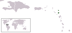
அன்டிகுவாவும் பர்புடாவும் (Antigua and Barbuda) கிழக்கு கரிபிய கடலில் அத்திலாந்திக் மாக்கடலின் எல்லையில் அமைந்துள்ள ஒரு தீவு நாடாகும். இது இரண்டு பிரதான தீவுகளைக் கொண்டுள்ளது அன்டிகுவா, பர்புடா. இதன் அண்மையில் குவாடலூப்பே , டொமினிக்கா , மார்ட்டினீக் , செயிண்ட் லூசியா , செயிண்ட். விண்சண்ட் கிரனடீன்சு , திரினிடாட் டொபாகோ என்பன அமைந்துள்ளன.
மேற்கோள்கள்
↑ The World Factbook , Central Intelligence Agency, 2012, p. 32, ISBN 9780160911422 , archived from the original on 27 June 2022, retrieved 30 September 2021
↑ "Government of Antigua and Barbuda" . Archived from the original on 3 May 2022. Retrieved 23 March 2022 .
↑ "Archived copy" (PDF) . Archived from the original (PDF) on 21 March 2022. Retrieved 23 March 2022 .{{cite web }}
: CS1 maint: archived copy as title (link )
↑ "The World Factbook – Central America:: Antigua and Barbuda" . cia.gov . Central Intelligence Agency. 21 December 2021. Archived from the original on 27 August 2021. Retrieved 24 January 2021 .
↑ "CHAPTER 43 : THE BARBUDA (EXTENSION OF LAWS OF ANTIGUA) ACT" (PDF) . Laws.gov.ag . Archived (PDF) from the original on 8 June 2022. Retrieved 2022-04-14 .
↑ "Chapter 304: The Parish Boundaries Act". Laws of Antigua and Barbuda (PDF) . 17 December 1873. Archived (PDF) from the original on 3 May 2022. Retrieved 14 April 2022 .
↑ "Population projections by age group, annual 1991 to 2026" . Statistics Division, Ministry of Finance and Corporate Governance of Antigua and Barbuda . Archived from the original on 27 June 2022.
↑ 8.0 8.1 "5. Report for Selected Countries and Subjects" . International Monetary Fund . Archived from the original on 13 June 2020. Retrieved 16 April 2019 .
↑ Horsford, Ian. "An Assessment of Income Inequality and Poverty in Antigua and Barbuda in 2007" . Archived from the original on 18 April 2022. Retrieved 23 March 2022 .
↑ "Comparison of Poverty measurement indicators" (PDF) . Economic Commission for Latin America (ECLA) . 2006. Archived (PDF) from the original on 2 May 2021. Retrieved 23 March 2022 .
↑ Human Development Report 2020 The Next Frontier: Human Development and the Anthropocene (PDF) . United Nations Development Programme. 15 December 2020. pp. 343– 346. ISBN 978-92-1-126442-5 . Archived (PDF) from the original on 15 December 2020. Retrieved 16 December 2020 .